Storm Kathleen: Wind warning remains in place for four counties as heavy showers expected
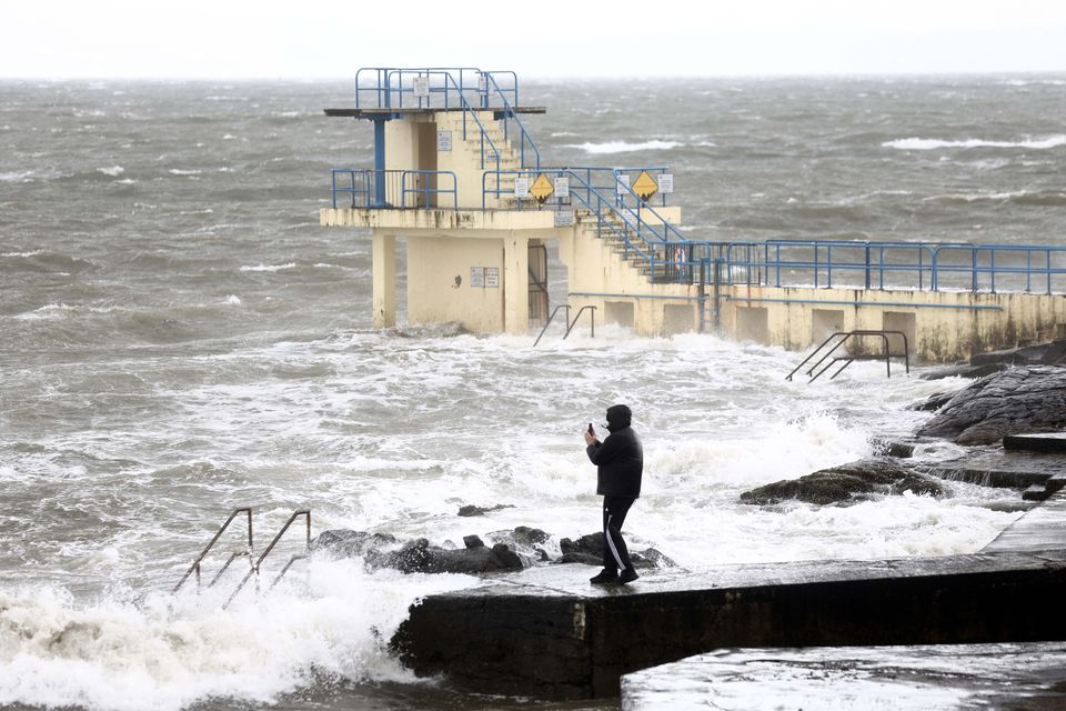
06/04/2024 Galway Ireland. People taking pictures with their mobile phones as high waves hit the coastline at Salthill as Storm Kathleen comes to Ireland. Photo: Sasko Lazarov/© RollingNews.ie
A Status Yellow wind warning remains in place for four counties as Storm Kathleen continues to bring strong southerly gusts.
Met Éireann warns there may be damage to already weakened structures after high winds swept across the country yesterday.
Counties Donegal, Mayo and west Galway were issued with a further warning from 8pm last night until 4pm today.
There is a risk of fallen trees, difficult travel conditions, debris, coastal flooding and wave overtopping.
Brave walkers in Salthill, Galway battle winds as Storm Kathleen sweeps Ireland
It comes as 12,000 homes, farms and businesses remained without power yesterday evening, down from a peak of 34,000.
The largest outages were in counties Mayo, Sligo, Leitrim, Laois and Wicklow.
ESB crews continued to work late into the evening to restore power to impacted customers, though a number remained without power overnight.
Storm Kathleen caused major travel difficulties yesterday as road, rail and ferry routes all faced disruption.
A total of 20 flights in and out of Dublin Airport had been cancelled as of 7.30pm, with eleven diverting away and three flights diverting into Dublin Airport.
Local authority crews were on standby to tackle fallen trees that obstructed roads yesterday, with Irish Rail passengers also facing substantial delays due to trees falling on the line.
All services from Heuston station were suspended for a period yesterday morning due to a tree falling on the line at Monasterevin.
Elsewhere across the country today, it will remain windy with strong, southwesterly winds while the northwest will see gales or strong gales near the coast.
There will be sunny spells mixed with scattered, blustery showers though some will turn heavy with isolated hail and thunder possible.
Highest temperatures of 10 to 14 degrees are expected before a cloudy night tonight where it will reach lows of 2 to 6 degrees.
Rain will extend to most areas tomorrow morning, gradually clearing from the west and northwest throughout the afternoon and evening.
It will likely persist across the rest of the country, heaviest in the southeast with the potential for localised flooding.
Winds will be light and temperatures will be cooler than the weekend at 5 to 10 degrees.
Join the Irish Independent WhatsApp channel
Stay up to date with all the latest news