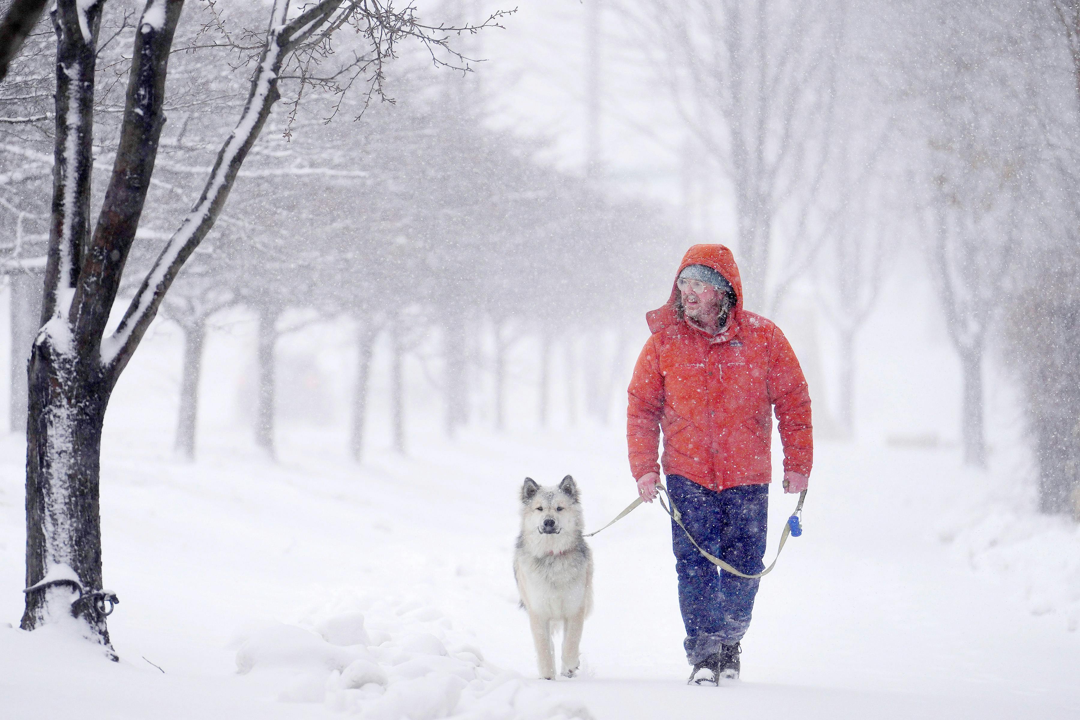
The flip-flop from rain to snow at the height of Tuesday's morning commute turned driving treacherous in a hurry. Roads became white and slippery, sending scores of drivers skidding into ditches and medians.
"Winter weather is not leaving us yet," said Anne Meyer, a spokeswoman for the Minnesota Department of Transportation. "It's tricky for travel, messy right now, but it's going to get better."
Snow that turned to rain and then back to snow with some sleet thrown in kept state troopers busy. In the 24-hour period that ended at 7:30 a.m. Tuesday, the State Patrol responded to 158 crashes and 138 spinouts across the state. Another 15 semitrailer trucks jackknifed, the patrol said.
By 8:30 a.m., nearly all mainline roads in the Twin Cities were fully or partially covered in snow and conditions were deteriorating rapidly as temperatures fell from the mid-30s to below the freezing mark, MnDOT said. Monday's rain prevented MnDOT from pretreating the roads, allowing for the rapid onset of slick conditions as temperatures dipped.
"We saw everything out there, and what each version of precipitation does to the roads," Meyer said.
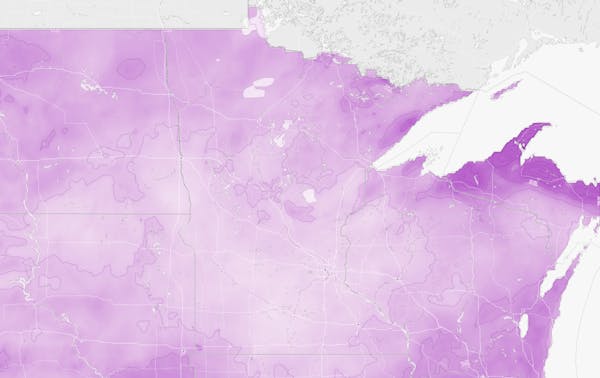
The storm that keeps on giving will deliver another 2 to 4 inches of snow Tuesday in the metro area and even more to the north, the National Weather Service said.
In addition to the snow, a thin layer of ice could form on roads and sidewalks particularly along and west of the Interstate 35 corridor as rain transitions over to snow, the weather service said.
"Plan on slippery conditions," the weather service said in posting a winter weather advisory that remains in effect until 4 p.m. for the metro and east-central Minnesota. "Expect a slow and slippery morning commute with reductions to visibility in falling and blowing snow."
The advisory will expire earlier in the day in western Minnesota as the slow-moving system travels northeast, pulling in colder air that will send temperatures falling into the 20s, the weather service said.
Winter weather advisories covered nearly the entire state Tuesday morning, with the exception of northwestern and southeastern Minnesota.
In St. Cloud, another 2 to 6 inches of snow is expected Tuesday. Similar amounts are expected in Brainerd, Hibbing, Duluth and along the North Shore, the weather service said.
That comes on top of more than a foot of snow that fell Sunday and Monday in Duluth, Braham and even the far northwest metro suburb of Otsego, the weather service said.
Behind the storm, the sun should come out Wednesday, but it won't feel like spring. Temperatures will reach the upper 20s but gusty winds will make it feel much colder. By Wednesday night, the mercury will fall into the single digits in the metro area, the weather service said.
More rain and snow is possible the rest of the week, but high temperatures will moderate into the 40s Friday through Monday.


Leader of young artist program sees a statewide appeal

Man backtracks on plea deal in fatal shooting of teen in Plymouth over luxury sneakers

Duluth City Council rejects Israel-Hamas war cease-fire resolution

Twin Cities rocker Brian Setzer to reunite with Stray Cats in 2024, including two Minnesota dates