A Category 4 typhoon is headed straight toward a nuclear power plant in southern Taiwan.
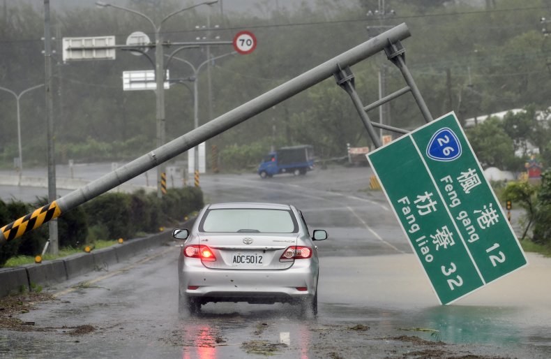
Typhoon Koinu slammed into Taiwan's southeastern islands on Wednesday and the massive storm is anticipated to hit southern Taiwan in the next few hours, which would be Thursday morning local time. The storm's strength prompted meteorologists and storm chasers to voice concern ahead of its landfall, as wind gusts of 212 miles per hour were documented by Lanyu Weather Station as the storm lashed Orchid Island on Wednesday. The storm has sustained winds of 130 miles per hour, which makes it equivalent to a Category 4 hurricane.
If the wind gust recording is accurate, it would be one of the top five strongest wind gusts ever recorded on Earth, a concerning fact as the storm is barreling toward the Maanshan Nuclear Power Plant in southern Taiwan. AccuWeather meteorologist Bill Deger told Newsweek he expects the storm may weaken to a Category 2 or Category 3 by the time it makes landfall.
However, the storm is expected to pass directly over Taiwan's last active nuclear power plant.
"It'll come very close to where the eye of this typhoon is expected to move," Deger told Newsweek.
In 2021, Taiwan Power Company submitted an application to shutter the two-unit power plant. The plant's 40-year operating licenses are set to expire, but the nuclear units won't close until 2024 and 2025.
Despite the storm's direct path toward the plant, there are no announcements on the power company's website about efforts being made to protect the plant from the incoming storm's harsh winds.
With a storm of Koinu's strength, Deger said power outages, structural damage and flooding can be expected. Up to 12 inches of rain is expected to fall as well, causing a flood risk.
Storm chasers and weather experts have issued warnings in advance of the storm's impact, with one storm chaser seemingly very concerned about the storm's path.
"12:10 am. Could be one of my final posts," storm chaser Josh Morgerman posted on X, formerly Twitter with a screenshot of the storm's intimidating radar image. "Star = my location in Jialeshui #Taiwan. Just outside #Typhoon #KOINU's potent eyewall. Wind starting to rip. 987 mb & falling fast. I'll post as long as I can."
12:10 am. Could be one of my final posts. Star = my location in Jialeshui #Taiwan. Just outside #Typhoon #KOINU's potent eyewall. Wind starting to rip. 987 mb & falling fast. I'll post as long as I can. pic.twitter.com/PgXCS52aUk
— Josh Morgerman (@iCyclone) October 4, 2023
Others commented on the storm's strength.
"Wow. Lanyu Weather Station on Orchid Island, Taiwan, at an elevation of 324 m, recorded a wind gust of 342 km/h (212 mph) at 9:53 pm local time as the eyewall of Typhoon Koinu moved over the area. This is provisionally the highest gust ever recorded in Asia," one user posted on X, formerly Twitter.
Wow. Lanyu Weather Station on Orchid Island, Taiwan, at an elevation of 324 m, recorded a wind gust of 342 km/h (212 mph) at 9:53 pm local time as the eyewall of Typhoon Koinu moved over the area. This is provisionally the highest gust ever recorded in Asia. pic.twitter.com/9FvDFoqZaU
— Nahel Belgherze (@WxNB_) October 4, 2023
Natural disasters have posed a high risk to power plants in the past. The Fukushima Daiichi nuclear plant in Japan was damaged by a tsunami after a 9.0-magnitude earthquake struck the area in 2011.
A typhoon is classified as a severe tropical cyclone occurring in the Northwest Pacific. A hurricane is the term for the same type of storm in the Northeast Pacific and Northern Atlantic. Outside of these regions, the storms are called tropical cyclones.