The federal National Hurricane Center (NHC) has released maps showing which areas are most at risk from flooding as Hurricane Hilary bears down on California and surrounding states.
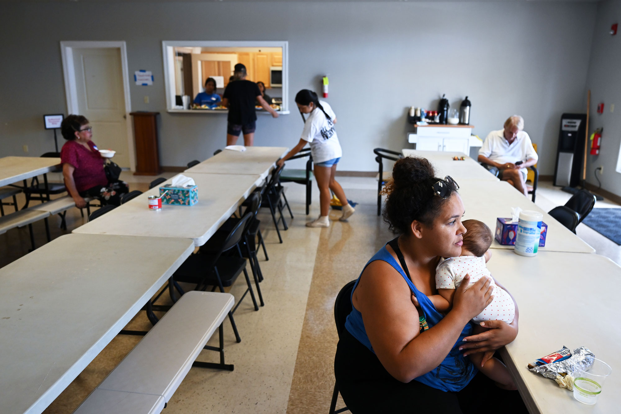
Hilary is expected to make landfall in southern California by Sunday night, though with its strength reduced to tropical storm level with wind speeds of around 50 miles per hour. Some desert areas, such as Palm Springs, could receive more than 12 times their monthly average rainfall in just two days, according to forecasters.
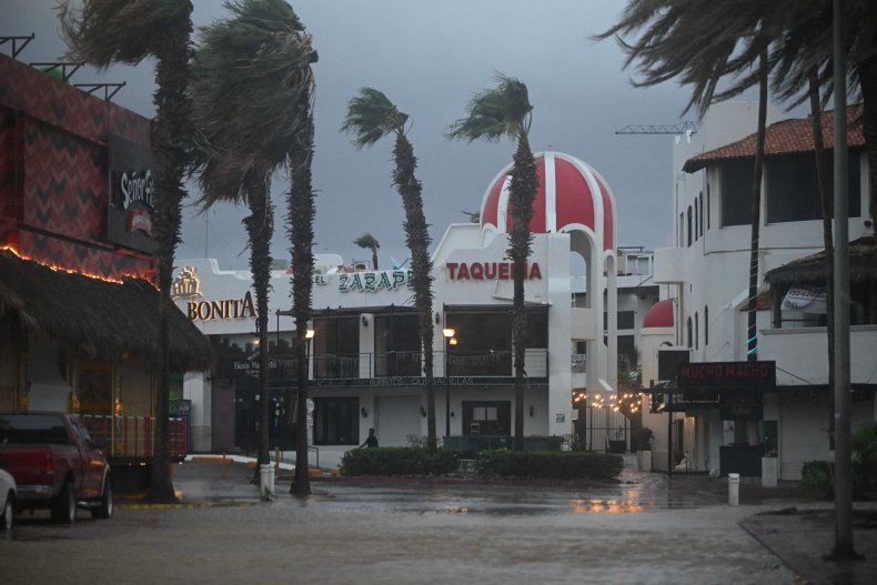
Before hitting the U.S., Hilary is expected to continue its journey north along Mexico's Baja California peninsula on Saturday and Sunday.
An NHC map released on Saturday gives the risk of flash flooding for areas of California and neighboring states in percentage terms. It shows there is an "at least 70 percent" chance of flash flooding in a swath of southern California extending from the Mexican border almost all the way to Nevada, though avoiding the coastline.
For a larger area, including San Diego and Los Angeles in California, along with Las Vegas and Tonopah in Nevada, the risk of flash floods is recorded as "at least 40 percent."
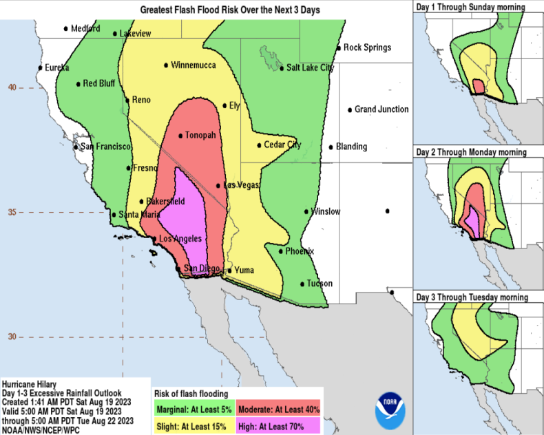
An even wider region, covering Ely and Winnemucca in Nevada, Cedar City in Utah and Yuma in Arizona, has an "at least 15 percent" chance of flash flooding. Further out, there is at least a five percent chance of flooding for much of northern California, Arizona, Utah and into Idaho and Wyoming.
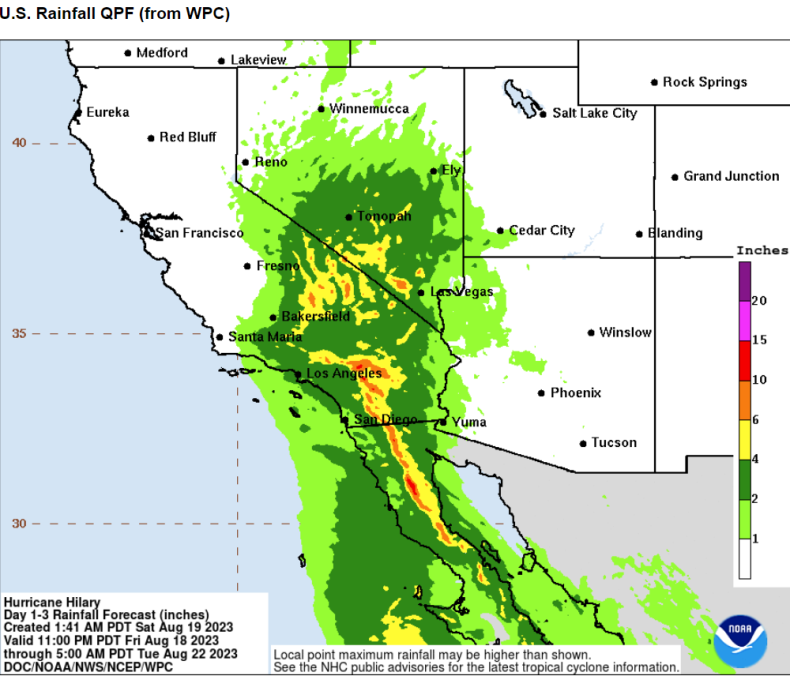
A second map shows how much rainfall is expected, with 10-15 inches being possible for parts of central south California and southern Nevada. A wider region is warned to expect up to six inches of rain, with the remainder of southern California and Nevada told to expect up to four inches.
In an update given at 9 a.m. MDT on Saturday, the NHC urged residents of these areas to brace for possible flooding.
It said: "Preparations for flooding impacts should be completed as soon as possible, as heavy rainfall will begin well in advance of the center [of the storm].
"In the Southwestern U.S., the potentially historic amount of rainfall is expected to cause flash, urban, and arrayo [dry channel] flooding including landslides, mudslides, and debris flows. Dangerous to locally catastrophic flooding impacts are expected late tonight through early Monday."
The agency warned the weather will deteriorate sharply on Sunday, commenting: "Tropical storm conditions are expected to begin Sunday afternoon in portions of the southwestern U.S. within the Tropical Storm Warning area. Winds could be particularly strong and gusty in and near areas of higher terrain."
In an interview with Newsweek on Thursday, Eric Boldt, a warning coordination meteorologist at the National Weather Service station in Los Angeles, warned of the danger from "flash flooding."
He said: "Rains could trigger flash flooding if the intensity is high enough, but otherwise most areas will be able to absorb several inches of rainfall."