
Mayo hotter than Milan – as thousands enjoy bank holiday sunshine in Mediterranean weather
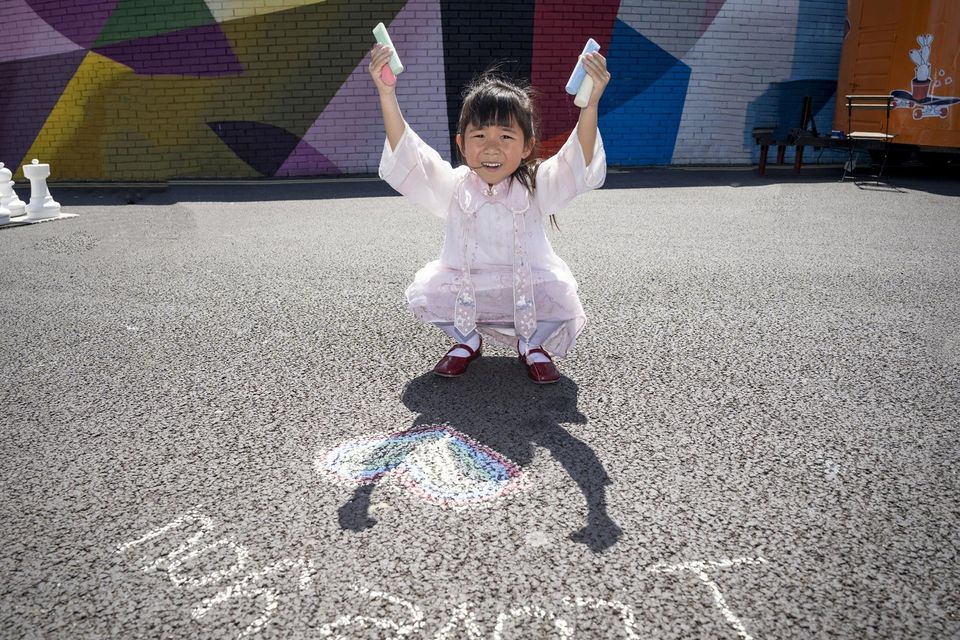
Aoife Kam creates some chalk art at ‘Summer at Honan’s Quay’ in Limerick city which was transformed into a recreational space by the river for people to enjoy. Photo: Don Moloney

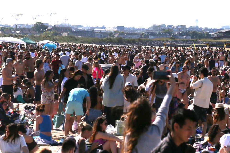
Pictured at the beach at Garretstown, Co Cork, was Luke Tett and Chloe McCarthy from Passage West, Co Cork. Photo: Denis Boyle
kk
kk


Holidaymakers and families were urged to make the most of the glorious weather amid indications the Azores High frontal system off Ireland will weaken from midweek with unsettled conditions and rain likely for next weekend.
Mediterranean-like weather left beach resorts, parks and beauty spots across Ireland packed over the June bank holiday weekend as Mayo proved warmer than Milan.
An estimated one million people savoured day-trips, mini-breaks and even early summer holidays as tourism officials said the sunshine had delivered an early season boom.
Hotels, restaurants and pubs reported busy trade – particularly in coastal areas – while councils increased refuse collections organised to ensure resorts remained in pristine condition.
Dublin and Cork were particularly busy thanks to Bloom, Forbidden Fruit and St Anne’s Park concerts, Cork City Marathon, Cork’s Ocean to City festival and the Cork-Kerry Munster Championship clash.
Read more
Met Éireann warned that the end of the Riviera-like spell is likely ahead – to the relief of farmers who, while savouring excellent silage and crop conditions until now, were increasingly worried at the lack of rainfall and the possibility of an early summer drought.
Uisce Éireann, formally Irish Water, said the introduction of a hosepipe ban was now unlikely despite overnight water restrictions in some areas in a bid to protect reservoir supplies.
Some areas have been subjected to overnight water restrictions, including Clonakilty, Co Cork, to allow local reservoirs to replenish.
Residents in areas of Mayo, Clare, Kilkenny, Westmeath and Wexford have also been asked to conserve water due to what Uisce Éireann described as “the current high demand for water as a result of the current warm spell”.
The plea came as the Azores High, which delivered two weeks of glorious sunshine, is to weaken – allowing more Atlantic weather streams over Ireland from later this week.
Met Éireann said next weekend is likely to prove more unsettled.
“While considerable uncertainty remains for the further outlook, the early indications are that the high pressure will start to wane as we approach the weekend, bringing more unsettled conditions with an increased chance of rain,” the forecaster said.
However, Ireland has at least another four days of dry, settled and largely sunny conditions – though western areas will at times prove up to be 5C warmer than the east.
“Monday will be generally dry and sunny once again, although cloud will build slightly during the afternoon and evening, with a further chance of isolated showers developing in Ulster. The highest temperatures will be 20C to 24C, again warmest in the west.
“Tuesday will be another mostly dry and sunny day with just light easterly breezes. Again, cloud will build slightly during the afternoon and evening, with isolated showers affecting northern parts. The highest temperatures will be 19C in the east to 24C in the west.
“Wednesday will stay dry and sunny for most areas, although isolated showers may develop once again in parts of the north. Highest temperatures of 17C to 23C.
Thursday will again prove to be a largely dry day, though clouds will build from the south-west and rain will impact parts of Munster from the late evening, heralding a change in outlook and with temperatures up to 4C cooler.
Latest Irish News

Fine Gael lead popularity contest on social media, with Leo Varadkar the most-followed cabinet TD
AstraZeneca lung cancer drug halves death risk from disease, landmark study finds
-
Retirement village ordered to refund €1,056 to resident following invalid rent increases
Mystery over father’s 50-year disappearance solved after news article
-
‘People say they won’t work for the weekend. They’ll wait until the weather changes’ – restaurateurs tell of staff shortage crisis
Staffing ‘nightmare’ is biggest threat to the tourism industry as foreign visitors return
It could be ‘curtains for fraudsters’ under new personal injury rules
‘We have reserved the first free pint for Taylor Swift’ – Iconic ‘Banshees of Inisherin’ pub restored to former glory in Co Galway
New courses provide pathway to a university degree for students who fell short in CAO race
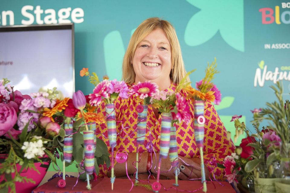
Bord Bia Bloom: How losing her job set one woman on the road to sweet success with cacao business


Top Stories
Eamonn Sweeney: A new format for football but still same old failings
I was breastfeeding my third when I found a lump –after a double mastectomy and reconstructive surgery I am ready to live again
650,000 child benefit bonus payments of €100 to be made this month
New courses provide pathway to a university degree for students who fell short in CAO race


Latest NewsMore
Holly Willoughby set to return to This Morning duties following Schofield exit
Love Island returns with new batch of contestants for 10th season
-
Stefanie Preissner: I’ve lost my passport but St Anthony is on the case — for a fee
-
Ask Allison: ‘Since I switched to part-time work, my husband has been hoarding his cash while I struggle. I feel so betrayed’
-
I was breastfeeding my third when I found a lump –after a double mastectomy and reconstructive surgery I am ready to live again
Barry Coffey pleased Cork City have ‘turned a page’ with three successive wins ahead of Bohs test
-
Sustainability report shows over-reliance of Irish firms on external consultants
IATA director Willie Walsh: Airlines will avoid repeat of last year’s summer travel chaos
UBS considers delaying results after Credit Suisse rescue
-
Thousands of small businesses at risk as regulatory environment becomes increasingly muddy