
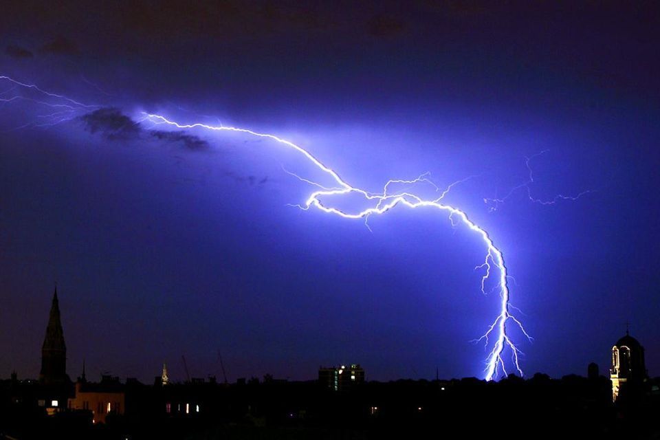
Met Éireann issues thunderstorm warning for 11 counties amid ‘lightning activity’
A thunderstorm warning is currently in place across 11 counties.
Met Éireann has issued a yellow weather warning for thunderstoms for 11 counties that will be in place until 10pm tonight.
With localised thunderstorms and lightning activity in 11 counties, many areas are expected to see heavy downpours.
These counties include Cavan, Monaghan, Dublin, Longford, Louth, Meath, Offaly, Westmeath, Galway, Leitrim and Roscommon.
Met Éireann have warned that localised spot flooding is a possibility as a result of any heavy downpours.
On Saturday, there will be a mix of cloud and sunny spells with widespread slow-moving showers, heaviest into the afternoon and evening with possible thundery downpours.
Highest temperatures will generally range between 15C and 18C, in light to moderate southerly winds.
Conditions will remain unsettled with rain or showers on most days. It will be mild or warm, especially in sunny spells.
On Sunday, sunny spells and scattered light showers during the morning and early afternoon, followed later by cloudier skies as rain and drizzle gradually extends countrywide, last to arrive to the east.
Highest temperatures will range between 14C and 19C, warmest in the east, in moderate south to southwest winds.
Monday will be a day of sunny spells and scattered passing showers with a few heavy ones possible.
Highest temperatures will range between 14C and 18C, in mostly moderate westerly winds.
Outbreaks of rain in the west on Tuesday will spread eastwards, with sunny spells and isolated showers following.
Highest temperatures will range between 12C and 16C, with light southwesterly winds freshening and becoming westerly behind the rain.
Latest Weather
LATEST | Met Éireann issues thunderstorm warning for 11 counties amid ‘lightning activity’
Ireland weather: Temperatures to cool as heavy outbreaks of rain expected in some areas
Record summer temperatures on cards globally from El Nino, predict experts
Ireland weather: Met Éireann forecasts largely dry day with sunny spells but change ahead for weekend
Ireland weather: Met Éireann forecasts mostly dry day with spells of sunshine
Bank Holiday Monday weather: mostly dry with sunny spells developing, Met Éireann forecasts
Temperatures could reach 18C for Bank Holiday Monday with only slight chance of showers lingering
Irish weather: Showers expected to turn heavy with a chance of thunder
Irish weather: Local downpours in areas with a chance of lightning, hail and spot flooding
Irish weather: Met Éireann forecasts sunny Bank Holiday weekend with temperatures hitting highs of 19C’


Top Stories
Office worker awarded €50,000 after male colleague tried to pull her trousers down in front of staff

11 wildcard presenters RTÉ could opt for to replace Ryan Tubridy on The Late Late Show
Man (40s) dies in collision between a car and parked truck in Co Cavan
Bruce Springsteen’s life in letters: Barry Egan’s A-Z of The Boss


Latest NewsMore
Coronation ceremony will be incredible 3D musical experience – album producer
David Attenborough believes Charles will give conservation ‘full backing’
-
Philly McMahon: David Bowie’s music, Croke Park dressing rooms and the madness of paranoid managers
-
Oliver Keens: I will never stop admiring the ways posh people pretend they’re not posh
Irish trio get off to slow start in Diamond League opener in Doha
ICycle diary: Consistency is key when building up to a big goal
Man (50s) arrested following seizure of €141,000 of cocaine, tablets and cannabis in Waterford
-
Inside the bonkers world of professional royal doppelgangers: ‘I played the Queen in a flea powder advert’
Live | Ulster vs Connacht: provincial rivals go head to head in URC quarter-final
188 arrested for driving while intoxicated across bank holiday weekend that saw 11 serious collisions