- News
- City News
- jaipur News
- Rain brings respite from heat, fresh spell likely next wk
Trending Topics
Rain brings respite from heat, fresh spell likely next wk
You're reading

Rain brings respite from heat, fresh spell likely next wk UWA Global MBA: Make your mark in the business world with the University of Western Australia’s MBA and IIM certification JDA spent ₹44L for rd, only to dig up within six months Goons lock professor with girl, extort ₹2 lakh from him

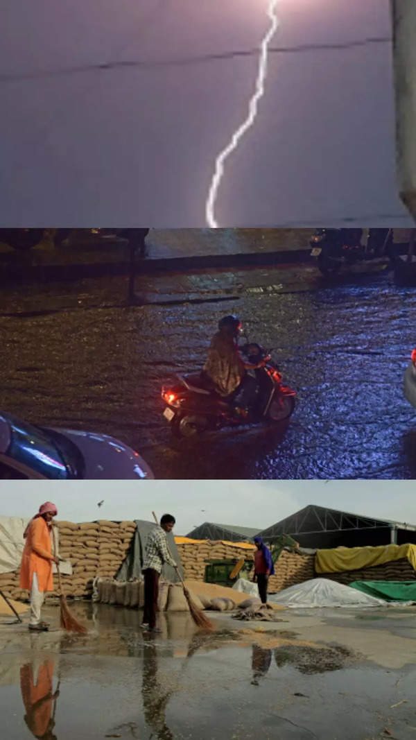
Jaipur: After the rain on Saturday morning, the minimum temperature in Jaipur dropped by 4 degrees Celsius.
There is a possibility of rain with strong thunderstorms in 20 districts of the state, including Jaipur, in the next 24 hours.
According to the Met office, due to fresh activation of western disturbances, there will be rain with strong thunderstorms in most areas of the state which will continue for a week.
The weather remained cloudy in many parts of the state while moderate rainfall was also recorded at some places.
With the change in weather, the temperature also remained below normal.
According to the Meteorological (MeT) centre here, light to moderate rain with thunderstorms were recorded in several parts of the state since Friday. Nimbahera in Chittorgarh recorded maximum 28 mm rainfall followed by Barmer where 25mm rainfall was received.
The department has predicted light to moderate rainfall in the state for Saturday and Sunday.
Another western disturbance is likely to activate from May 1 which will trigger fresh spell of rainfall activity on May 2 and 3. The maximum temperature is likely to remain 3 to 5 notches below the normal and there is no possibility of heatwave next week, it forecast.
Western disturbance as a cyclonic circulation lies over central Pakistan and neighbourhood in middle tropospheric levels.
"A fresh western disturbance is likely to affect northwest India from the night of May 1. Dust storms are very likely at isolated places over Rajasthan during May 2-3", said Met forecast .
Start a Conversation
FOLLOW US ON SOCIAL MEDIA
FacebookTwitterInstagramKOO APPYOUTUBE


Elections
TOP TRENDS
Popular Categories
Hot on the Web
Top Trends
DC vs SRH Live ScoreKKR vs GTNeeraj ChopraDefence Ministers MeetingCovid NewsJEE Main ToppersRajnath SinghMallikarjun KhargeKarnataka Election NewsChrisann PereiraOperation KaveriCovid Cases in IndiaWorld Test Championship FinalTS EAMCET Hall TicketLunar Eclipse 2023Karnataka Elections 2023IPL Schedule 2023IPL 2023 Points Table
Trending Topics
Ponniyin Selvan 2 ReviewJanhvi KapoorVitamin DActress DressPonniyin Selvan 2Twitter ReviewFilmfare Awards 2023Summer Travel PlaceAgent Movie ReviewHansika MotwaniMouni RoyBest Places In WorldPriyanka ChopraMango BenefitsEmily RatajkowskiSamanthaLadakh Travel TipsVivo Y55sLaptops under 30000WiFi RoutersTablets under 15000
Living and entertainment
Copyright © 2023 Bennett, Coleman & Co. Ltd. All rights reserved. For reprint rights: Times Syndication Service