- News
- City News
- chennai News
- Why showers failed Chennai
Trending Topics
Why showers failed Chennai


Rain has been forecast for the next two days
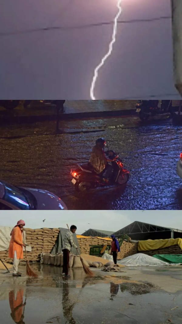
CHENNAI: The city has been experiencing cloudy skies during the day and thunderstorms in the evening, but the rain that was forecast never arrived. Instead, the weather was hot, stuffy and sweaty.
This is due to the convergence of opposing winds from the east and the west or the trough falling over the interior parts of the state. This brought intermittent showers to the suburban parts of the city while those close to the coast remained dry and sultry due to the incoming easterlies that travelled towards the convergence area over the interior region.
Weathermen have forecast thunderstorms and rainfall in the city and suburbs for the next two days. However, private forecasters and bloggers said rain may continue to skip the city and move to interior areas.
IMD said a cyclonic circulation lies over south Tamil Nadu and neighbourhood areas extending up to 0.9km above mean sea level. "A trough/wind discontinuity runs from the cyclonic circulation over central Madhya Pradesh to the cyclonic circulation over south interior Tamil Nadu and neighbourhood across interior Maharashtra and interior Karnataka at 0.9km above mean sea level," an IMD official said.
On Monday, a cloudy weather maintained the day temperatures at 35.7 deg C and 36.2 deg C in Nungambakkam and Meenambakkam which were near normal for the month. On Sunday evening, there was thunder in some parts of the city, but the rainfall was restricted to neighbouring and interior districts.
Mahesh Palawat, chief meteorologist, Skymet Weather said the trough is influencing the rainfall in the state and it may continue to bring rain at least for the next two to three days before its intensity begins to drop. Blogger Pradeep John said the city also missed its share of rain on early Monday morning as the storms moved away from the city.
Start a Conversation
FOLLOW US ON SOCIAL MEDIA
FacebookTwitterInstagramKOO APPYOUTUBE


Elections
TOP TRENDS
Popular Categories
Hot on the Web
Top Trends
SRH vs DCCovid NewsIPL Live ScoreSachin TendulkarAjinkya RahaneCovid Cases in IndiaWFI ProtestOperation KaveriTarek FatahNitish KumarKarnataka Election NewsSame Sex MarriageCovid Cases in indiaKerala State Lottery ResultBank Holidays in AprilKarnataka Elections 2023IPL Schedule 2023IPL 2023 Points Table
Trending Topics
Living and entertainment
Copyright © 2023 Bennett, Coleman & Co. Ltd. All rights reserved. For reprint rights: Times Syndication Service