
Astronomers create epic map of more than 1 billion galaxies

Recently an international collaboration of astronomers released the most accurate map yet of all the matter in the universe, to help to understand dark matter, and now this is being joined by the largest two-dimensional map of the entire sky, which can help in the study of dark energy. A data release from the Dark Energy Spectroscopic Instrument (DESI) Legacy Imaging Survey shared the results from six years of scanning almost half of the sky, totaling one petabyte of data from three different telescopes.

This is an image centered on a relatively nearby galaxy cluster dubbed Abell 3158.
This is an image centered on a relatively nearby galaxy cluster dubbed Abell 3158; light from these galaxies had a redshift value of 0.059, meaning that it traveled approximately 825 million years on its journey to Earth. The image is a small part of the DESI Legacy Imaging Surveys — a monumental six-year survey covering nearly half the sky. DESI Legacy Imaging Survey/KPNO/NOIRLab/NSF/AURA; Image processing: T.A. Rector (University of Alaska Anchorage/NSF’s NOIRLab, Jen Miller, M. Zamani & D. de Martin (NSF’s NOIRLab)

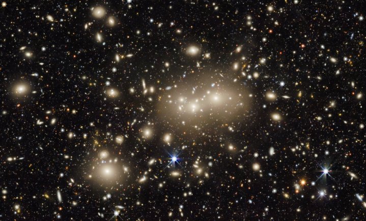
The reason that such large-scale data is required to study dark energy and dark matter is that these can only be detected due to their effects on ordinary matter — so researchers need to look at many galaxies to track how these otherwise unseen forces are adding mass or affecting the interaction between galaxies. This particular map was created to help scientists identify 40 million target galaxies which will be studied as part of the DESI Spectroscopic Survey.

To make the map as comprehensive as possible, the researchers included data taken in the near-infrared wavelength as well as the visible light wavelength. That is important as the light from distant galaxies appears redshifted, or shifted toward the red end of the spectrum, due to the expansion of the universe. “The addition of near-infrared wavelength data to the Legacy Survey will allow us to better calculate the redshifts of distant galaxies, or the amount of time it took light from those galaxies to reach Earth,” explained one of the researchers, Alfredo Zenteno of NSF’s NOIRLab, in a statement.

The map should be useful to astronomers in other fields as well, such as those looking in the radio or X-way wavelengths, as it can help pinpoint the sources of these other emissions.

“Anyone can use the survey data to explore the sky and make discoveries,” said Arjun Dey, an astronomer with NSF’s NOIRLab. “In my opinion, it is this ease of access which has made this survey so impactful. We hope that in a few years, the Legacy Surveys will have the most complete map of the entire sky, and provide a treasure trove for scientists well into the future.”

Editors' Recommendations

SpaceX reaches agreement with astronomers to limit Starlink interference
Image showing the disruption of astronomical observations caused by a previous Starlink launch

This week, National Science Foundation announced it has reached an agreement with SpaceX to limit the effects of Starlink satellites on astronomy.

Astronomers have been raising concerns about the effects that Starlink satellites could have on scientific study for several years now, as part of a wider consideration of the cultural and environmental importance of dark and quiet skies. The International Astronomical Union has even set up a special center for addressing the issue of satellite megaconstellations like Starlink on both optical and radio astronomy.

Read more
Doorbell camera captures much more than just a house visitor
Google Nest Doorbell (battery) camera lens.

While most Alaskans were tucked up in bed early on Wednesday morning, a number of home security cameras in and around Anchorage captured a natural phenomenon that would otherwise have gone largely unnoticed.

At around 5:45 a.m. local time, a meteor hurtled across the sky, its speed as it hit Earth’s atmosphere causing a bright light that momentarily lit up a large portion of Southcentral Alaska.

Read more
James Webb survey image shows a field of shining galaxies
A swath of sky measuring 2% of the area covered by the full moon was imaged with Webb’s Near-Infrared Camera (NIRCam) in eight filters, and with Hubble’s Advanced Camera for Surveys (ACS) and Wide-Field Camera 3 (WFC3) in three filters that together span the 0.25 to 5 micron wavelength range. This image represents a portion of the full PEARLS field, which will be about four times larger.

As well as providing new information about objects like exoplanets and giving new views of some famous space scenes, the James Webb Space Telescope is also being used to observe large patches of the sky in wide-scale surveys. Researchers from one such Webb survey, called the Prime Extragalactic Areas for Reionization and Lensing Science or PEARLS, recently released their first results showing an area of the sky called the North Ecliptic Pole.

This image shows around 2% of the sky, as captured by both Webb's Near-Infrared Camera or NIRCam and the Hubble Space Telescope's Advanced Camera for Surveys. This is just a part of the PEARLS survey, but shows thousands of galaxies including some extremely distant ones. You can see a zoomable version of the image on the Webb website.

Read more