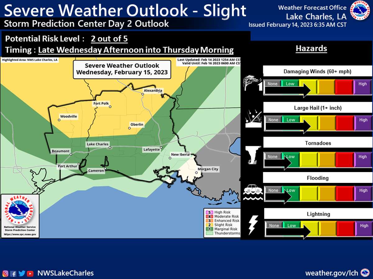
The National Weather Service Lake Charles office severe weather outlook for Southeast Texas, Feb. 15, 2023.
National Weather Service Lake CharlesSoutheast Texas could see severe storms Wednesday.
There is a slight risk for severe storms with damaging straight line wind gusts for all of Orange County, most of Jefferson County and the southern portions of Jasper and Newton counties late Wednesday afternoon into Thursday morning, according to a hazardous weather message from the National Weather Service Lake Charles office.
"There is also the potential for large hail and spin up tornadoes," the weather service said. "Gusty winds look to be possible again during the daytime Wednesday with another potential for a wind advisory."
The Lake Charles office on Tuesday morning extended a flood warning until further notice for the Sabine River at Deweyville.
As of 1 p.m. Tuesday, the river was in the "minor flooding" stage, according to the National Oceanic and Atmospheric Administration.
The Sabine River at Deweyville was sitting at 24.66 feet as of 11:45 a.m. Tuesday – just over half a foot higher than the river's flood stage of 24 feet. The river is expected to crest at 24.8 feet by midnight Wednesday, before slightly lowering throughout the week, though it is expected to remain in the minor flooding stage through Sunday.
According to the National Weather Service's Advanced Hydrologic Prediction Service, when the river is at or above 24 feet, minor lowland flooding of surrounding areas will occur.
The potentially severe weather Wednesday will be followed by a cold front moving through the area Wednesday afternoon through early Thursday morning, the Lake Charles office said.
Over the next five days, the Beaumont-Port Arthur area will see cooler temperatures with highs in the mid-50s and lows in the mid-30s.
Wednesday will see a high temperature of around 76 degrees with a patchy fog before noon and then again after 5 p.m. The day will be mostly cloudy with a southeast wind of 5 to 15 mph, with gusts as high as 25 mph possible. There is a 30% chance of precipitation throughout the day.
Moving into Wednesday night, a 60% chance of precipitation will be accompanied by a south wind of 10 to 15 mph, with gusts as high as 20 mpg possible and a low temperature around 58 degrees.
Cooler temperatures will begin Thursday with a high of 68 degrees and a low of around 37 degrees expected. The forecast calls for a 40% chance of showers and thunderstorms before noon. The day will be cloudy with southwest winds of 10 to 15 mph and gusts as high as 20 mph possible. Thursday night is expected to be partly cloudy with a north wind around 15 mph, with the possibility of gusts as high as 20 mph.
The sun is expected to come out Friday, though the high temperature is expected to be around 55 degrees with a low around 36. A north wind of 15 to 20 mph with gusts as high as 30 mph will be possible throughout the day. Friday night is expected to be partly cloudy with a northeast wind around 10 mph.
Saturday is expected to be partly sunny, with a high near 57 degrees and a low around 43 degrees. A northeast wind of 5 to 10 mph shifting southeast in the afternoon is possible.
Temperatures will start rising slightly Sunday entering the new week, with a high of 70 and low of 57 degrees expected.
olivia.malick@hearst.com
twitter.com/OliviaMalick