Top Searches
- News
- City News
- dehradun News
- Isro releases images: Joshimath sank 5.4cm in 12 days, entire town may sink
Isro releases images: Joshimath sank 5.4cm in 12 days, entire town may sink
ARTICLES

Isro releases images: Joshimath sank 5.4cm in 12 days, entire town may sink Expert Speak: Dinesh Bansal, CFO, Asia-Pacific, Lenovo (MBG) on how to stay relevant in your finance career Cracks inside Army brigade HQ buildings in Joshimath: Indian Army Assess Joshimath damage on war footing: CM Pushkar Singh Dhami to scientists

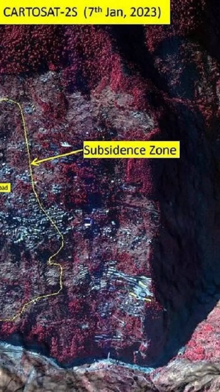
ISRO releases satellite images of Joshimath landslide for the first time. Photo: IANS
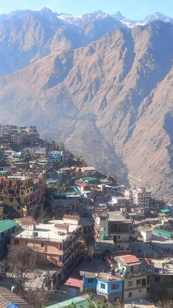
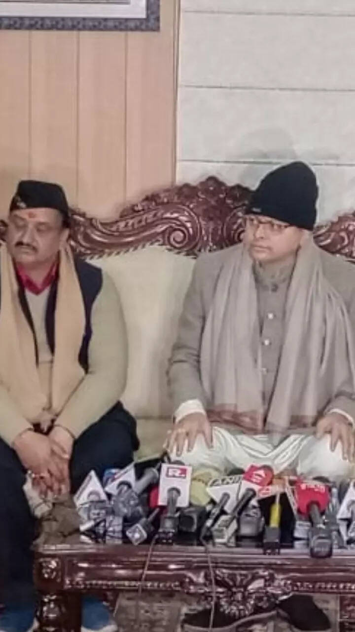
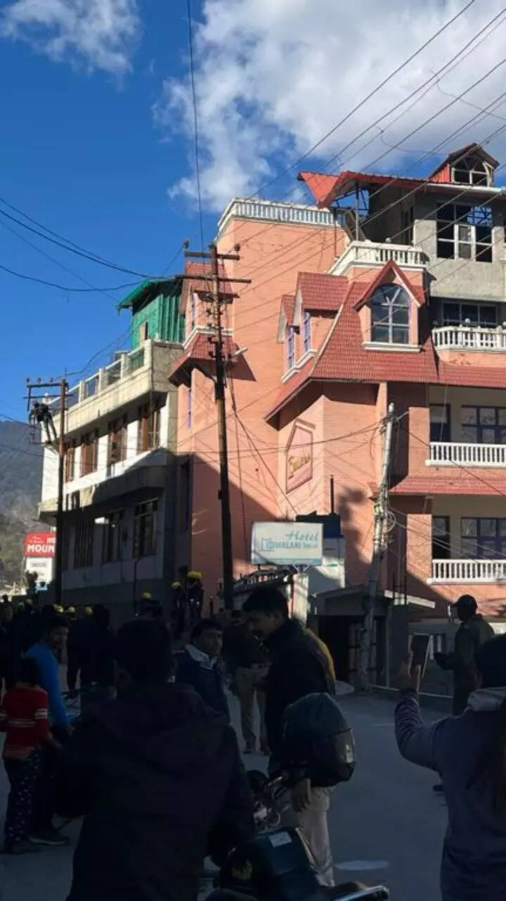
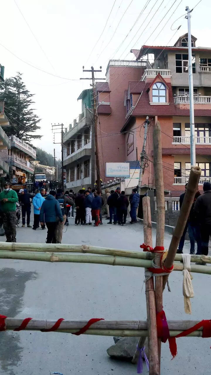
NEW DELHI/DEHRADUN: Uttarakhand chief minister Pushkar Singh Dhami is holding a cabinet meeting today and may announce some important decisions regarding subsidence-hit Joshimath town in Chamoli district.
The Uttarakhand cabinet meeting is taking place after the CM's meeting with all stakeholders on the Joshimath land subsidence issue yesterday.

During the meeting on Thursday, the chief minister interacted with the Army, ITBP, NDRF and scientists from various establishments engaged in landslide investigation, district administration, police and district-level officers associated with essential services at Sunil ITBP camp.
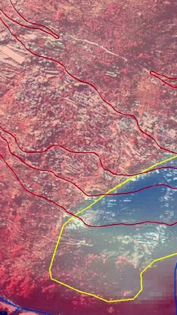
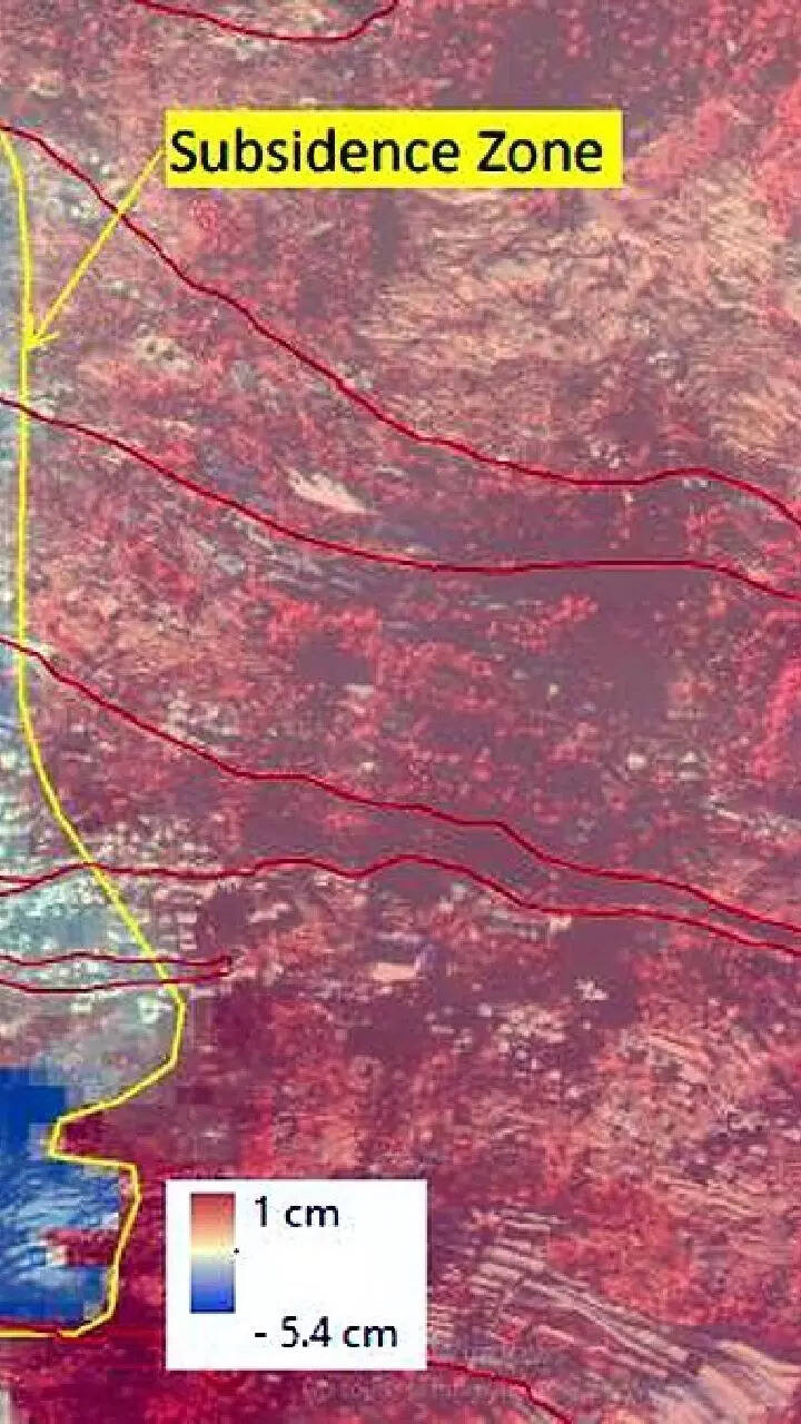
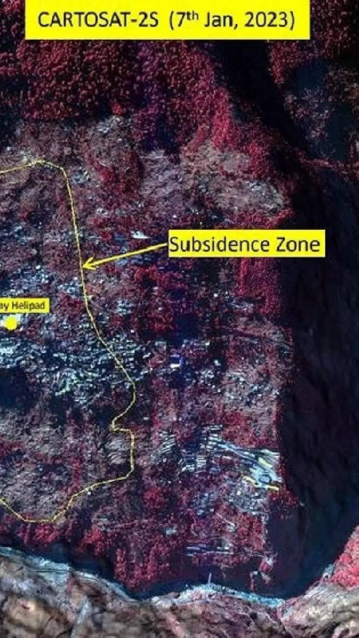
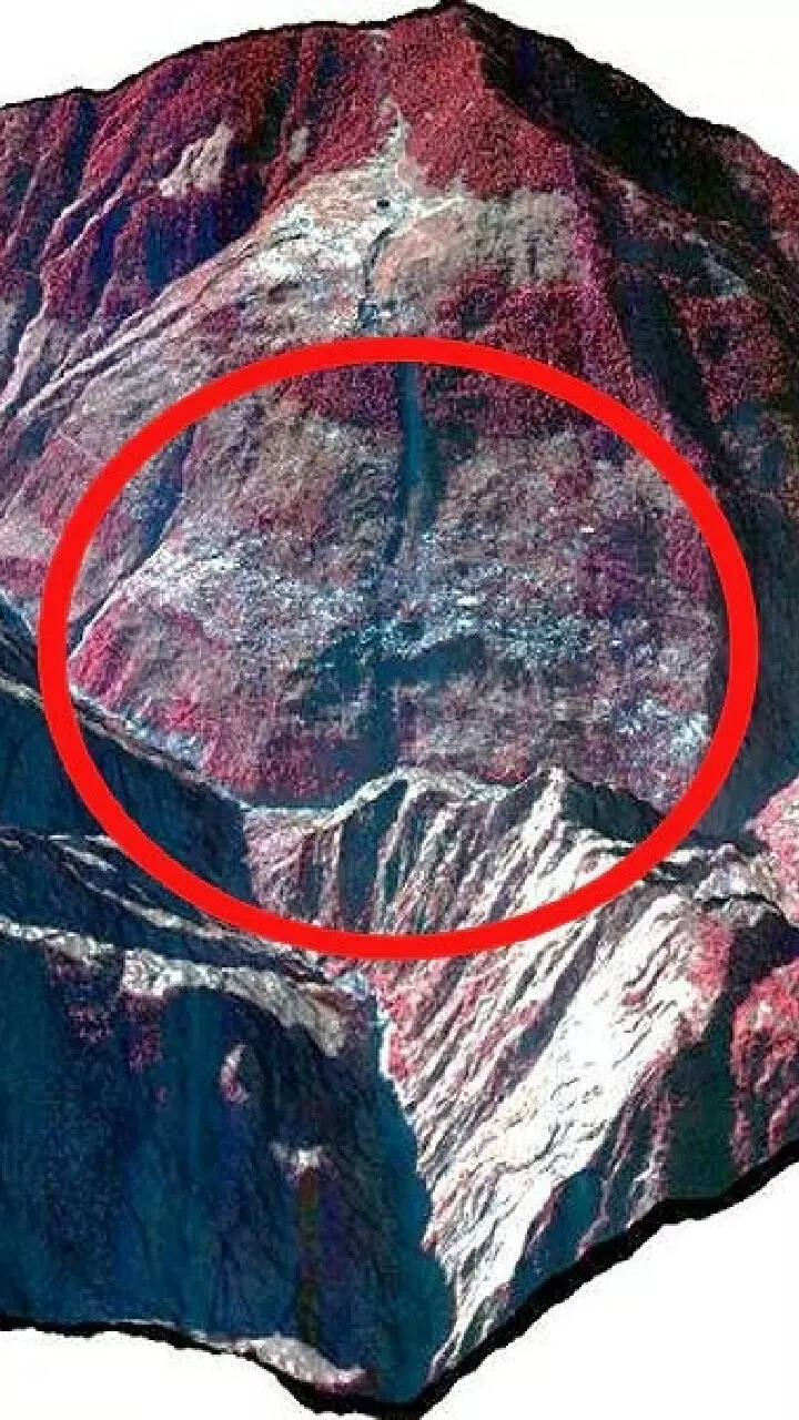
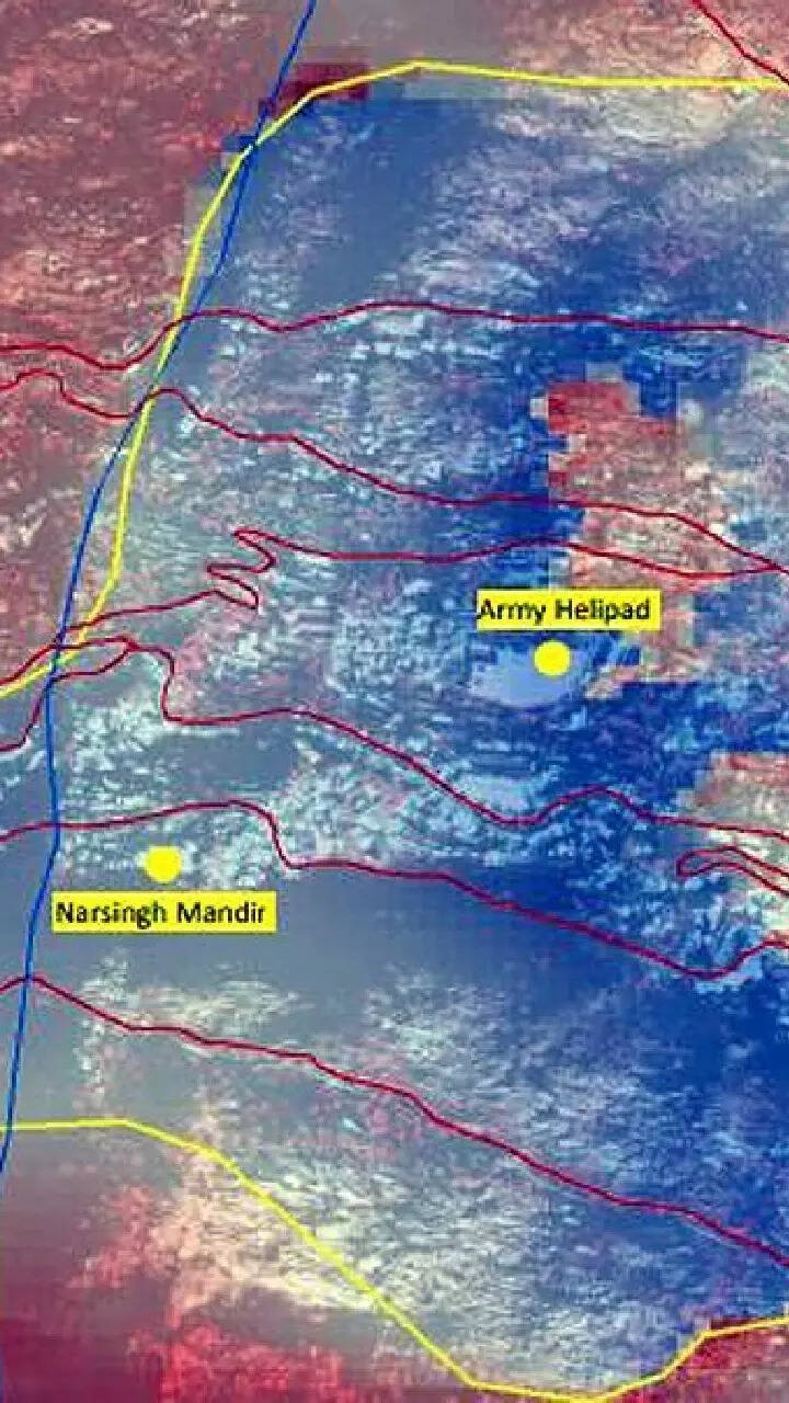
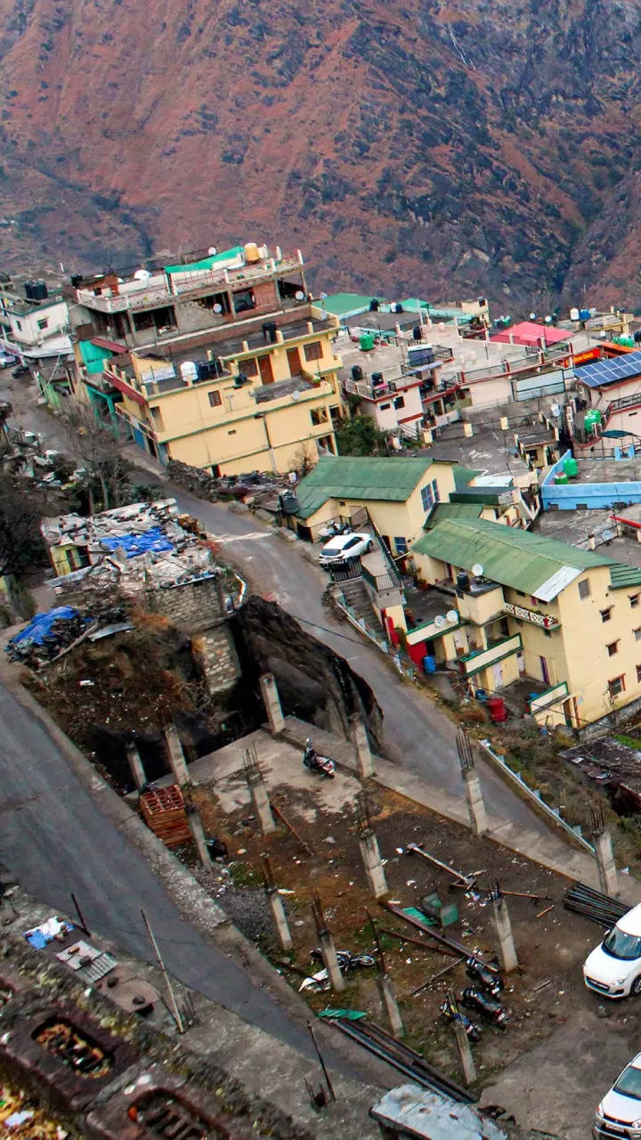
Meanwhile, the Indian Space Research Organisation's (Isro) National Remote Sensing Centre (NRSC) in Hyderabad has released satellite images that reveal the severe land subsidence affecting the town of Joshimath. The images, taken by the Cartosat-2S satellite, show that the entire town, including the Army's helipad and a temple, has been designated as sensitive zones.
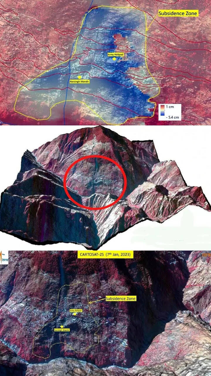
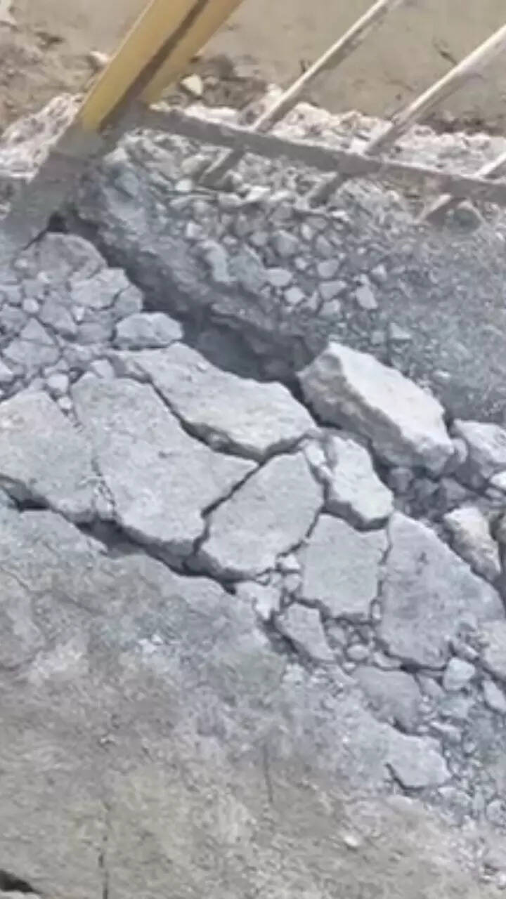
The preliminary report from Isro states that the land subsidence was slow between April and November 2022, during which time the town sank by 8.9cm.
However, between December 27, 2022 and January 8, 2023, the intensity of land subsidence increased dramatically, causing the town to sink by an additional 5.4 cm in just 12 days.
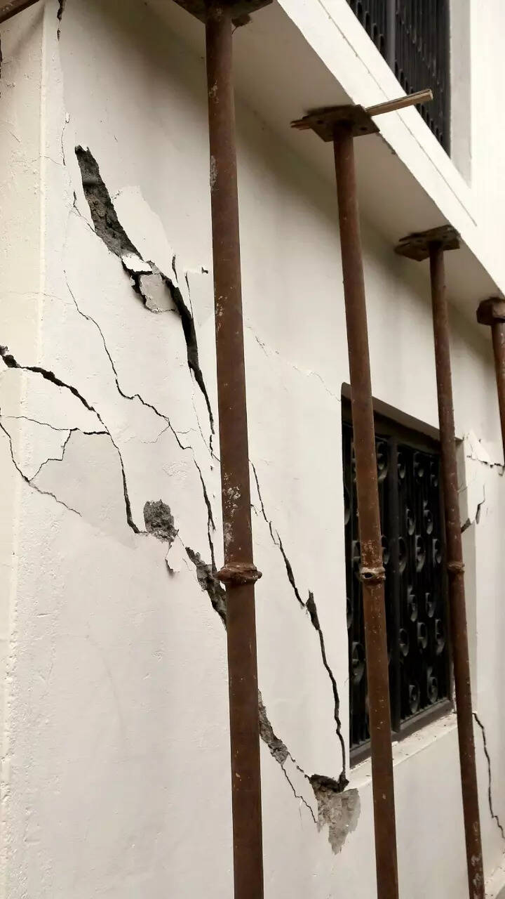
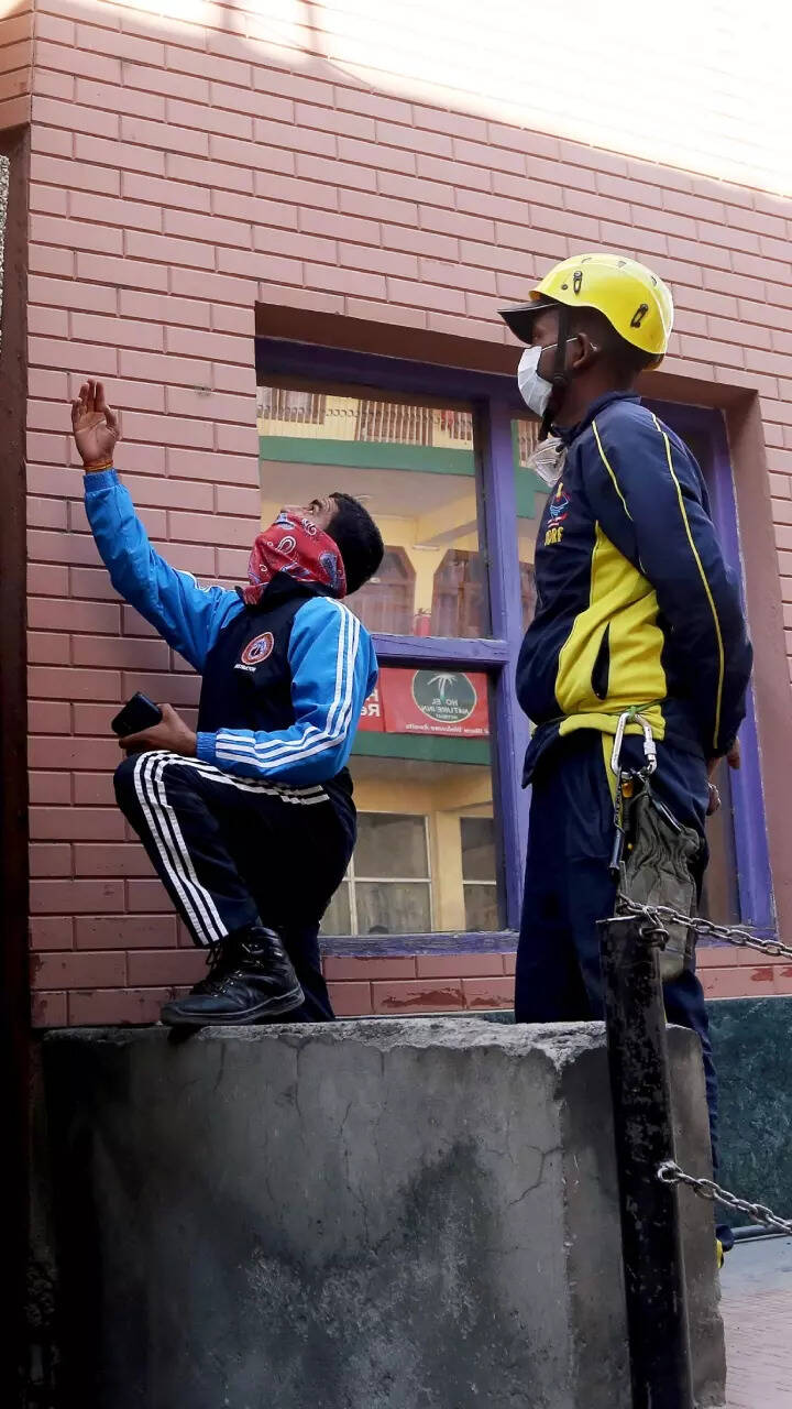
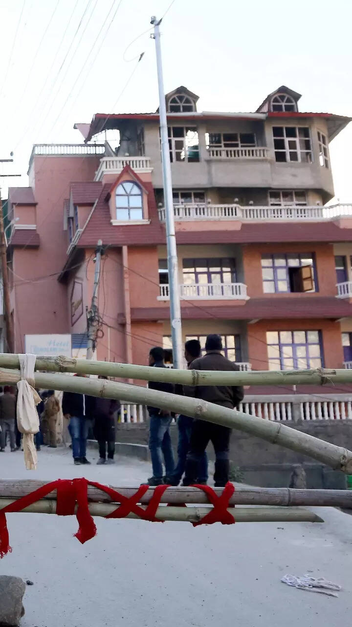
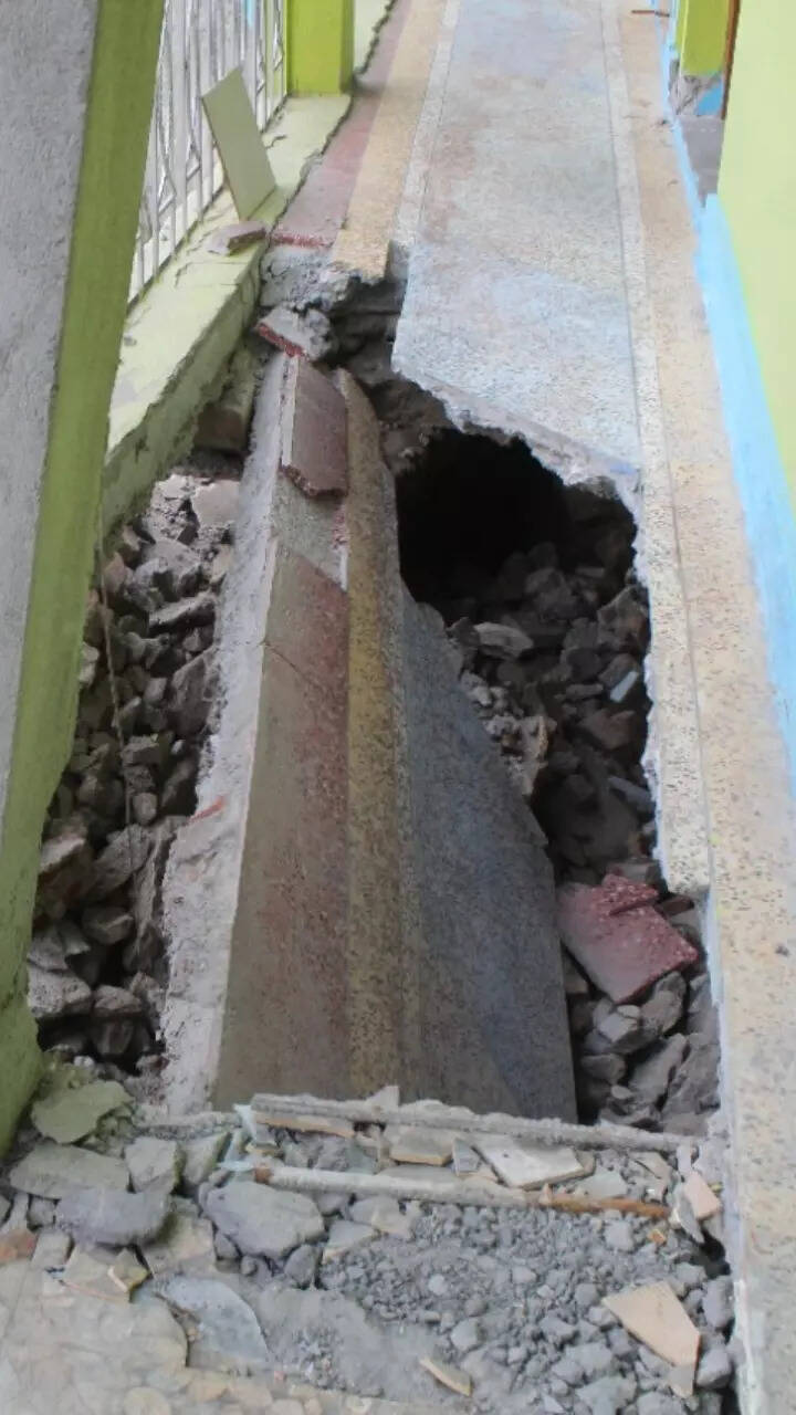
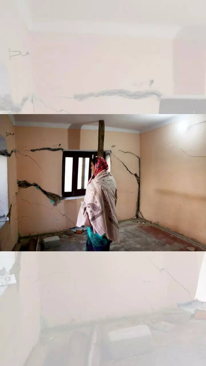
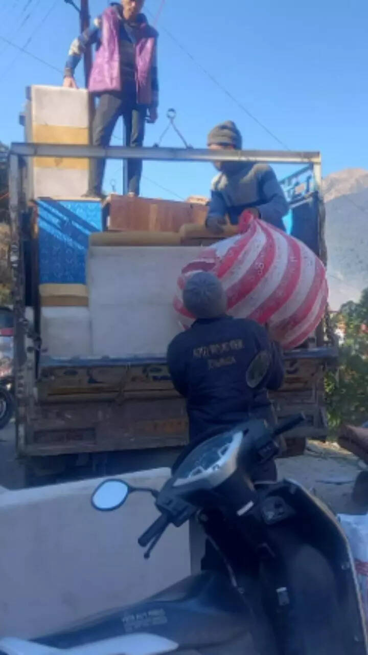
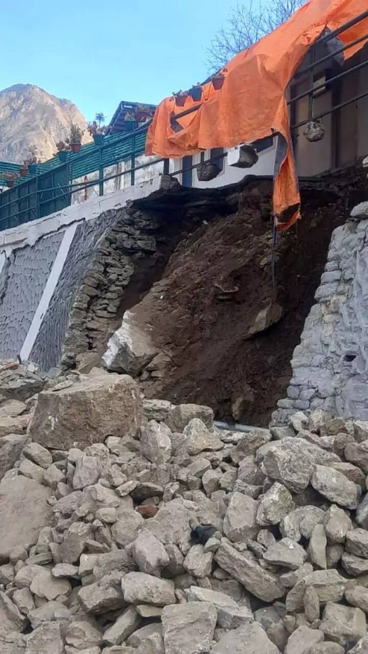
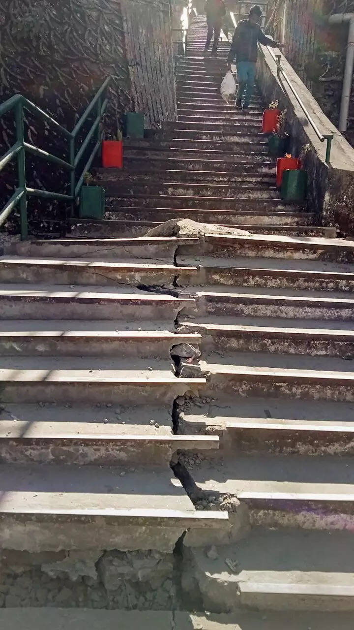
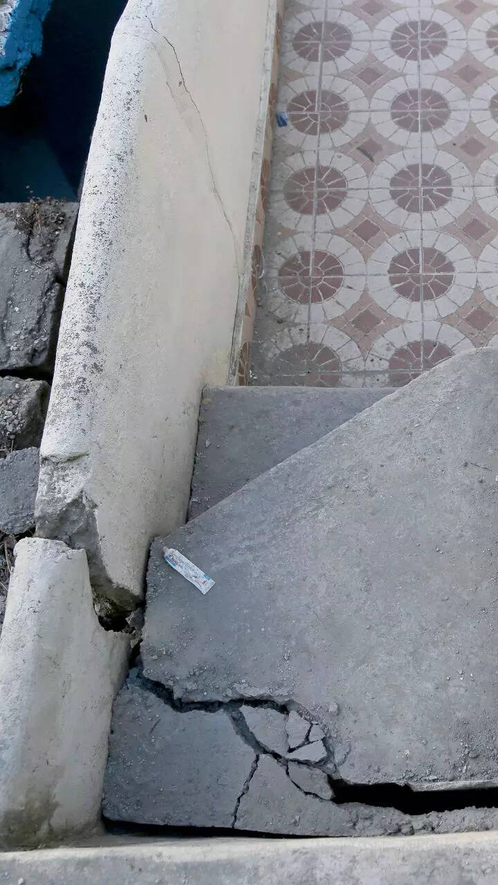
The Uttarakhand government is already conducting rescue operations in danger-prone areas and relocating residents to safer locations as a priority. The satellite images also indicate that the Joshimath-Auli road is at risk of collapse due to the land subsidence.
Watch What satellite images reveal: All of Joshimath may sink!
The Uttarakhand cabinet meeting is taking place after the CM's meeting with all stakeholders on the Joshimath land subsidence issue yesterday.

Image released by ISRO. Photo: IANS
During the meeting on Thursday, the chief minister interacted with the Army, ITBP, NDRF and scientists from various establishments engaged in landslide investigation, district administration, police and district-level officers associated with essential services at Sunil ITBP camp.
Meanwhile, the Indian Space Research Organisation's (Isro) National Remote Sensing Centre (NRSC) in Hyderabad has released satellite images that reveal the severe land subsidence affecting the town of Joshimath. The images, taken by the Cartosat-2S satellite, show that the entire town, including the Army's helipad and a temple, has been designated as sensitive zones.
1/20
What ISRO images tell about the sinking Joshimath
Show Captions
The preliminary report from Isro states that the land subsidence was slow between April and November 2022, during which time the town sank by 8.9cm.

Image released by ISRO. Photo: IANS
However, between December 27, 2022 and January 8, 2023, the intensity of land subsidence increased dramatically, causing the town to sink by an additional 5.4 cm in just 12 days.
The Uttarakhand government is already conducting rescue operations in danger-prone areas and relocating residents to safer locations as a priority. The satellite images also indicate that the Joshimath-Auli road is at risk of collapse due to the land subsidence.
1/20
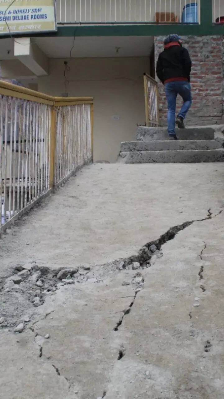
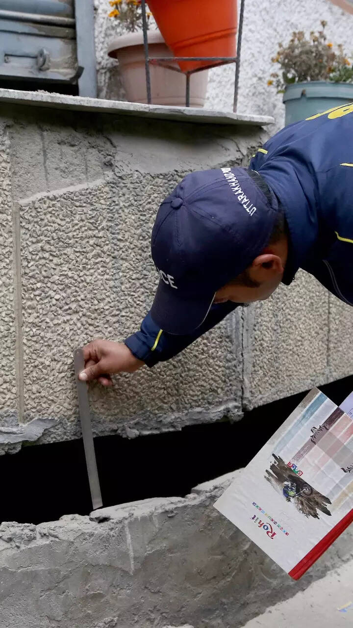
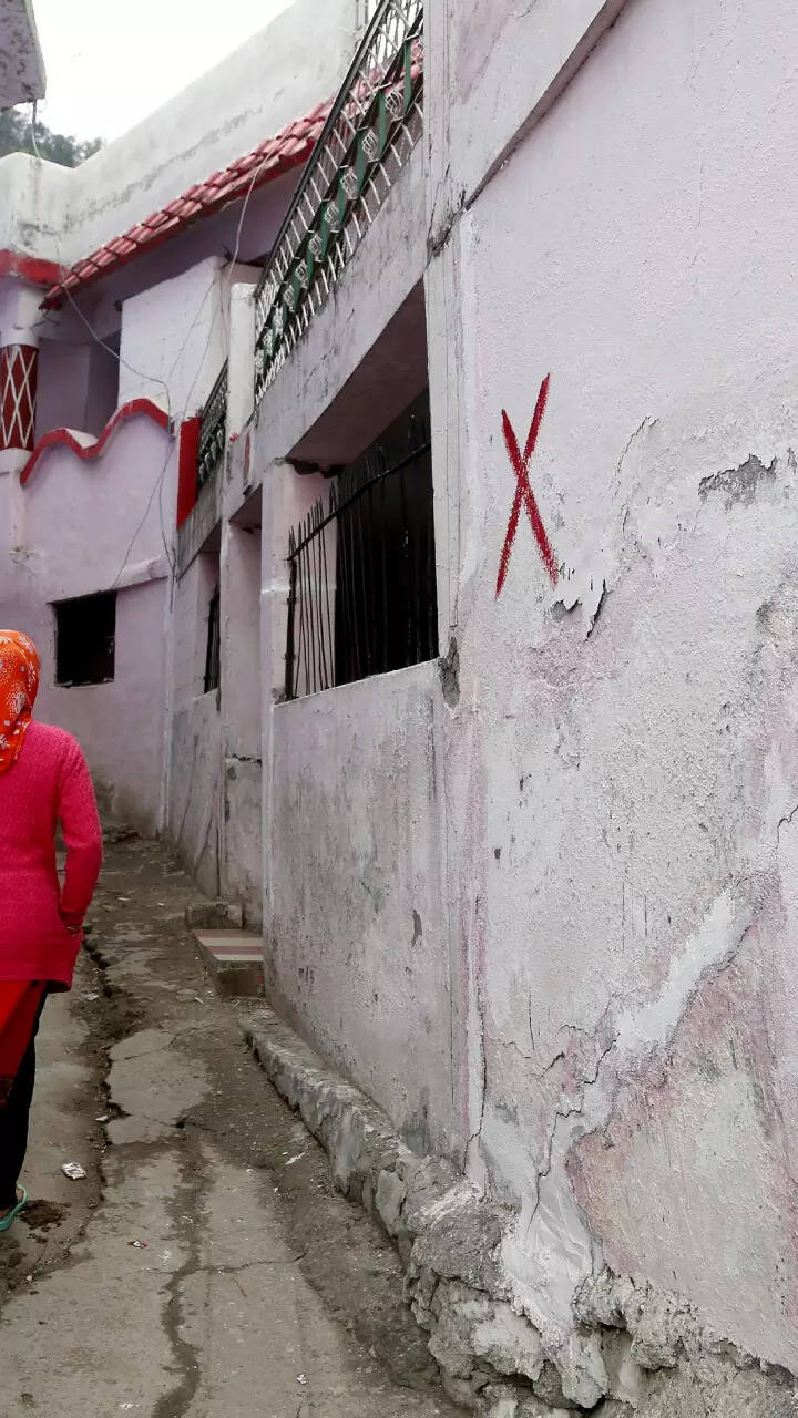
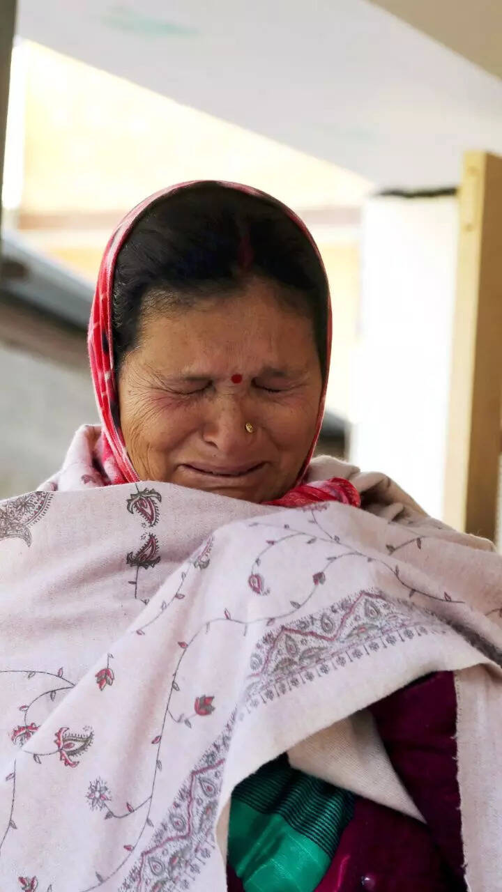
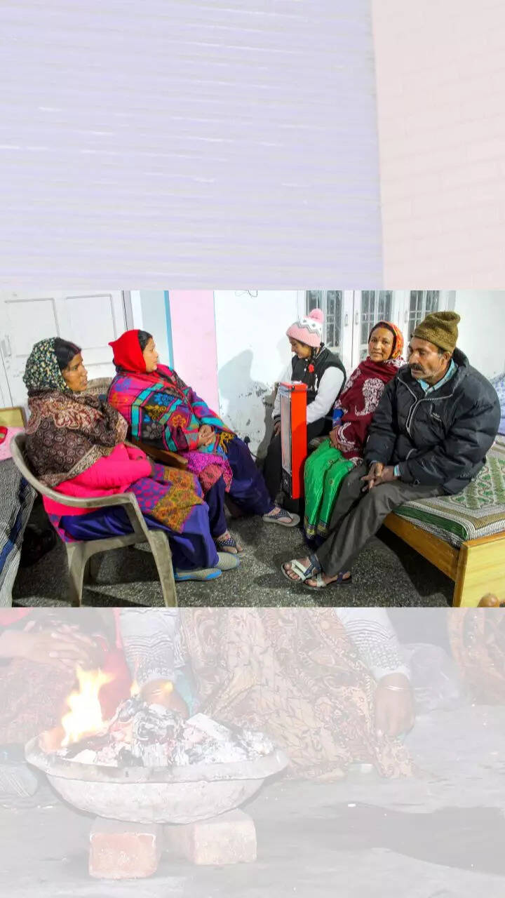
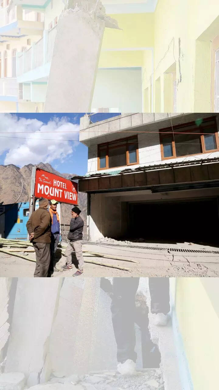
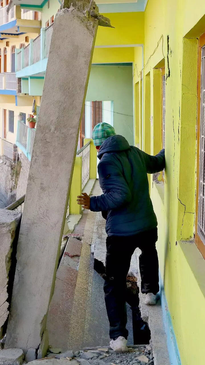
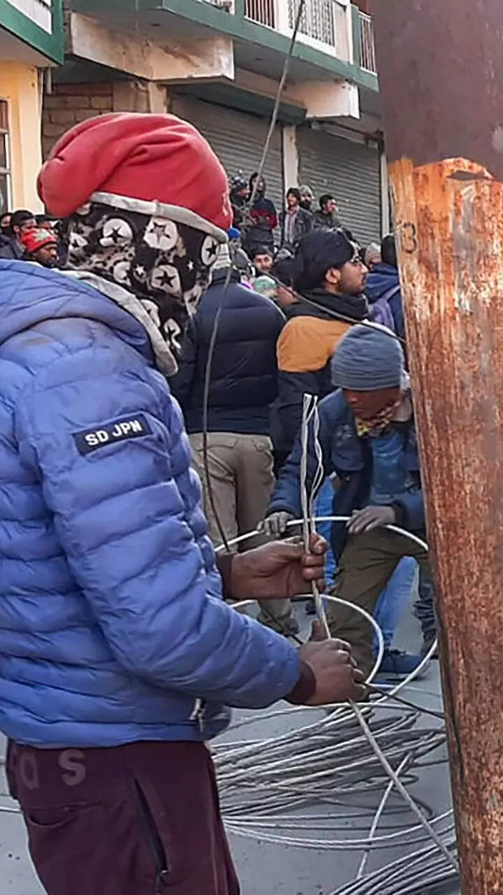
These photos capture the anger and helplessness in Joshimath
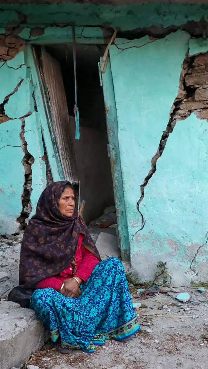
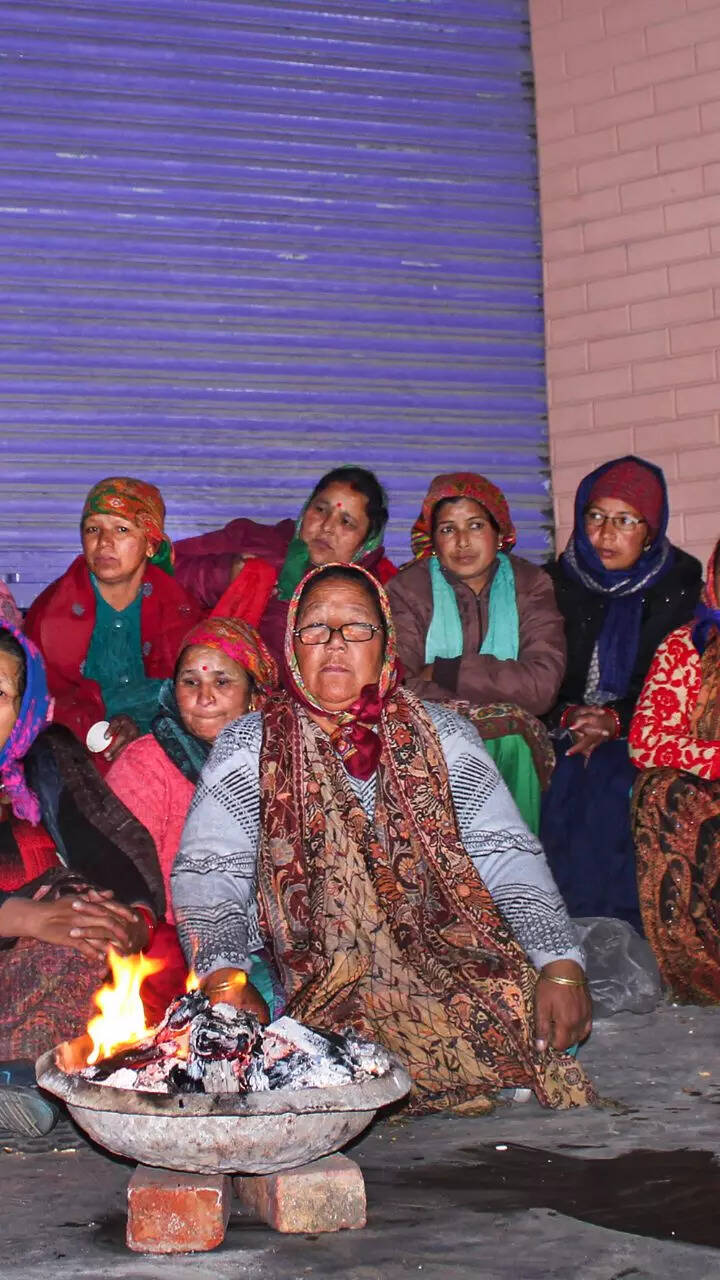
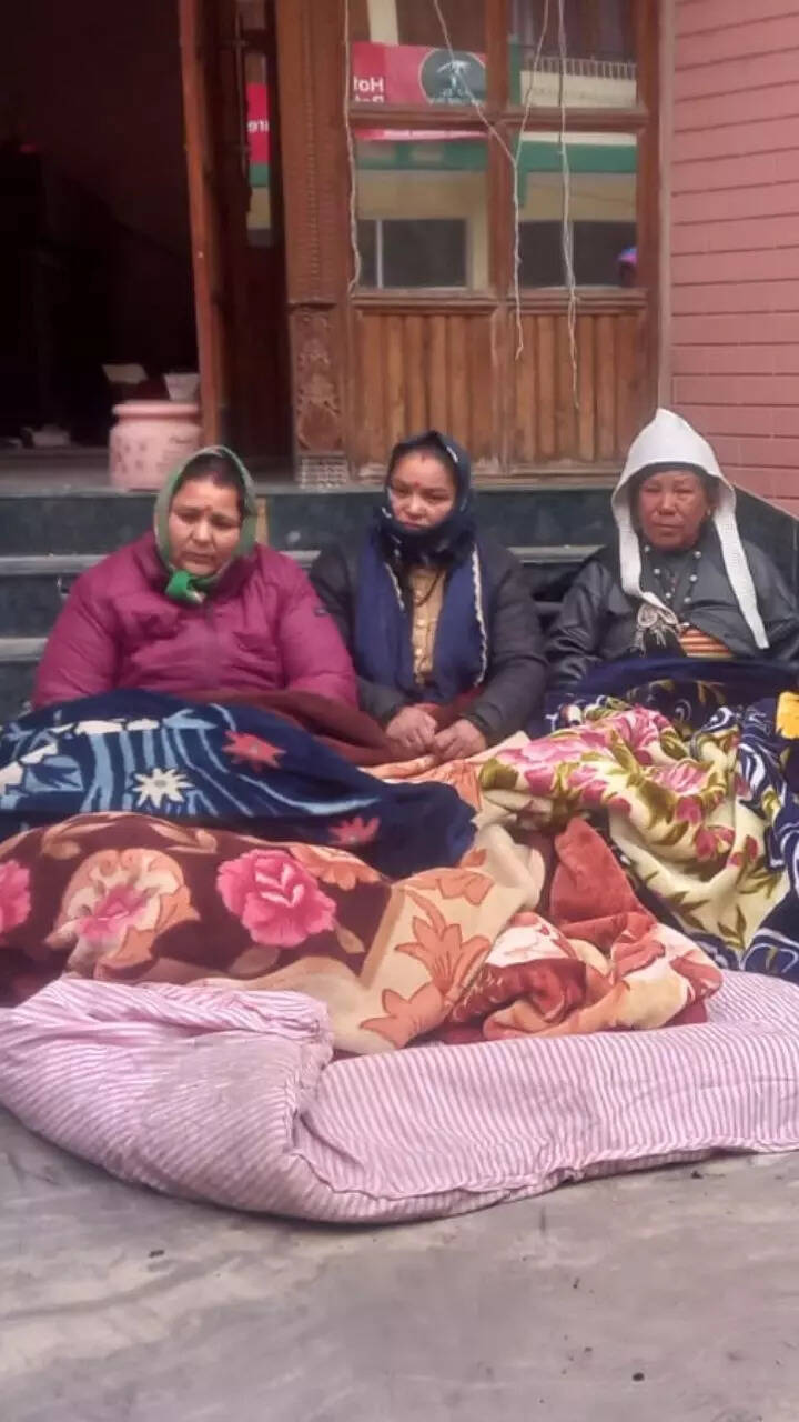

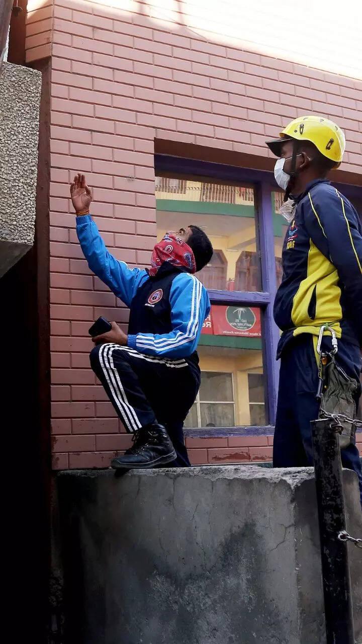
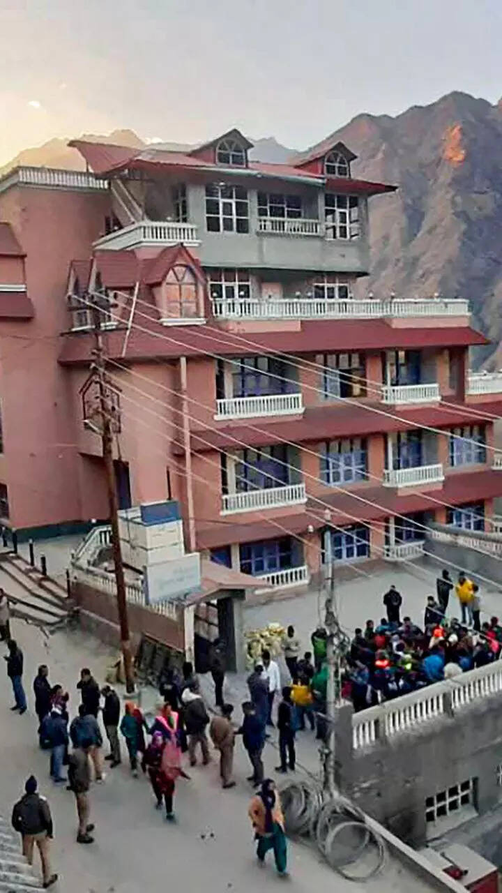
Show Captions
Watch What satellite images reveal: All of Joshimath may sink!
Start a Conversation
FOLLOW US ON SOCIAL MEDIA
FacebookTwitterInstagramKOO APPYOUTUBE


Budget
Top Trending
Popular Categories
Hot on the Web
Top Trends
Sharad Yadav DeathToday HoroscopeSharad YadavGanga Vilas LaunchDelhi Weather TodayJoshimath Land SinkingInd vs SL ODI HighlightsCovid Cases in IndiaCoronavirus Live UpdatesCovid Cases TodayHockey World Cup CeremonyCleanest Cities In IndiaAgniveer TrainingRussia Ukraine War LiveUnion BudgetAP Constable Hall TicketChina Covid NewsCryptocurrency Price in India
Trending Topics
Shah Rukh KhanLohri MessagesLohri QoutesWaltair Veerayya ReviewThunivu CollectionAlia BhattBigg Boss 16Zodiac SignsShruti HaasanMiss India Universe 2022Sri SatyaLohri WishesNamita ThaparMakar Sankranti ImportanceWaltair Veerayya Movie ReviewVarisu CollectionVivo Y55sLaptops under 30000WiFi RoutersTablets under 15000
Living and entertainment
Copyright © 2023 Bennett, Coleman & Co. Ltd. All rights reserved. For reprint rights: Times Syndication Service