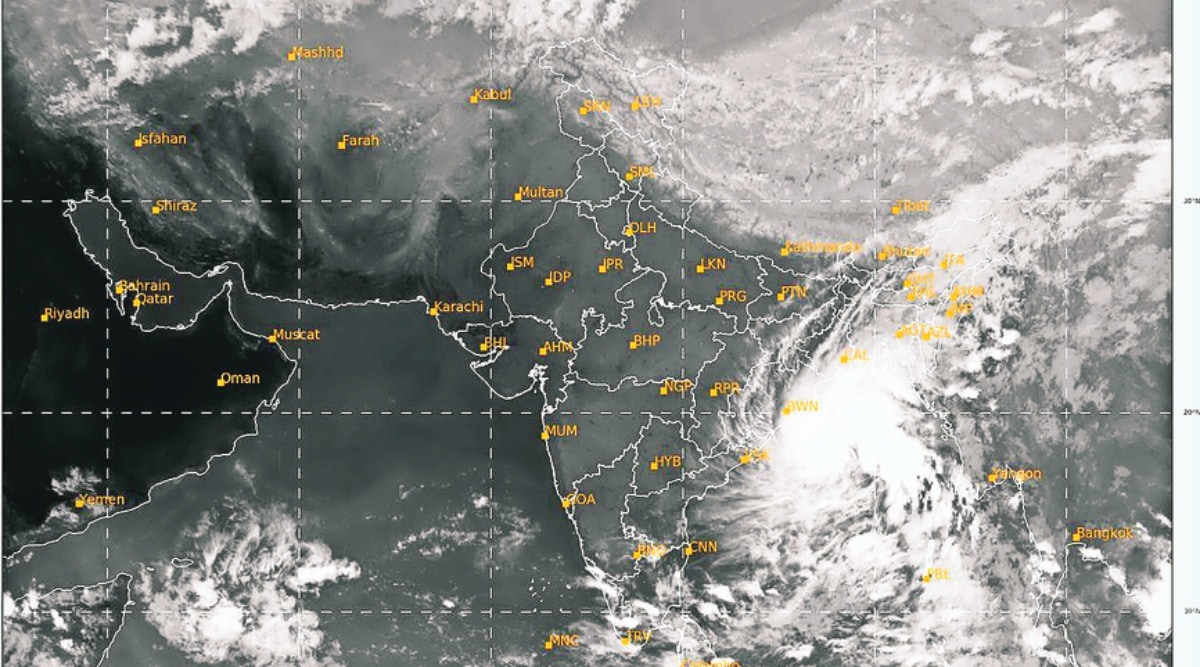
 A satellite image of the cyclonic storm over Bay of Bengal on Sunday 6 pm. (Source: IMD)
Cyclone Sitrang Live Updates, October 24: The India Meteorological Department (IMD) said Monday that cyclonic storm Sitrang was about 300 km from Sagar Island and that it would intensify further into severe cyclonic storm in next 6 hrs.
The southern districts of West Bengal, including Kolkata, woke up to light rain and an overcast sky on Monday as cyclone ‘Sitrang’ moved towards north Bay of Bengal, raising the likelihood of a downpour during the day and threatening to dampen Diwali festivities. The system is expected to make a landfall between Tinkona island and Sandwip in Bangladesh early on October 25, the Met department said. It lay centred around 430 km south of Sagar Island on Monday morning, the department said.
Sitrang, which is likely to intensify further into a severe cyclonic storm, will bring in its wake heavy to very heavy rain and wind reaching speed of 90 to 100 kmph, gusting to 110 kmph, in the coastal districts of South 24 Parganas, North 24 Parganas and East Midnapore on Monday, the weather office said. The cyclone is expected to cross Bangladesh and adjoining West Bengal coast on Tuesday morning (October 25). According to the forecast, Sundarbans, on both sides of the international border, is likely to receive the maximum impact.

According to the IMD bulletin, Cyclone Sitrang is centred about 300 km south- southeast of Sagar Island. It is very likely to continue to move north-northeastwards and intensify further into a severe cyclonic storm during next 6 hours.
The cyclone will cross Bangladesh coast between Tinkona Island and Sandwip close to Barisal around 25th October early morning.
According to the IMD bulletin, rough to very rough sea conditions are prevailing along and off Odisha, West Bengal and Bangladesh coasts on Monday, 24th October. It will become high to very high from monday evening along the WB and Bangaldesh coasts.
Wind Speed: Squally wind speed reaching 40-50 kmph gusting to 60 kmph is prevaling along and off the coasts of Odisha and West Bengal, says the IMD.It will gradually increase to 90 kmph along WB coast till today evening.
The IMD has predicted that a tidal wave of about 1 metre above normal tide is likely to inundate low lying areas of West Bengal (North and South Parganas) when Cyclone Sitrang makes a landfall.
According to IMD, Cyclone Sitrang is centred about 380 km south of Sagar Island as of today morning. It will cross Bangladesh coast between Tinkona Island and Sandwip close to Barisal around 25th October early morning.
The southern districts of West Bengal, including Kolkata, woke up to light rain and an overcast sky on Monday as cyclone 'Sitrang' moved towards north Bay of Bengal, raising the likelihood of a downpour during the day and threatening to dampen Diwali festivities.
The system is expected to make a landfall between Tinkona island and Sandwip in Bangladesh early on October 25, the Met department said. It lay centred around 430 km south of Sagar Island on Monday morning, the department said.
Sitrang, which is likely to intensify further into a severe cyclonic storm, will bring in its wake heavy to very heavy rain and wind reaching speed of 90 to 100 kmph, gusting to 110 kmph, in the coastal districts of South 24 Parganas, North 24 Parganas and East Midnapore on Monday, the weather office said. Read more
As the cyclonic storm Sitrang moves north-northeastwards and intensifies into a severe cyclonic storm during next 12 hours, it will continue to move in the same direction and likely cross Bangladesh coast between Tinkona Island and Sandwip close to Barisal around October 25 early morning, the IMD said Monday.
The cyclonic storm 'Sitrang' over west-central and adjoining east-central Bay of Bengal on Monday moved north-northeastwards with a speed of 15 kmph in the past six hours and lay centered at 5.30 am over east-central and adjoining areas of west-central and north-west Bay of Bengal, about 810 km north-northwest of Port Blair, 430 km south of Sagar Island and 580 km south-southwest of Barisal (Bangladesh).
The India Meteorological Department (IMD) said Monday that cyclonic storm Sitrang was about 520 km from Sagar Island and that it would intensify further into severe cyclonic storm in next 12 hrs.
More from India
The India Meteorological Department (IMD) said that Cyclone Sitrang developed over the east-central Bay of Bengal around the late evening hours on Sunday.
The India Meteorological Department (IMD) said on Sunday that Cyclone Sitrang will develop over the east-central Bay of Bengal around the late evening hours.
In it's latest bulletin, IMD said, "Deep depression over west-central & adjoining east-central Bay of Bengal moved northwestwards with a speed of 18 kmph during the past 6 hours & is very likely to move northwestwards during next 6 hrs & intensify into a cyclonic storm over the central Bay of Bengal."
With the India Meteorological Department (IMD) predicting heavy rainfall and thunderstorm in Tripura on Diwali, the state government has alerted district officials to take precautionary measures at the earliest. According to the IMD, heavy to very heavy rainfall will occur at isolated places in the state on Monday and Tuesday owing to the low pressure that has developed in the Bay of Bengal.
A letter issued from the office of P Acharjee, additional secretary to the state government, said, “Heavy rains and thunderstorms may affect this Diwali festival. However, looking at the current situation, may follow the impact-based advisories of IMD and take up following measures…”. Acharjee has instructed all district magistrates to alert the National Disaster Response Force (NDRF), the State Disaster Response Force (SDRF), fire services and trained volunteers to remain ready to tackle any situation, if required. Read more
The India Meteorological Department (IMD) said Sunday that Cyclone Sitrang will develop over the east-central Bay of Bengal around the late evening hours. It will be the first October cyclone to develop in the Bay of Bengal after Cyclone Titli in 2018, and is expected to make landfall near Bangladesh’s Barisal on Tuesday morning.
On Sunday morning, the prevailing depression strengthened into a deep depression (wind speed 50-60 kmph, gusting to 70 kmph). The system was located about 640 km northwest of Port Blair, 670 km south of West Bengal’s Sagar Island and 820 km south-southwest of Barisal in Bangladesh. Read more
Heavy rain and wind gusts up to 100 kmph are likely to hit the coastal areas of West Bengal as a deep depression over Bay of Bengal intensifies into a possible cyclone by Sunday evening, dampening Kali Puja and Diwali festivities in large parts of the state.
It is very likely to bring heavy to very heavy rain in coastal districts of South 24 Parganas and North 24 Parganas, and heavy rainfall in East and West Midnapore on Monday, while Kolkata, Howrah and Hooghly are likely to receive moderate rain on Monday and Tuesday, the Met Department said in a bulletin. Heavy rain will occur in North 24 Parganas, South 24 Parganas and Nadia on Tuesday, it said.
A Kolkata Municipal Corporation official said it has initiated steps to tackle any situation that may emerge owing to the impending cyclone in the metropolis, including keeping all pumping stations active and making arrangements for shifting residents from dilapidated buildings to local schools or community halls. (PTI)
Coastal districts of Odisha and West Bengal will receive widespread heavy rainfall till Tuesday, with moderate to heavy rainfall likely over southern Assam, east Meghalaya, Nagaland, Mizoram, Manipur and Tripura on Monday, the IMD said.
Meaniwhile, heavy rainfall at isolated palces over Andaman and Nicobar Islands tis also expected today.
According to the IMD bulletin, squally wind speed reaching 35-45 kmph gusting to 55 kmph is very likely along & off Odisha and West Bengal coasts and Andaman Islands and adjoining north Andaman Sea on Sunday.
Depression over eastcentral Bay of Bengal moved northwestwards with a speed of 17 kmph during past 6 hours, intensified into a Deep Depression and lay centered at 5:30 am as of today, the 23rd October over the same region near latitude 15.4N and longitude 89.0E, about 580 km northwest of Port Blair, 700 km south of Sagar Island and 830 km south of Barisal (Bangladesh).
It is very likely to move northwestwards during next 12 hrs and intensify into a cyclonic storm over central Bay of Bengal. Thereafter, it would recurve and move north-northeastwards and cross Bangladesh coast between Tinkona Island and Sandwip around 25th October early morning.