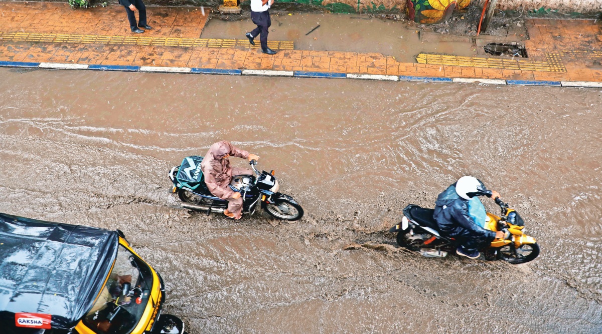
 The cyclonic circulation continues to prevail over interior Karnataka, which has brought Bengaluru to its knees. On Wednesday, the rainfall activity shifted to northern Karnataka and will continue to do so in the coming days. Guttal (150mm), Gadag 9120mm), Kakkeri (80mm) recorded heavy rainfall since Tuesday.
 A fresh low-pressure system is likely to form over the Bay of Bengal on Thursday and keep the momentum of rainfall activity over most parts of the country going till the end of this week, the India Meteorological Department (IMD) has said.
Even though the Southwest monsoon begins to retreat from the extreme northwestern parts of the country from early September, there are no immediate signs of a retreat. The upcoming synoptic and following systems are likely to keep the monsoon active and the rainfall activity is expected to continue till the third week of the month, the Met said.
On Wednesday, the IMD said a cyclonic circulation had formed over east-central Bay of Bengal. “Under the influence of this cyclonic circulation, a low-pressure system is likely to form over the west-central Bay of Bengal during the next 24-hours,” the IMD said in its bulletin on Wednesday.
The present active monsoon spell will affect central, peninsular and eastern India, the agency said, adding that Odisha, Chhattisgarh, Telangana, Andhra Pradesh, Maharashtra, Gujarat and parts of northern Karnataka and Kerala will receive widespread heavy rainfall (64.5 to 115.4mm in 24 hours) over the next five days.
At present, there are multiple favourable weather systems active over central India. On Wednesday, the monsoon trough shifted south of its normal position, which will bring enhanced rainfall over peninsular India regions.
The cyclonic circulation continues to prevail over interior Karnataka, which has brought Bengaluru to its knees. On Wednesday, the rainfall activity shifted to northern Karnataka and will continue to do so in the coming days. Guttal (150mm), Gadag 9120mm), Kakkeri (80mm) recorded heavy rainfall since Tuesday.
On Wednesday, the entire southern India along with Maharashtra and Goa received normal or above rainfall. Since June 1, the quantum of rainfall across the country was 784.9mm, 5 per cent above normal. With three more weeks of the monsoon remaining, it is highly likely that the country would end up receiving normal seasonal rainfall this year.
According to IMD’s latest forecast, rainfall intensity over Bengaluru will reduce significantly even as cloudy skies would prevail till the end of this week. Both urban and rural areas of Bengaluru, the IMD said, will receive light rainfall (2.4 to 15mm in 24-hours) over the next five days.
An ‘orange’ alert is out for north interior Karnataka, Telangana, Andhra Pradesh and Odisha till Saturday, with the IMD warning of widespread very heavy rainfall (115.5 to 200.4mm in 24-hours).
The Met had also issued a ‘yellow’’ alert on Saturday and Sunday, warning of heavy rain, thunder and lightning over Gujarat, eastern Rajasthan, Uttar Pradesh, Bihar, West Bengal, Delhi, Uttarakhand, Himachal Pradesh, Punjab, Haryana and Jammu and Kashmir.