
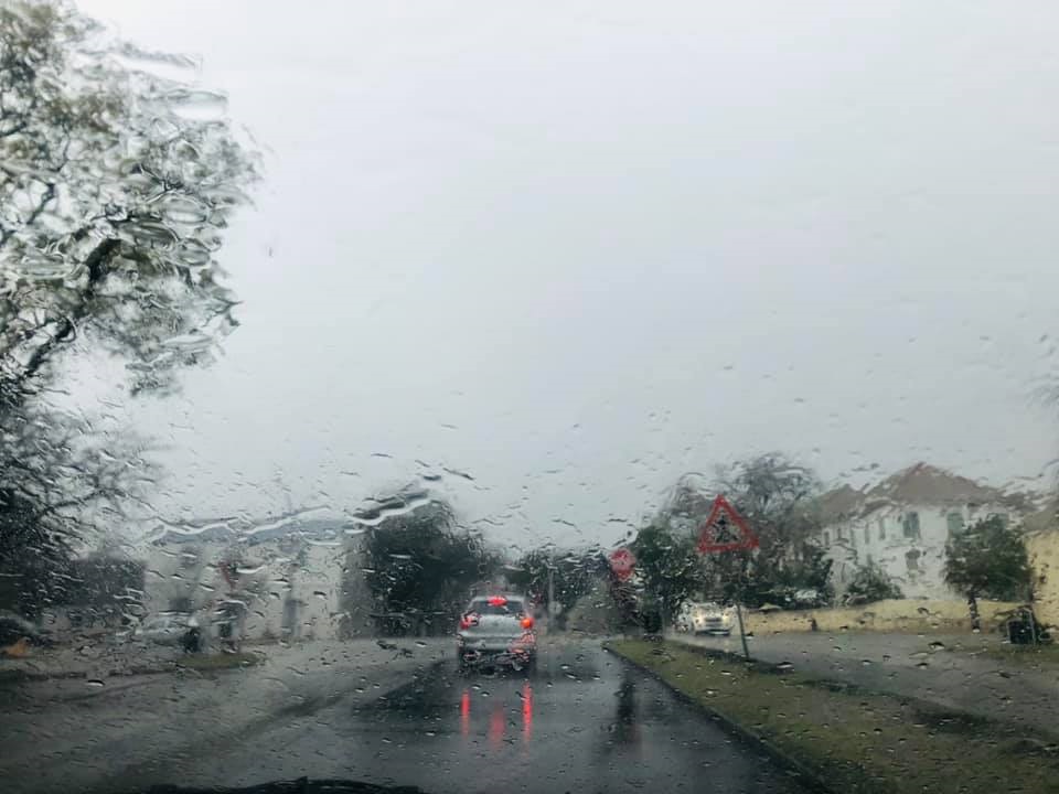
- Eastern Cape residents are bracing themselves for icy temperatures, wind and rain as two winter system move over the country.
- Snow could fall in high-lying areas from Thursday.
- The intense cold front will cause temperatures to drop significantly, with showers and rain in most places over the Eastern Cape.
A cold front is sweeping through the Eastern Cape, bringing icy temperatures, wind and rain.
According to the South African Weather Service, two winter systems are moving over the country and their impact is expected to extend into the weekend.
Snow could fall in high-lying areas from Thursday and the intense cold front will cause temperatures to drop significantly and lead to showers and rain in most places in the Eastern Cape.
The SA Weather Service in Gqeberha said freezing temperatures were expected on Thursday, resulting in snowfall over high-lying areas from the afternoon into Friday.
??Media Release: Two winter systems affecting South Africa in the days to come (12 to 15 August 2021). pic.twitter.com/Mc0QJEZR69
— SA Weather Service (@SAWeatherServic) August 11, 2021
Very cold conditions are expected in places over the western parts of the Eastern Cape on Thursday, spreading across the whole province by Friday and persisting into Saturday.
Windy conditions are also expected over the interior on Friday.
On Saturday, showers and rain are expected across the Eastern Cape with heavier falls over the northern parts of the province.
But according to SAWS spokesperson Garth Sampson, the rain won't be enough to end the drought in the province.
"In a nutshell, we expect some nice rain but not enough to end the water crisis," Sampson said.
Cold front made landfall over the Western and Eastern Cape Provinces. Expected to move into KZN tonight and to Mpumalanga, parts of GP and Limpopo tomorrow. Widespread snowfall is expected over the high lying areas of EC today and tomorrow including the Drakensberg of KZN. pic.twitter.com/oy79m12Btz
— SA Weather Service (@SAWeatherServic) August 12, 2021
The weather authority has issued the following warnings for the province:
- A yellow level 2 for disruptive rain is expected along the South Coast and adjacent interior from Thursday, persisting into Friday and resulting in localised flooding of settlements, roads and low-lying areas. Traffic disruptions can also be expected.
- an orange level 5 for disruptive snow is expected over the high lying areas into Friday, resulting in traffic disruptions and most passes closed and some communities temporarily inaccessible.
- Very cold conditions are expected in places over the western parts on Friday, spreading across the province on Friday and persisting on Saturday.
- A yellow level 2 for disruptive rain is expected over the northern parts of the province on Saturday, resulting in localised flooding and traffic disruptions.
In the Western Cape, the weather service warned in a statement, a cold front is expected to make landfall early on Thursday morning, resulting in rainy and very cold conditions.
It said the conditions were expected to spread to the Eastern Cape during the day and to parts of KwaZulu-Natal in the evening hours, extending into Friday.
Widespread rainfall of 15 to 35mm is expected over the southern parts of the Western Cape and the south-western parts of the Eastern Cape.
— Azwi Tuwani (@atuwani) August 12, 2021
Twenty-four-hour accumulated rainfall of up to 40 to 50mm is also likely along coastal and adjacent mountainous regions of the eastern Garden Route District of the Western Cape and the south coast and adjacent interior of the Eastern Cape, resulting in localised flooding of susceptible areas and roads.
Snowfall is expected over the eastern high-lying areas of the Western Cape, spreading to the high-lying areas of the Eastern Cape from the afternoon into the evening, and persisting into Friday, where some areas may experience traffic disruptions on roads and mountain passes.
Furthermore, snowfall is also expected to spread to the Drakensberg regions of KwaZulu-Natal from Thursday night onwards.
The good news is that weather conditions will generally start to improve over the Western Cape on Friday when the cold conditions can be expected to arrive in parts of Mpumalanga and southern Gauteng.
??A cold front will bring very cold conditions, snow and rain to parts of the Western and Eastern Cape Provinces from tomorrow (12 August 2021). Here are the impacts that can be expected. Small stock farmers are advised to take the necessary precautions. pic.twitter.com/8ucv6N8am9
— SA Weather Service (@SAWeatherServic) August 11, 2021
The national weather desk added that a second weather system, a cut-off low pressure system (an upper-air low pressure system displaced northwards and isolated from the original westerly wave regime), would develop on Friday over the country's western interior.
As a result, windy and cold conditions will prevail across most parts of the country on Friday and Saturday.
Showers and thundershowers will develop in association with the cut-off low, affecting the eastern parts of the Northern Cape, the Free State, and the northern and eastern parts of the Eastern Cape.
Rainfall of 30 to 40mm can be expected over the extreme eastern parts of the Northern Cape, the south-western parts of the Free State and the extreme northern interior of the Eastern Cape, where very cold conditions will persist.