Photo courtesy of the National Weather Service.
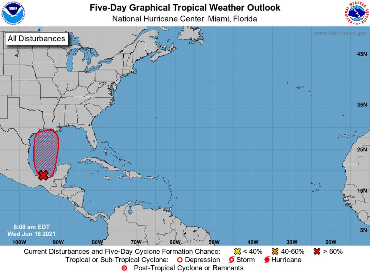
National Weather ServiceThe National Hurricane Center has now increased the chance for a tropical development by the end of the week to 90%.
According to National Weather Service Lake Charles Warning Coordination Meteorologist Roger Erickson, the system hasn’t moved much this week but it’s expected to start moving north and become a tropical depression late Thursday or Friday.
Meteorologist Donald Jones during a Wednesday afternoon Facebook Live briefing said the system could even develop into a medium-strength tropical storm, but it’s not expected to grow much stronger.
“All indications over the past few days is that this will be a rather weak tropical system,” he said.
As a result of the system, the Southeast Texas and Southwest Louisiana region should expect higher rain chances and elevated tides Friday through the weekend. Tides are expected to run 1 to 2 feet above normal and rain totals could be up to 5 inches.
However, that rain chance has come down since the storm has started tracking to the east, Jones said.
“Anywhere from Southeast Texas to Central Louisiana is where we’re pinpointing at the moment for (the center of the storm) to reach,” he said during the briefing.
The higher rainfall totals and wind gusts are expected east of the center.
However, Erickson still cautioned that residents should expect street flooding in heavier rain bands. The storm also is expected to present an isolated tornado threat in certain areas.
The storm is expected to be out of the Southeast Texas area by late Sunday, but it won’t take the rain chance with it.
A “cold front” will bring another round of showers and thunderstorms early next week.
“If we do see significant rain from the tropical system, the additional rain from this frontal boundary may continue the flash flood situation if we have one set up,” Jones said.
Residents should expect to begin seeing storm-related weather advisories on Thursday afternoon.
kaitlin.bain@beaumontenterprise.com
twitter.com/KaitlinBain