Telegraph Fire Map, Update as Arizona Blaze Burns Nearly 140,000 Acres
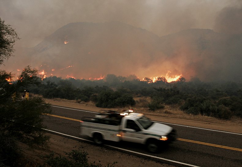
The Telegraph Fire in Arizona has burned at least 139,615 acres, with 59 percent contained, according to the latest report Wednesday from the Incident Information System of the National Wildfire Coordinating Group (NWCG).
The "fast moving and dynamic" fire was reported to be less than a mile from the Top-of-the-World area of Gila and Pinal counties.
The blaze, which was first detected on June 4, has burned 22 structures, according to the latest report posted on the Telegraph Fire Information Facebook page.
No deaths or injuries have been reported so far. The cause of the fire is noted as "human" and is under investigation, the NWCG report said.
ABC 15 Arizona reported the Telegraph Fire has now merged with the inactive Mezcal Fire, which has burned 72,250 acres and its containment remains at 88 percent, according to the latest update Tuesday from the NWCG.
The NWCG report said: "Active fire activity burning in timber with grass and understory, brush and timber with litter and understory, has warranted numerous evacuation status alerts."
A new "Telegraph Fire Safety Closure order" has been issued for Tonto National Forest, which will be in effect from Wednesday at 6 a.m. local time through August 1 or until rescinded.
According to the latest update on the Telegraph Fire Information Facebook page, the evacuation status is now "Go" for the areas listed below.
A "Go" notification indicates "danger in your area is imminent and life threatening" and "residents should evacuate immediately," the Gila County Sheriff's Office explains.
- El Capitan (east and west)
- Dripping Springs
- Wind Spirit
- Hagen Ranch
- Slash S Ranch
- Government Springs
Telegraph Fire information maps, including the evacuation map and fire progression map, are available on Inciweb https://t.co/QCPjRKqKGF pic.twitter.com/1jcP2B1bpw
— TelegraphFireInfo (@TelegraphFire) June 15, 2021
The evacuation status for the following areas of Arizona is now at "Set," which advises residents to be prepared for the "possibility of having to evacuate," explains the official "Ready, Set, Go" website of the California Department of Forestry and Fire Protection (Cal Fire).
- Top-of-the-World
- Bellevue
- Oak Flat
- Beverly Hills
- Six Shooter
- Icehouse
The following areas of the state are under a "Ready" evacuation status, which advises residents to "Create and maintain defensible space and harden your home against flying embers," according to the "Ready, Set, Go" website.
- Superior
- Globe
- Miami
- Claypool
- Skill Center
- Central Heights
- Pinto/Carlotta
- The Battle Axe
The blaze was reported to have "transitioned from primarily burning in heavier fuels (pine, oak, dense manzanita) into lighter Sonoran desert grass/brush" and "pockets of dense brush still support very active fire behavior," the NWCG report said Wednesday.
Over the next 24 hours, the fire is expected to see easterly and southerly growth. The NWCG report said: "Better humidity recovery and more consistent winds will likely provide more consistent and predictable fire growth in the desert grass and brush.
"The green triangle in the north will continue backing downslope in the pine. Eastern growth from Hwy [Highway] 77 to the 2021 Mescal Fire scar will continue south of El Capitan Mountain," the report added.
The fire's southerly growth is projected to continue "in the desert grass/brush down Cedar Creek, Stone Cabin Wash, and Pioneer Creek," according to the NWCG report.
See the Telegraph Fire Information Facebook page and the NWCG website for the latest updates on the Telegraph Fire.