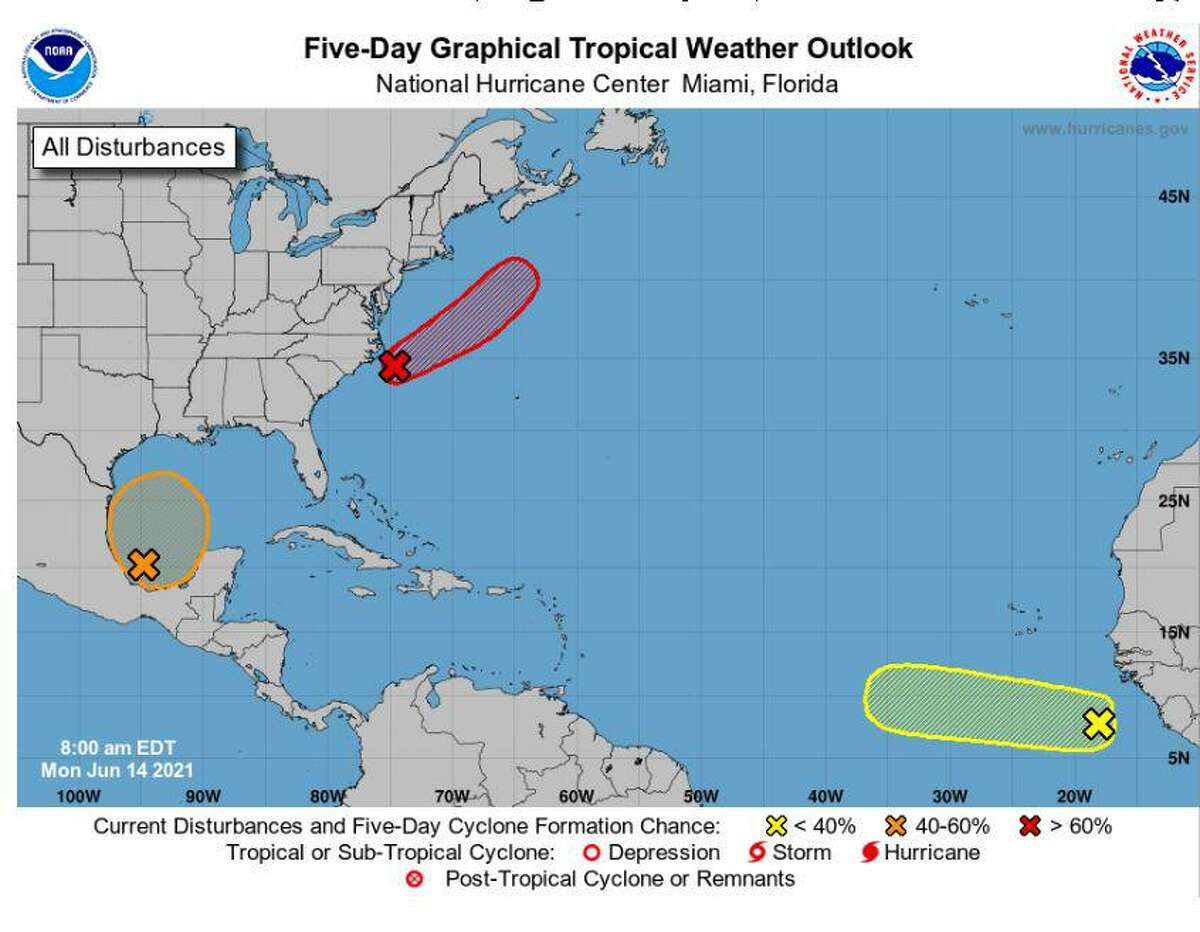
Southeast Texans glued to their weather apps on Monday saw that there is a tropical system in the Gulf of Mexico with a 70% chance of development within the next five days. But there’s no need to panic.
According to National Weather Service Lake Charles meteorologist Chanelle Stigger, the system, which currently is in the Bay of Campeche, has started to move north and later this week could become a tropical depression.
If the system does progress and moves into the Southeast Texas and Southwest Louisiana area, widespread showers and thunderstorms and higher tides could be expected, Stigger said in a Monday Facebook Livestream. In that instance, the depression likely would make landfall in the area late Friday.
However, Stigger said these are early forecasts and may change as the week progresses. NWS Lake Charles meteorologist Donald Jones said it is not certain where the system might land or how severe it might be at this point.
“I think by the middle of the week, maybe Wednesday or Thursday, we’ll have an idea (of location impact and rainfall totals),” Jones said. “Now, if we’re talking about a tropical depression or a weak tropical storm, which seems to be the most likely scenario at this point, it certainly wouldn’t be out of the realm of possibility for some areas to see 10 to 15 inches of rain.”
Jones said there is going to be widespread rain across the Beaumont area this weekend, regardless of where the storm lands, because computer models indicate the storm will be a “large, kind of sloppy, mess.”
Additionally, unrelated showers are expected over the next couple days, Stigger said. Temperatures are expected to reach the mid-90s and could carry heat advisories.
Jones and Stigger responded to some comments made on the Livestream, where viewers posed a range of questions. A frequent question was whether the system could develop into a Category 1 hurricane or larger.
“I never say never when it comes to tropical systems anymore,” Jones said. “We’ve seen so much crazy stuff across the area the last couple of years that I’ve just given up on that. But right now, both computer models have been very consistent in keeping the storm relatively weak.”
Jones said at this point, the storm likely would not reach hurricane strength but could bring more rain than wind.
Another frequent question centered around where the storm could land, but Jones and Stigger reiterated that, at this point in the forecast, it could land anywhere from Corpus Christi to Louisiana.
Jones also noted the storm likely will move slowly — about 5 to 10 miles per hour. Jones said there is no indication that the storm will stall like Tropical Storm Harvey did in 2017.
“This is the latest information we have based on the best science that’s available right now,” Jones said. “Meteorology is not an exact science — there’s plenty of errors that get introduced into forecasts the further out you go in time. So, this is the best we understand it as of right now. It’s likely to change here over the next few days, though.”
For more information, visit the National Weather Service Lake Charles’s website.
oliviasmalick@gmail.com
twitter.com/oliviamalick