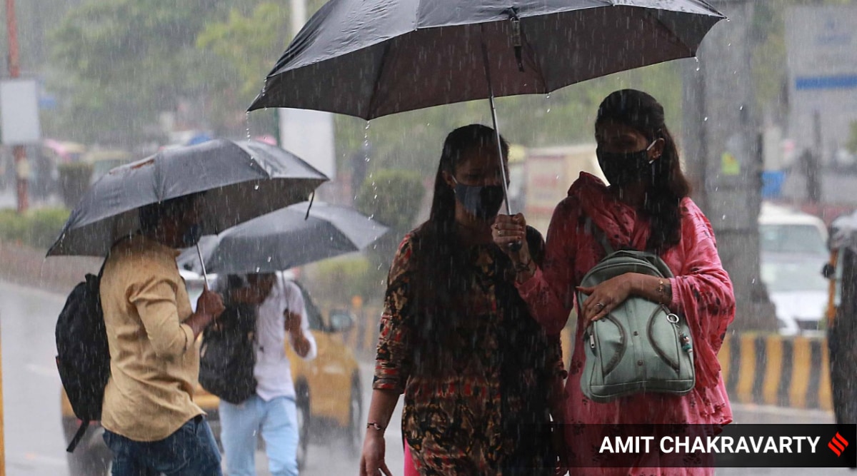
 IMD notified that the red alert for Mumbai, Palghar and Thane, turned green, as the rainfall reduced. (Express Photo by Amit Chakravarty)
Weather forecast Today Live Highlights: Nineteenth session of the South Asian Climate Outlook Forum (SASCOF-19) conducted online had predicted normal to above normal rainfall in South Asia. Heavy rainfaill has been predicted over the northwest and region along the foothills of Himalaya.
Southwest monsoon is expected to intensify in north India. IMD along with ICMR is trying to reduce the transmission of malaria in Odisha. Odisha, in 2020, witnessed 1,81,831 cases and 63 deaths.
Light shower is expected in national capital, as southwest monsoon is going to intensify in Delhi in few hours. The expected date for monsoon in Delhi in June 27.
IMD had shared a low-pressure area and cyclonic circulation over northwest Bay of Bengal, an east-west trough running from south Punjab to the centre of the low-pressure area over northwest Bay of Bengal, strong south-westerly winds along the west coast, and an off-shore trough near the west coast signify that monsoon will arrive Delhi a few weeks early.
North Goa and old Goa experienced heavy rainfall on Monday. IMD says it will rain more than 204.4 mm on June 15, as rain-bearing clouds are approaching the state from Arabian Sea.
The monsoon in west has shifted to south Konkan region. IMD notified that the red alert for Mumbai, Palghar and Thane, turned green, as the rainfall reduced.
The IMD’s Santacruz observatory recorded the maximum temperature at 33.6 degrees Celsius, while the minimum temperature was at 27.4 degrees Celsius.4
In Odisha, Puri received 52.8 mm rainfall, Cuttack district 44.2 mm till 8.30 am on Monday and Bhubaneswar recorded 11.4 mm rain. The Met centre has forecast light to moderate rain in Odisha.

Delhi forecast shows cloudy skies with light to moderate rain or thundershowers accompanied with gusty winds of 40-50 kmph speed.
The maximum temperature is expected to hover around 36 degrees Celsius.
The MeT office said the relative humidity recorded in the city at 8.30 am was 65 percent.
"Westerlies winds have slowed down the progress of the monsoon in northwest India. It is not likely to hit Delhi in the next two days," an India Meteorological Department (IMD) official had said on Monday.
It was earlier predicted that the monsoon may reach Delhi by June 15, 12 days early. (PTI)
Coastal and interiors of south Karnataka have been put on red alert according to the India Meteorological Department (IMD) after these areas experienced widespread rainfall due to active monsoon.
IMD Bengaluru Centre Head CS Patil said low pressure had developed over Jharkhand and its neighbourhoods, while a trough ran from East Central Arabian Sea to south Konkan. There was another low-pressure zone near the Karnataka coast. Due to its influence, heavy rainfall has been predicted in coastal areas.
The IMD has sounded a red alert for Udupi and Dakshina Kannada districts on June 15, orange alert on June 16 and 17 and yellow alert on June 18. For June 17, orange alert has been issued for Shivamogga, Kodagu, Gadag and Haveri districts.
Meanwhile north Karnataka experienced scattered rains on Monday. Panambur, Kutta and Bhagamandala received the highest rainfall (9 cm), followed by Mangaluru and Agumbe (8 cm).
Bengaluru city is expected to experience light to moderate rainfall for the next two days.
Heavy rain lashed most parts of Goa on Monday with Old Goa and the northernmost taluka of Pernem receiving very heavy rain throughout the day.
According to the India Meteorological Department’s (IMD) Meteorological Centre at Goa, there was a warning of likely extremely heavy rainfall – more than 204.4 mm in 24 hours – on Tuesday as well. The IMD has also predicted heavy rainfall in the state until Friday in both North and South Goa.
Parts of Panaji saw traffic diversions and water-logging Monday. The cumulative rainfall received until 8:30 pm was 113.5 mm in Old Goa, 98 mm in Panaji and 97 mm in Pernem. According to the IMD’s forecast on Monday evening, rain would very likely be accompanied by a wind of 30-40 kmph and intense short spells are very likely. Read More
More rainfall and thunderstorms are expected from the early morning hours of June 15 to 16, with light to moderate rainfall (1-5 cm) at most places and heavy to very heavy rainfall (7-12 cm) at isolated places likely during this period, states IMD Chandigarh.
Light to moderate rain (1-3 cm) at many places with isolated heavy rain (6-7 cm) likely to continue over Punjab, Haryana including Chandigarh during the next 48 hours. Isolated thunderstorms with lightning and gusty winds (30-50 kmph) also likely during this period. (ANI)
As heavy rainfall continues in Mumbai, a video of a parked car suddenly being swallowed up by a sinkhole has taken social media by storm. The incident took place in the parking lot of a residential complex in Mumbai’s Ghatkopar area, the ANI reported.
In the video going viral, a black car was seen sinking into the ground rapidly and then quickly disappearing into a pool of muddy waters. Even as the car, which appeared to be a hatchback, was swallowed up, two other vehicles parked near it were not affected. Read full report
Southwest monsoon has covered all parts of Himachal Pradesh today, states IMD, Shimla. (ANI)
Rain lashes several parts of Kochi. India Meteorological Department has predicted 'generally cloudy sky with a few spells of rain or thundershowers' for the next four days in the city.
Conditions are favourable for further advancement of southwest monsoon into most parts Madhya Pradesh, remaining parts of east Uttar Pradesh, Delhi and some more parts of west Uttar Pradesh, Haryana, and Punjab during next 48 hours, states IMD.
IMD issues update on progress of southwest monsoon
Waterlogging reported from several areas of Prayagraj following rainfall. IMD has forecast “generally cloudy sky with one or two spells of rain or thundershowers” for next four days in the city. (ANI)
Continuing its rapid progress since its onset on June 3, the southwest monsoon on Sunday has now covered nearly 80 per cent of the geographical area of the country within 10 days.
The India Meteorological Department (IMD) on Sunday afternoon said that the monsoon has reached the doorstep of Delhi, where it is most likely to arrive during the next two to three days. The normal dates for the onset of monsoon over Chandigarh and Delhi are June 26 and June 27 respectively.
By Sunday, the monsoon has covered the entire Odisha, West Bengal, Jharkhand, Bihar, Jammu and Kashmir, Ladakh, Gilgit-Baltistan and Muzaffarabad and some parts of Haryana, Chandigarh and northern Punjab, covering nearly 80 per cent of the country’s geographical area. Read full report
Light-to-moderate rainfall coupled with strong winds is expected in Delhi on Sunday, the India Meteorological Department (IMD) said.
With monsoon expected to arrive around June 15 in the city, the IMD expects cloudy skies and light showers till Thursday.
The minimum temperature recorded in the early hours of Sunday was 23.8 degrees Celsius and the maximum is set to be 35 degrees Celsius.
Mercury is expected to dip further due to the rain. On Monday, the maximum is likely to be 34 degrees Celsius, which will further go down to 33 degrees on Tuesday and Wednesday. Read More
Rains lashed several parts of Punjab and Haryana on Sunday morning, and more showers are expected in the region over the next two days, the meteorological department said here.
It said downpour was recorded at several places in the twin states between 5.30 pm on Saturday and 8.30 am on Sunday.
The Union Territory of Chandigarh, which is the common capital of Punjab and Haryana, received 20.6 mm rainfall, while its adjoining areas, including Mohali and Panchkula, also received showers, the weather office said.
In Haryana, Sirsa received a heavy downpour of 101.4 mm, while Dabwali received 62 mm rain.
Among other places, Narwana recorded 32 mm downpour, Ratia in Fatehabad 52 mm, Ambala 28.6 mm, Hansi 20 mm, Jhajjar 19 mm, Narnaul 16 mm and Rohtak 14.8 mm, the Met said.
In Punjab, Bathinda received 49.4 mm rainfall, Faridkot 24.4 mm, Hoshiarpur 23 mm, Adampur 17.2 mm, Muktsar 51 mm, Balachaur 19.1 mm, Rajpura 57.6 mm, Ludhiana 15 mm and Jalandhar 10 mm.
According to the weather office forecast, light to moderate rain and thundershowers are likely in many parts of Haryana and Punjab on June 14 and 15. (PTI)
A spell of early morning rain on Sunday provided relief to the people from scorching heat in Jammu, where the minimum temperature plummeted five notches below the season’s average to settle at 20.6 degrees Celsius.
On Thursday, Jammu city recorded the season’s highest night temperature of 30.8 degrees Celsius, while the hottest day of the season was recorded a day earlier at 42.7 degrees Celsius.
The rains started in the city around 1.50 am and continued for six hours, bringing much needed change in the weather conditions. (PTI)
Overcast conditions are likely to prevail over Pune from the afternoon of Sunday, the India Meteorological Department (IMD) has said.
The Met department also expects light-to-moderate intensity (2.4mm – 64.4mm) of rains over the ghat areas of Pune. The city’s maximum temperature will be around 28 degrees Celsius and the minimum temperature will be 22 degrees Celsius on Sunday.
Strong westerly winds and presence of an off-shore trough between south Maharashtra and Lakshadweep persists. Read More
According to India Meteorological Department Konkan and Goa can expect higher intensity rainfall on June 13 and June 14.
Some other states with the same forecast are Odisha, Chhattisgarh, West Bengal & Sikkim, Jharkhand, Madhya Pradesh, Vidharbha and Telangana.
Isolated heavy falls are predicted over Bihar, Uttar Pradesh and Uttarakhand, as per IMD. Heavy rainfall will also to take place in northwest India excluding Rajasthan on June 13.
In Maharashtra the coastal areas and adjoining ghats region will face heavy shower. Karnataka's coastal region too expects havey rainfall from June 11 to June 15.