A picture taken by International Space Station of space cargo freigher Dragon orbiting over Dubai on July 27, 2019.
Image Credit: Twitter/NASA
2 of 16
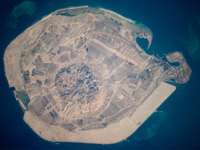
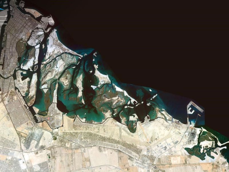
This astronaut photograph illustrates the varying character of surfaces on Sir Bani Yas, an island near the west coast of the United Arab Emirates, on March 15, 2010.
Image Credit: NASA
3 of 16
Dubai, pictured from the International Space Station as it orbited 261 miles above on Feb. 4, 2021.
Image Credit: NASA
4 of 16
The stunning picture of UAE from the ISS space station taken by Hazza Al Mansouri, the first astronaut from the United Arab Emirates to venture into space.
Image Credit: Twitter /@astro_hazzaa
5 of 16
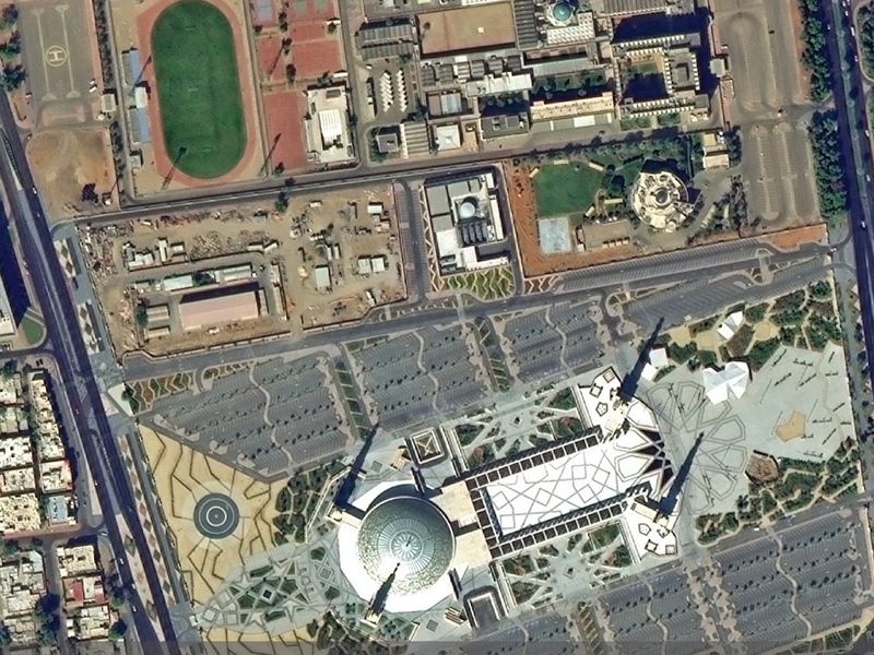
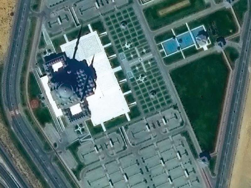
The captivating Sheikh Khalifa bin Zayed Al Nahyan Mosque in Al Ain was captured by KhalifaSat. The mosque is distinguished by its magnificent dome, which measures 86 meters in diameter and is adorned with Arabic calligraphy.
Image Credit: Mohammed Bin Rashid Space Centre
6 of 16
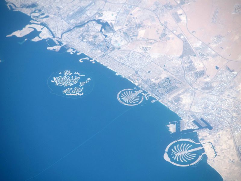
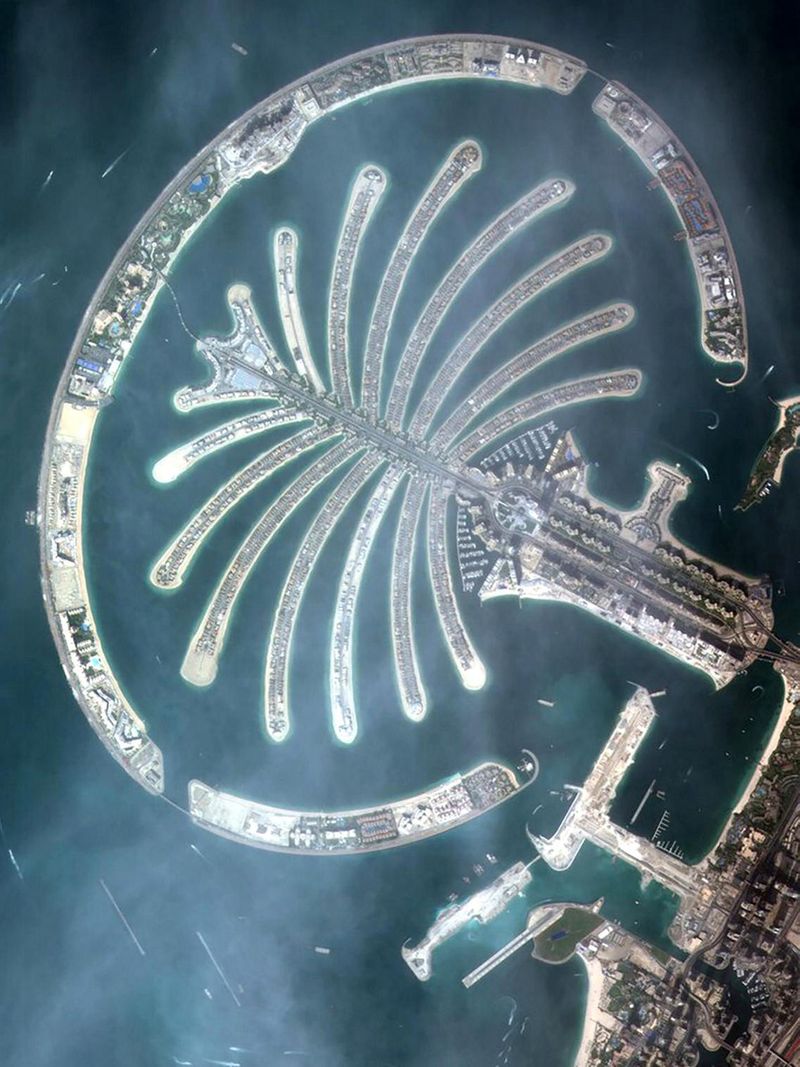
The World Islands, Palm Jumeirah and Palm Jebel Ali taken on May 29, 2019.
Image Credit: NASA
7 of 16
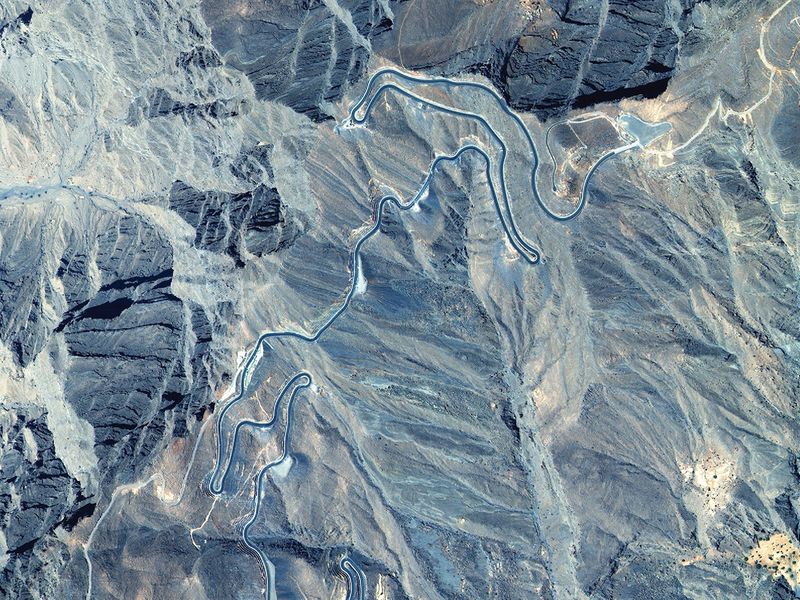
This photo, taken by KhalifaSat, shows Jebel Jais, the highest summit in the UAE (around 2,000 m above sea level), which features the world’s longest zipline with some breathtaking views.
Image Credit: Mohammed Bin Rashid Space Centre
8 of 16
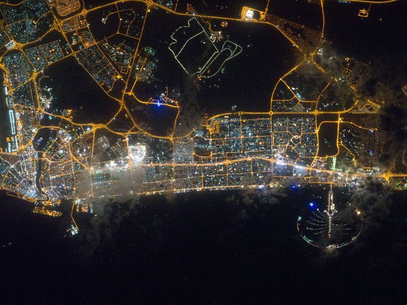
City lights of Dubai, are featured in this image taken by the Expedition 30 crew aboard the International Space Station.
Image Credit: NASA
9 of 16
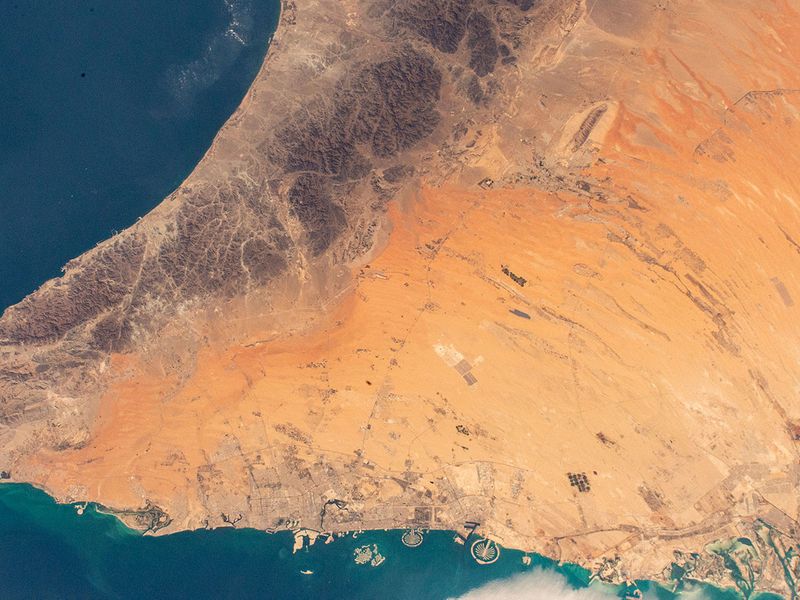
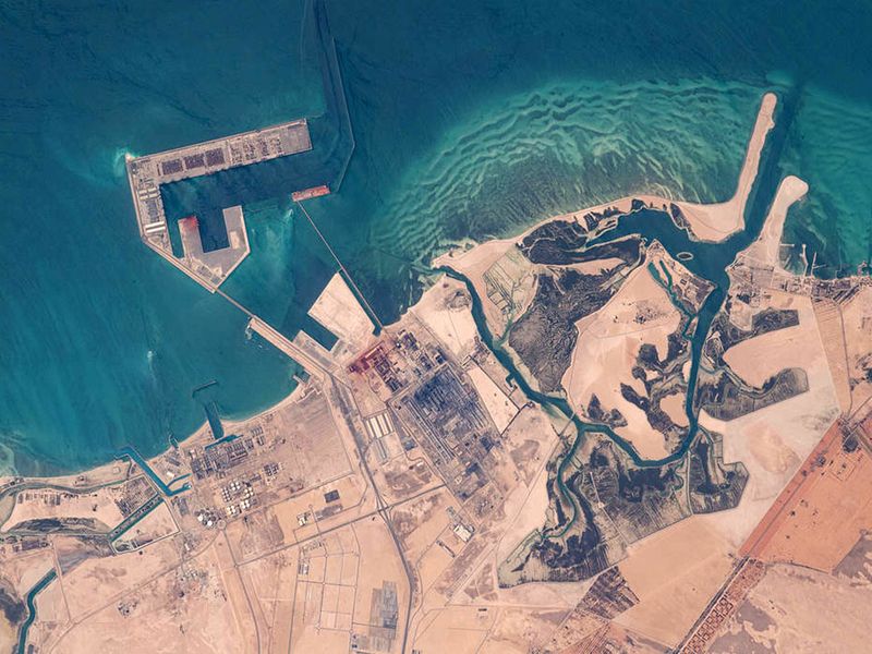
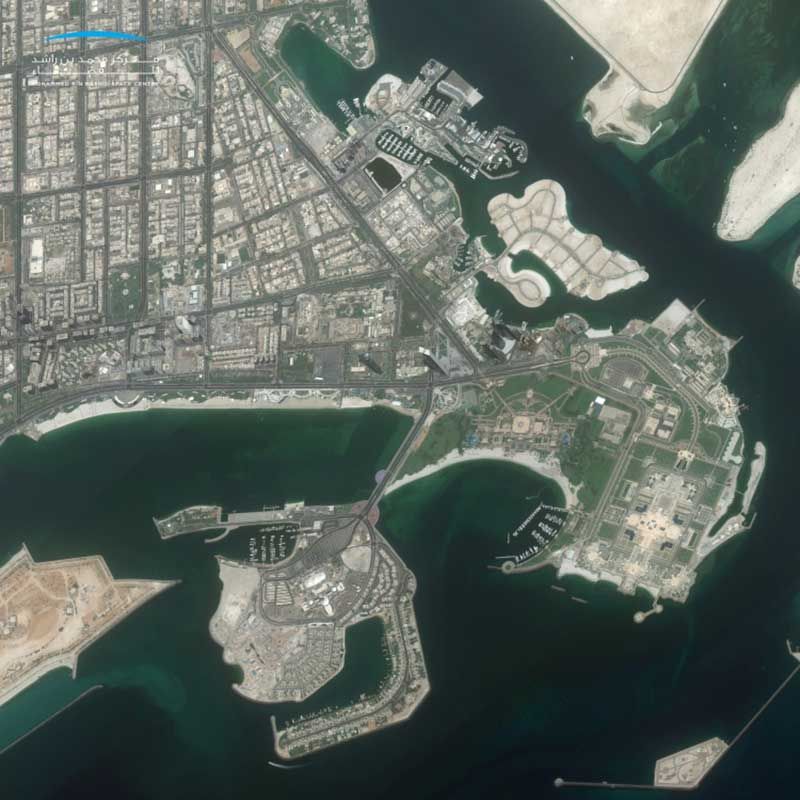
A manufacturing site near Abu Dhabi is pictured from the International Space Station as it orbited 262 miles above.
Image Credit: NASA
10 of 16
On August 4, 2020, the Mohammed Bin Rashid Space Centre announced the completion of an updated map of the Abu Dhabi and Dubai using the UAE's first high-resolution satellite image "Mosaic", captured by KhalifaSat. The system captures a matrix of individual digital images to create a single high-resolution picture of the UAE’s terrain. This imaging system by MBRSC will provide a comprehensive view of the UAE’s topography, using remote sensing systems, image processing, geographic information systems and artificial intelligence.
Image Credit: Mohammed Bin Rashid Space Centre
11 of 16
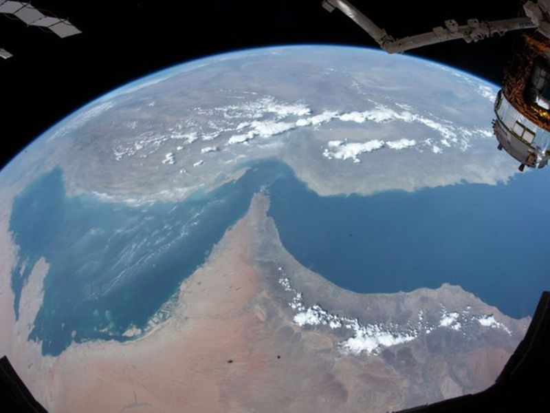
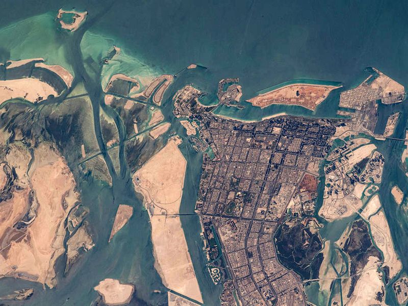
Abu Dhabi pictured from the International Space Station as it orbited 263 miles above Oman on April 19, 2021.
Image Credit: NASA
12 of 16
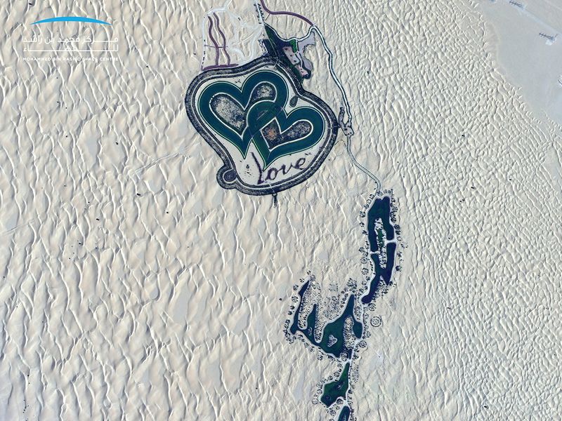
This photo, taken by KhalifaSat, shows Dubai’s Love Lake, one of the lakes at Al Qudra where the greenery and trees create a unique natural masterpiece.
Image Credit: Mohammed Bin Rashid Space Centre
13 of 16
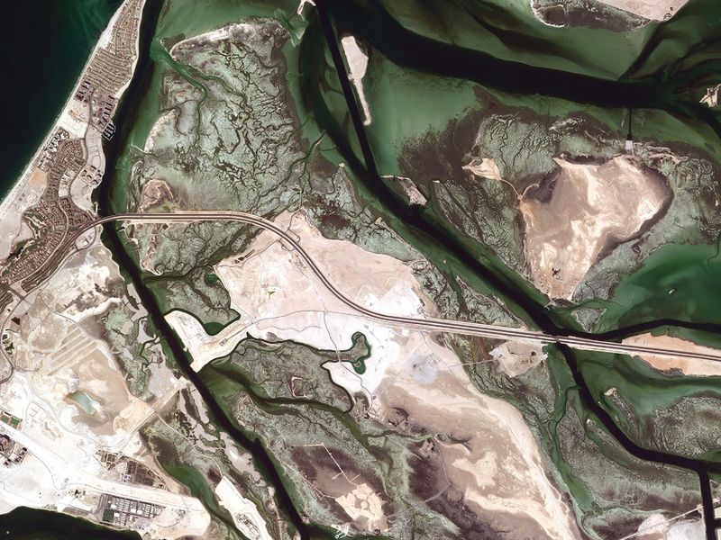
Al Jubail Island in Abu Dhabi. The island is characterized by its unique wildlife, scenic natural beauty and also features a mangrove park.
Image Credit: Mohammed Bin Rashid Space Centre
14 of 16
An aerial image of Palm Jumeirah, taken from space by KhalifaSat in 2018. The image was taken at 1.32pm when KhalifaSat passed over Dubai. This was the first official photo taken by the KhalifaSat — that of the Palm Jumeirah in Dubai — signalling the beginning of its five-year Earth imaging journey in space.
Image Credit: Mohammed Bin Rashid Space Centre
15 of 16
The fascinating domes of Sharjah Mosque from space. This photo, taken by KhalifaSat, shows the Sharjah Mosque, which can accommodate more than 25,000 worshipers. The mosque is considered a unique model of Islamic architecture.
Image Credit: Mohammed bin Rashid Space Centre
This website stores cookies on your computer. These cookies are used to improve your experience and provide more personalized service to you.
Both on your website and other media. To find out more about the cookies and data we use, please check out our Privacy Policy.