


Forecast from National Weather Service Lake Charles as of 8:30 a.m. Friday
Photo courtesy of NWS Lake CharlesAt 8:30 a.m. Friday, forecasters with the National Weather Service reported the threat of severe weather from storms headed into the area starting in the afternoon had risen.
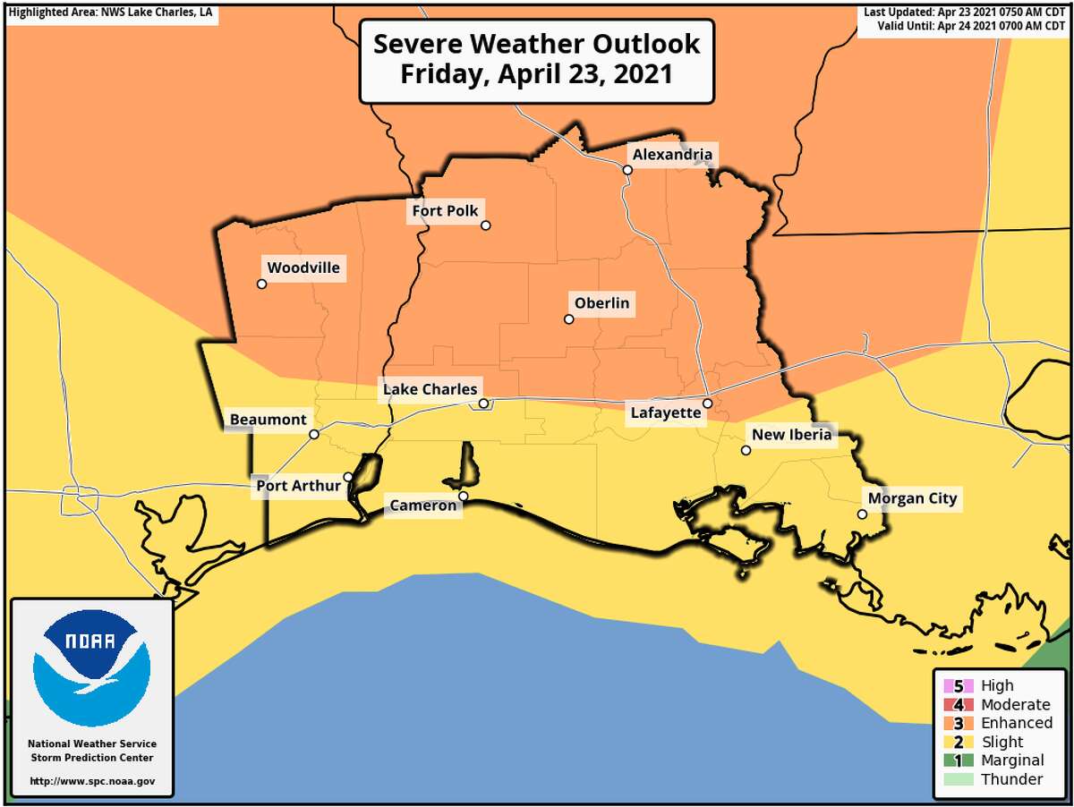
There is now an enhanced risk for tornadoes, large hail, and damaging winds along and north of the Interstate 10 corridor from Southeast Texas, across southwest Louisiana, into south central Louisiana, according to NWS Lake Charles.
Severe weather has been predicted to impact the area between 2 p.m. today and 2 a.m. Saturday morning.
Most of Southeast Texas below the Hardin County and Tyler County line is under a warning for a slight chance of severe weather, but everything north of the line is under an enhanced warning.
NWS reported gusts over 60 mph and hail would be the mostly likely cause of damage in the area, but some tornadoes could be possible.
The zone of risk also includes all of east Texas and central Louisiana, as well.
jacob.dick@beaumontenterprise.com
twitter.com/jd_journalism


