


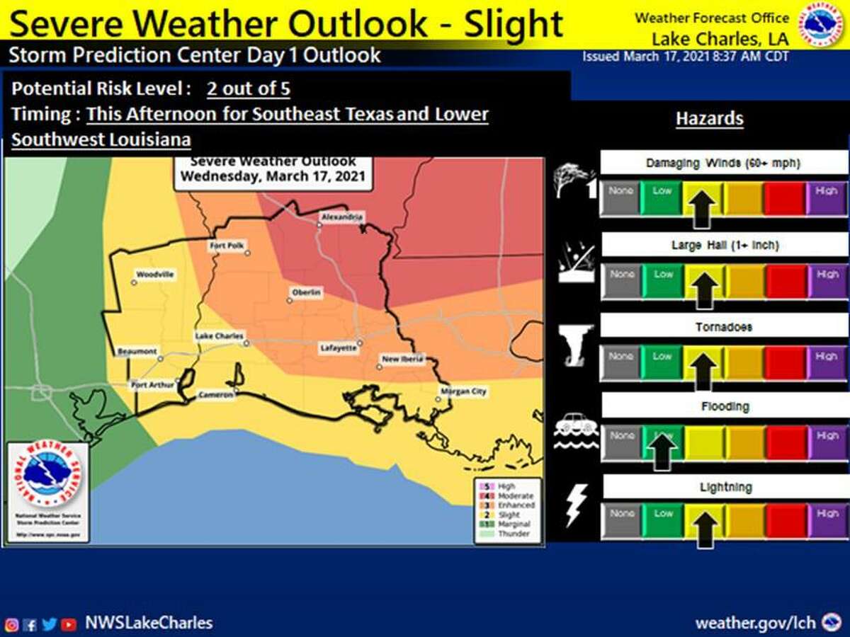
The potential for severe weather increased for Southeast Texas overnight and the region is at a slight risk to see thunderstorms before noon, the National Weather Service says.
Between 10 a.m. and 3 p.m., Southeast Texas could potentially see wind gusts higher than 60 mph in some areas and hail greater than 1 inch in diameter. There is a slight threat of tornadoes. Rainfall amounts between a 0.1 inch and 0.25 inch are expected, with the possibility of higher amounts in some areas, according to the Weather Service.
“Once the front passes, showers and thunderstorms will quickly come to an end this afternoon and evening,” a weather discussion said. “In the wake of the front cooler temperatures and dry weather will prevail until early next week when moisture begins to increase ahead of the next frontal system.”
Wednesday night is expected to drop down to 49 degrees with clear skies and winds from 10 mph to 15 mph with gusts as high as 20 mph.
The Weather Service expects winds to remain in the 5 to 10 mph range throughout the week.
jorge.ramos@beaumontenterprise.com
twitter.com/byjorgeramos


