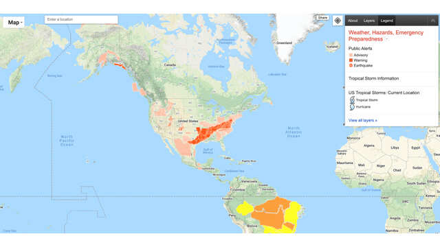
Google is shutting down its website which warned about earthquakes, storms

Internet search giant Google has announced that it is going to shut down its Crisis Map website, which it had launched eight years ago.
The website can be accessed through https://google.org/crisismap and describes itself as “a collection of national and regional-scale layers related to weather, hazards, and emergency preparedness and response, mostly for the US.”
Announcing that the website will not be available next month, Google said,“As we continue to invest in impactful crisis response tools and features, we are shifting from the stand alone Crisis Map as of March 31, 2021. After this date, Crisis Map will no longer be available, and we will continue to offer and invest in a broader suite of Crisis Response features and map creation tools,” said Google in its support page.
Most of the data that was visible on Google Crisis Map is now available directly on Google Maps and Google Search.
The website used to allow users to enable layers for tropical storm information, evacuation resources, and storm reports. Now, that support will no longer be provided. “Crisis Maps will no longer be available for editing or viewing, which includes maps created by Google. This means, links and embeds for published maps will stop working,” added Google.
Anyone who wants to visualise locations of a hazard or a temporary shelter, the company asks them to use Google My Maps, Earth, Earth Pro, or Maps Platform.


All Comments (0)+^ Back to Top
Refrain from posting comments that are obscene, defamatory or inflammatory, and do not indulge in personal attacks, name calling or inciting hatred against any community. Help us delete comments that do not follow these guidelines by marking them offensive. Let's work together to keep the conversation civil.
HIDE