
Large parts of England and Wales are facing ice warnings, as temperatures fell into minus figures overnight following prolonged periods of rain.
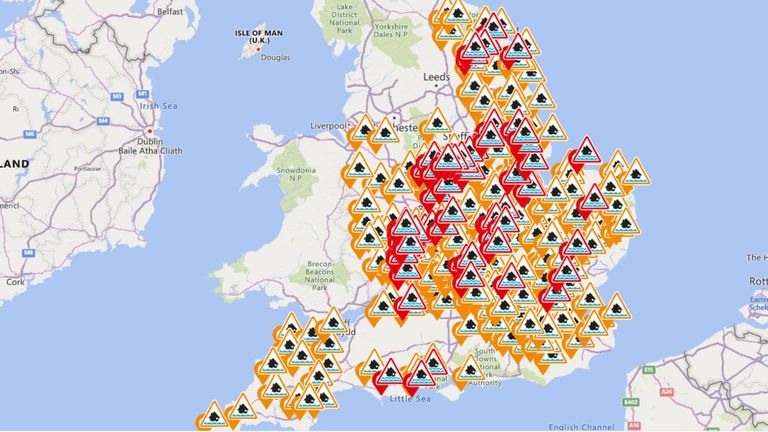
Hundreds of flood warnings also remain in place alongside the chilly temperatures as waters rose in several places across England.
In some areas of England, the mercury dropped to -6C (21F) overnight with expectations it could be even colder in Scotland.
Latest Sky News weather forecast
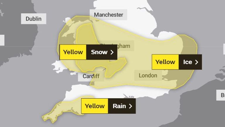
A yellow warning for ice stretching from western Welsh coasts across to London and East Anglia came into force on 8pm on Saturday, and lasts until 11am.
On Saturday evening, the Environment Agency had put in place 90 flood warnings across England, alongside 243 less serious flood alerts, after water levels rose across the country throughout the day.
Police in Hertfordshire reported "extensive flooding" affecting a number of properties in Long Marston on Saturday afternoon, after heavy rain fell throughout the day.
Police in Hertfordshire reported "extensive flooding" affecting a number of properties in Long Marston on Saturday afternoon, after heavy rain fell throughout the day.
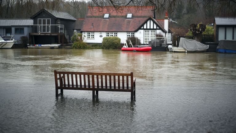
There were also reports of flooding in Gloucestershire and Henley-on-Thames in Oxfordshire, where water was seen approaching riverside homes.
The wintry weather is set to continue next week.
Met Office forecaster Simon Partridge said: "It gets a bit more interesting as we go into Tuesday and the middle of the week."
He predicted a "much heavier" band of rain to arrive overnight on Monday into Tuesday which will "quickly turn to snow as it bumps up against cold air", and has triggered further yellow weather warnings for snow and ice on Tuesday and Wednesday.
Northern England and parts of Wales could see snow "pretty much anywhere", with 1cm to 5cm likely at lower levels and 5cm to 10cm possible in the hills.
The highest areas could get "up to 20cm or so though the course of the day", and Mr Partridge predicted that Trans-Pennine routes in particular could have some issues on Tuesday.