
Evacuations have begun for some residents in Greater Manchester who have been told to leave their homes as waters rise and two 'danger to life' warnings are issued.
The two severe flood warnings affect those in East Didsbury, West Didsbury and Northenden, along the River Mersey.
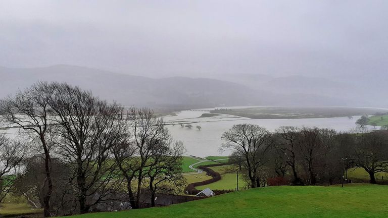
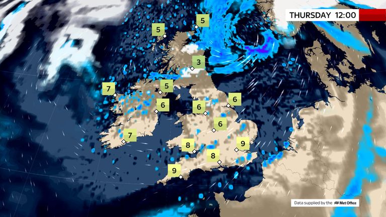
There are fears that Britain could see two months' worth of average rainfall in just two-and-a-half days as Storm Christoph hits the country.
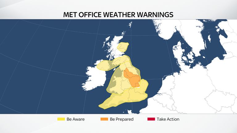
The Met Office earlier issued yellow warnings of heavy rain for much of the UK, with a more severe amber rainfall warning covering parts of northern England and the Midlands in place until Thursday.
Read the latest weather forecast about Storm Christoph
Assistant Chief Constable of Greater Manchester Police Nick Bailey said: "Unfortunately - despite the best efforts of all agencies involved - we are now at the stage where evacuations are necessary in areas of Didsbury.
"We will be directly in touch with residents in those properties that have been identified as potentially being at risk and we have an evacuation plan in place to set up those who have been displaced in temporary accommodation.
"I think it's important to stress that if you are contacted and advised to evacuate then we would strongly urge you to do so."
According to the city council, people living in the following postcodes - M20 2, M20 5, M21 7, M21 8, M21 9, M22 4 - should check the Environment Agency's flood warning website to see if they are in the affected area and should evacuate.
The council said: "If someone is asked to leave their home and need to stay with family or friends temporarily due to flooding, they will not be in breach of coronavirus laws, which allow for exceptions including to escape the risk of harm - and no legal action will be taken."
It added: "However, people should still take precautions to minimise the risk of transmission of the virus - remember to wear a face covering, keep your distance from others outside of your household or bubble, and wash hands regularly.
"Manchester City Council has also set up a COVID-safe emergency rest centre at Wythenshawe Forum in case anyone is told to evacuate because of flooding and has nowhere else to go."
Mr Bailey earlier said areas of Didsbury, Northenden and Sale near the River Mersey could see flood waters, with a peak expected at 11pm on Wednesday.
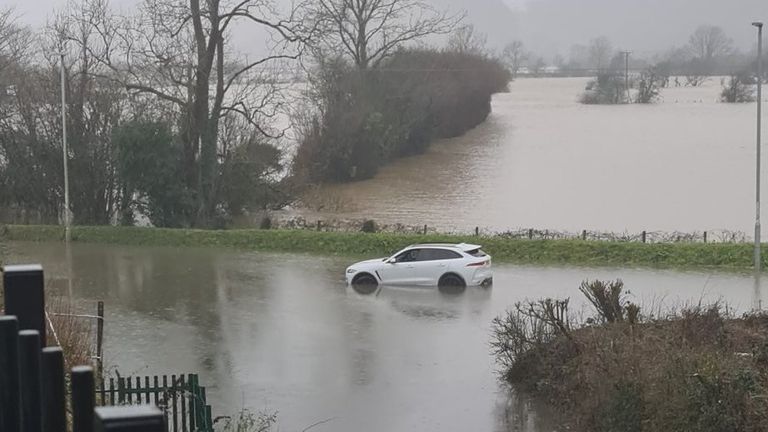
Up to 3,000 properties in Greater Manchester could be affected by flooding, police have warned.
Boris Johnson also said people should evacuate their homes if advised to do so.
The Environment Agency has warned of a "volatile situation", and a major incident was declared in both Greater Manchester and South Yorkshire ahead of further expected heavy rain.
Speaking after chairing a meeting of the COBRA emergency committee, the prime minister said there was a "situation potentially developing" in Manchester and the situation could get worse next week.
He said: "We want to make sure we are totally prepared in every part of the UK for flooding because it's coming on top of the stress people are already under fighting COVID."
He wanted to ensure that transport networks were prepared, that electricity outrages would not be severe, that there were enough supplies of sandbags, and evacuation centres were on standby.
He said: "It really is advisable - follow the advice. If you are told to leave your home then you should do so."
Simon Partridge, a Met Office forecaster, explained: "It's not a traditional sort of storm, it's going to be windy but it's not based on the wind strength at all, it's really down to the disruption that's being caused by rain.
"There are already parts of Cumbria that have already seen over 80mm of rain since midnight on Tuesday and there's a large number of places that have seen 50mm, and we are going to see further rain over the next 24 to 36 hours."
Mr Partridge said some areas could see double the average amount of monthly rainfall over a few days.
He said: "Those areas that have seen between 50mm and 70mm already, the warning is out until midday on Thursday, so an extremely long period, but by then we could see up to 150mm to possibly 200mm of rainfall.
"The Midlands for example, their average rainfall total for the whole month is 73mm, so they could easily get double that in the course of two, two-and-a-half days."

The rain combined with snowmelt increases the risk of flooding in some areas.
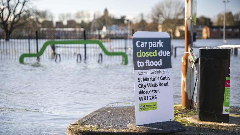
The Environment Agency has issued around 100 flood warnings (meaning flooding is expected) across England and 200 less serious flood alerts (meaning flooding is possible).
The Welsh mountains and Pennines could see up to 200mm (8ins) of rain by the middle of Thursday.
And snow is also likely for some, with yellow warnings in place in southern and northern Scotland.
North Yorkshire County Council said more than 15,000 sandbags were at the ready around the county.

People were also preparing for rising floodwaters in West Yorkshire on Wednesday, with towns in the Calder Valley laying out sandbags and flood wardens monitoring water levels.
As the week continues and Storm Christoph makes its way east, the risks of snow increase, the Met Office said.
Public Health England issued a cold weather alert from "first thing" on Thursday until 9am on 25 January for the North East, North West and Yorkshire and the Humber.
The agency said the risk of flooding will amplify the public health risks of the severe cold weather.
Yellow snow warnings are also in place for parts of Scotland.