0
Comment(s)
*
* The moderation of comments is automated and not cleared manually by indianexpress.com.
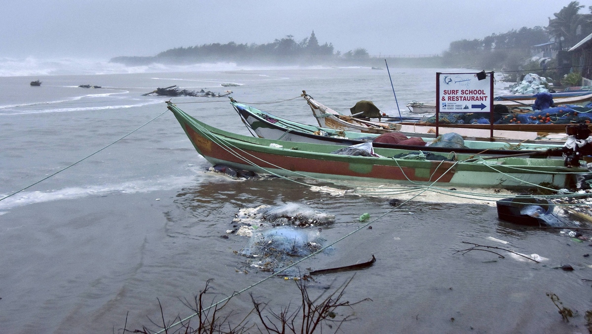 Boats anchored at a coastal area before the landfall of Cyclone Nivar, in Mamallapuram. (PTI Photo/ Nov. 25, 2020.)
Cyclonic storm Burevi has formed in the Bay of Bengal, the India Meteorological Department (IMD) announced late on Tuesday evening.
Named by the Maldives, this is the second cyclone formed in the southwest region of the Bay of Bengal within a week. Burevi is also the third cyclone formed in the North Indian Ocean region— comprising the Bay of Bengal and the Arabian Sea.
On November 23, cyclone Gati, formed in the Arabian Sea, had hit the Somalia coast. Soon after, severe cyclone Nivar, formed in the Bay of Bengal, hit Karaikal in Puducherry on November 25.
Updating about cyclone Burevi, the Met department’s special bulletin said, “The cyclone is located 400kms east-southeast of Trincomalee in Sri Lanka and 800kms east-southeast of Kanyakumari in Tamil Nadu. It will intensify within the next 12 hours, crossing near Trincomalee during evening or night Wednesday.”
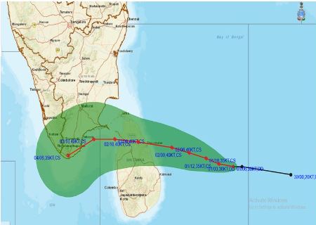 The projected trajectory of cyclone Burevi. (Source: IMD)
The storm, which will retain its intensity and maintain a wind speed of 75 to 85 km/hr gusting to 95 km/ hr till December 4, will then emerge near Gulf of Mannar on Thursday morning.
“It will move westwards and cross Kanyakumari and Pamban on the morning of December 4,” the officials of IMD said.
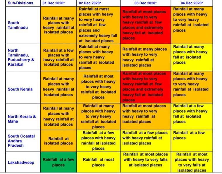 Rainfall warning for the next few days. (Source: IMD)
With the storm approaching, a ‘red’ (take action) alert for extremely heavy rain has been issued for Kanyakumari, Tirunelveli, Thoothukudi and Tenkasi districts in Tamil Nadu and Thiruvananthapuram, Kollam, Pathanamthitta and Alappuzha districts of Kerala for Wednesday and Thursday.
Heavy rain will continue over the extreme southern districts of both these states till December 4.