
Cyclone Nivar is forecast to move north and further weaken over the next few hours
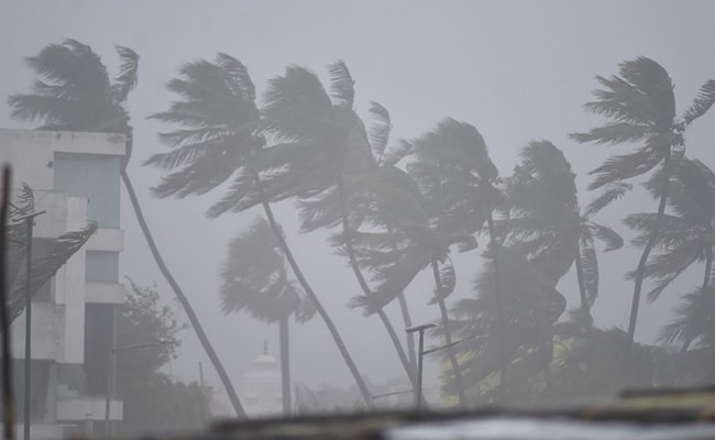
Cyclone Nivar hurtled into the Puducherry coast late on Wednesday night, uprooting trees and packing strong winds and rains as tens of thousands of people took refuge in shelters.
Cyclone Nivar made landfall at around 2.30 am with winds of up to 130 kilometres per hour.
Thousands of state and national emergency personnel were deployed in Tamil Nadu, Andhra Pradesh and Puducherry as authorities suspended power supply across several cities to prevent damage to the electricity grid.
Initially classified as a "very severe cyclonic storm" as it swirled in the Bay of Bengal, Nivar weakened after landfall into a "severe cyclonic storm", the India Meteorological Department (IMD) said.
It is forecast to move north and further weaken over the next few hours, the weather bureau added.
The danger "is not over yet as some part of the cyclone is still over the sea though center is over the land," the IMD tweeted.
The fierce winds uprooted trees and toppled electricity pylons while downpours lashed parts of the region, causing flash floods.
The coastal states have been bracing for the cyclone - the fifth-strongest category on India's scale of seven storm types - and more than a lakh people were evacuated from low-lying areas. Nivar has forced authorities to declare a public holiday till Thursday, close the Chennai airport and metro services.
Tamil Nadu Chief Minister E Palaniswami appealed to people to stay indoors as far as possible and said over 4,000 "vulnerable" locations had been identified and local officials have been told to ensure peoples' safety.
Here are the Live Updates of Cyclone Nivar:
Thunderstorm with lightning accompanied with light to moderate spells of rain likely in Bangalore Rural, Bangalore Urban, Tumkur, Chitradurga, Kolar, Chikballapura, Ramnagar districts in the next three hours: IMD Karnataka
The severe Cyclonic Storm ''Nivar'' is likely to continue to move northwestwards and weaken further into a cyclonic storm in the next six hours, the India Meteorological Department (IMD), Goa informed on Tuesday.
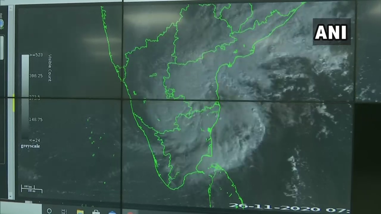
The storm crossed the coasts of Tamil Nadu and Puducherry from 11:30 pm on Wednesday night to 2:30 on Thursday and moved west-northwestwards at a speed of 9 kmph in the last six hours.
"The very severe cyclonic storm Nivar over Southwest Bay of Bengal moved west-northwestwards with a speed of 9 kmph during past six hours and crossed Tamil Nadu and Puducherry coasts near Puducherry from 11:30 pm on Wednesday night to 2:30 am today as a very severe cyclonic storm with estimated wind speed of 120-130 kmph gusting to 145 kmph," the IMD said.
#WATCH Chennai witnessing spell of strong winds after #Cyclone Nivar made landfall near Puducherry late last night#TamilNadupic.twitter.com/jZZB3FCJUX
- ANI (@ANI) November 26, 2020
 Cyclone Nivar Makes Landfall; Heavy Rain In Chennai, Puducherry: 10 Points
Cyclone Nivar made a late-night landfall near Puducherry. The tropical storm has weakened from a "very severe cyclonic storm" to a "severe cyclonic storm" with a wind speed of 100-110 km per hour, gusting up to 120 km per hour, the weather office said in a statement. The coastal states have been bracing for the cyclone - the fifth-strongest category on India's scale of seven storm types - and more than a lakh people were evacuated from low-lying areas. Nivar has brought with it heavy rain and strong winds and forced authorities to declare a public holiday till Thursday, close the Chennai airport and metro services.
Watch Live News:


