Meanwhile, water will be released from Chembarambakkam lake, one of the key drinking water sources to Chennai, since it was nearing capacity, the government said.
Severe cyclonic storm 'Nivar' will intensify into a very severe cyclonic storm over the next 12 hours and cross the coast between Tamil Nadu and Puducherry on Wednesday midnight or early Thursday, the India meteorological department said.
Meanwhile, water will be released from Chembarambakkam lake, one of the key drinking water sources to the city, since it was nearing capacity, by noon, the government said.
In its latest bulletin on Wednesday, the IMD said Nivar was over the southwest Bay of Bengal and moving west-northwest-wards with a speed of seven kmph during the past six hours and lay centred at 0530 hrs at about 290 km east-southeast of Cuddalore, about 300 km east southeast of Puducherry and 350 km south-southeast of Chennai.
"It is very likely to intensify further into a very severe cyclonic storm during next 12 hours.
“It is very likely to move northwestwards and cross Tamil Nadu and Puducherry coasts between Karaikal-Mamallapuram and Puducherry during the midnight of November 25 and early hours of November 26 as a very severe cyclonic storm with a wind speed of 120-130 kmph gusting to 145 kmph," it said.
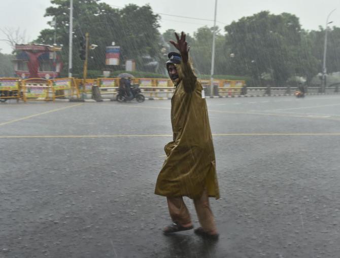
Chennai and its suburbs received heavy overnight rains, with low-lying areas getting inundated and water entering houses in many localities.
Civic officials were involved in clearing the roads of stagnant water, even as many city residents recalled the damage caused during the 2015 deluge.
A holiday has been declared in Tamil Nadu on Wednesday in view of the cyclone's expected landfall and transport services have been suspended.
Meanwhile, PWD officials announced that 1000 cusecs of water will be released from the Chembarambakkam lake, as the level stood at 22 ft of the total 24ft.
Water will be released from 12 noon onwards and the dischagre will be stepped up depending upon the inflow, they said.