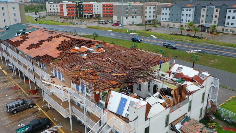
Hurricane Laura tore roofs off buildings, snapped massive trees like twigs and left huge swaths of southwest Louisiana under water, dramatic aerial footage showed.
A drone hovering over Lake Charles, Louisiana, captured the devastation brought on the community that's about 150 miles east of Houston and 200 miles west of New Orleans.
The Category 4 storm packed sustained winds of 150 mph, making it the most intense storm to make landfall in Louisiana in 164 years. The Last Island Storm of 1856 also had sustained wind of 150 mph.
Ben Terry, a meteorologist for local NBC affiliate KPLC-TV, posted heartbreaking pictures of his home — in pristine condition on Wednesday and ripped apart by Thursday.
"My house is a total loss in Hurricane Laura," Terry wrote on Twitter.
By Thursday afternoon, Laura had been downgraded to a tropical storm as it moved north and east.
Still, the storm threatened to do serious damage to homes and businesses all over Arkansas, where Gov. Asa Hutchinson warned citizens to take the rainfall seriously. He reminded that even 6 inches of moving water could carry a person away.
"If you see a road underwater, turn around, don’t drown," Hutchinson said. "The water may be deeper than you think, and the current could carry your vehicle away. Please be safe if you have to be out on the roads."
Three National Guard teams were activated in Arkansas, in anticipation of rescues and evacuations brought on by heavy rain.

