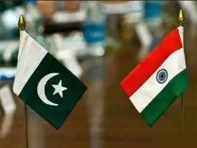
NEW DELHI: Seeking to raise the ante on the first anniversary of the revocation of the special status of Jammu and Kashmir (JnK), the Imran Khan government Tuesday released a new political map of Pakistan showing the entire erstwhile state, now organised into 2 separate union territories, in Pakistan. India reacted quickly calling it an exercise in political absurdity which only confirmed the reality of Pakistan's obsession with "territorial aggrandizement" supported by cross-border terrorism.
"We have seen a so-called 'political map' of Pakistan that has been released by Prime Minister Imran Khan. This is an exercise in political absurdity, laying untenable claims to territories in the Indian state of Gujarat and our Union Territories of Jammu & Kashmir and of Ladakh," said the government in a statement, adding that these ridiculous assertions had neither legal validity nor international credibility.
Like with some of earlier formal maps, Pakistan's new "official map" also included Junagadh and Manavadar in Gujarat.
"The new map has only brought to the fore the contradiction in Pakistan's position, between calling Kashmir an unfinished agenda of Partition and its right to self-determination rhetoric," said TCA Raghavan, former diplomat who served as India's high commissioner to Pakistan.
"The government has to show that it's moving mountains on the first anniversary of the reorganisation of Jammu and Kashmir. It also has to do with their domestic issues, he added, while calling it another case of misguided aspirations.
Leaving the frontier "undefined" at the Ladakh border with China, the new map, while describing JnK as disputed territory, said the final status will be decided in line with "relevant" UNSC resolutions. It also shows Siachen in Pakistan.
Ensuring ambiguity by leaving the frontier undefined, the map said that the actual boundary in the region would "ultimately be decided by the sovereign authorities concerned after the settlement of the Jammu and Kashmir dispute."
Khan was quoted as saying in the evening, as he unveiled the map, that the federal cabinet had earlier on Tuesday approved the map and that it was now going to be used in schools and colleges.
"We will do political struggle, we don't believe in military solutions. We will remind the UN again and again that you had made a promise [to the people of Kashmir] which you did not fulfil," said the Pakistan PM, adding that the map reflected the aspirations of the people.
According to Pakistan foreign minister Shah Mahmood Qureshi, the map made it clear that Siachen belonged to Pakistan and that it also rejected India's claims on Sir Creek.
"We have said that our border is towards the eastern bank; India had claimed that it goes towards the west," said Qureshi, accusing India of capturing Pakistan's exclusive economic zones.
Download
The Times of India News App for Latest India News

Coronavirus outbreak
Trending Topics
LATEST VIDEOS
India
 PM Modi to plant divine tree 'Parijaat' during Ram temple bhoomi pujan: Mahant Rajkumar Das
  Meet Haryana’s Pradeep Singh, who topped 2019 UPSC exams
  After 492 years, our dream comes true: Spiritual leaders express happiness ahead of Ram temple bhoomi pujan
  PoK: Higher education remains elusive amid continuous systemic harassment
  Bhoomi Pujan: Students make massive 3300 square feet long rangoli of Ayodhya temple and Lord Ram
  Ram temple event: Devotees perform Hanuman Chalisa, light lamps on eve of Foundation laying ceremony
More from TOI


Navbharat Times
Featured Today in Travel
Quick Links
Coronavirus in MumbaiCoronavirus in KolkataCoronavirus in HyderabadCoronavirus in DelhiCoronavirus in BangaloreCoronavirus symptomsCoronavirus in IndiaWhat is CoronavirusCoronavirus NewsSolar EclipseNPRWhat is NRCCAB BillCAB and NRCRTI BillPodcast newsLok SabhaShiv SenaYSRCPCongressBJP newsUIDAIIndian ArmyISRO newsSupreme Court
Get the app