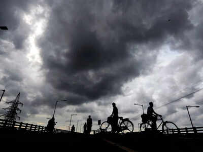
CHENNAI: After experiencing rainfall either in the day or in the evening, the city was treated to surprise midnight thunderstorms for the last three nights. This, according to meteorologists, was due to upper air cyclonic circulation over Bay of Bengal and the convergence of winds closer to the city coast. An IMD forecast said that rainfall is likely to continue for one more day before monsoon winds and rainfall pick up in the west coast.
IMD has forecast the sky condition to be generally cloudy. Light to moderate rain is likely to occur in some areas. Maximum and minimum temperatures are likely to be around 35 and 27 deg C in the city for the next 24 hours.
IMD officials said the midnight thunderstorms was mostly due to the convergence of westerlies and easterly winds closer to the coast and moving into the land, which happened in the night for the last three days. The spells during this season would otherwise be either during the day or in the evening in the city.
On Tuesday past midnight, residents in some parts of the city observed the size of the raindrops to be bigger than usual. N Puviarasan, director, Area Cyclone Warning Centre, said it was not uncommon. "Usually the first spell will have big raindrops over the area where the convection takes places. The stronger the updraft the larger the drop can grow," he said.
Though June left around 50% deficit for Chennai subdivision, experts said many suburbs including Tiruvallur with 28% deficit and Kanchipuram with 33% deficit, which has the catchment areas, received relatively better spells during the month of June.

Coronavirus outbreak
Trending Topics
LATEST VIDEOS
City
 Heartbreaking: Child weeps over body of grandfather killed in cross-firing in Kashmir
  Blast in NLC thermal power station in Tamil Nadu’s Neyveli, six workers killed, several injured
  Why Bengaluru’s lauded model to fight Covid-19 is suddenly unravelling
  West Bengal BJP state president Dilip Ghosh allegedly attacked by miscreants during morning walk
More from TOI
Navbharat Times
Featured Today in Travel
Get the app


