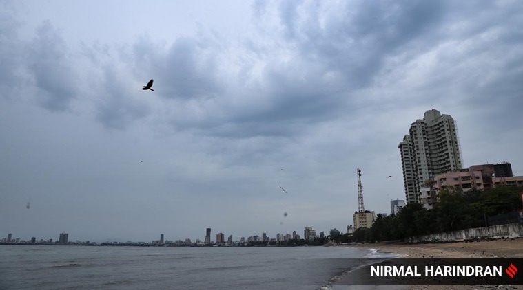
 An overcast Mumbai sky. Cyclone Nisarga is headed towards the coastline of north Maharashtra and south Gujarat. It is likely to hit the coastline on Wednesday. (Photo: Nirmal Harindran)
The deep depression formed in the Arabian Sea Tuesday is likely to develop into a severe cyclonic conditions by tomorrow, affecting the northern coast of Maharashtra and the southern coast of Gujarat.
Cyclone Nisarga is set to make landfall close to Alibaug between Harihareshwar in Raigad and Daman during the afternoon on June 3.
Taking stock of the situation, Prime Minister Narendra Modi urged people to take all possible precautions and safety measures. “Took stock of the situation in the wake of cyclone conditions in parts of India’s western coast. Praying for everyone’s well-being. I urge people to take all possible precautions and safety measures”, the Prime Minister said.
The cyclonic storm Nisarga, developed in to a cyclonic storm over the course of the day today and lay 430 km south-southwest of Mumbai and 640 km south-southwest of Surat. IMD officials today said that it is likely to intensify in to a severe cyclonic storm over the next 12 hours, cross north Maharashtra and adjoining south Gujarat coast between Harihareshwar and Daman, close to Alibag in Maharashtra’s Raigad district, tomorrow afternoon. The IMD has predicted that the storm will hit the Maharashtra coast with windspeeds of 100-110 kmph gusting to 120 kmph.
Light to moderate rainfall is predicted in most areas including Konkan and Goa, coastal Karnataka, central Maharashtra and Marathwada and Madhya Pradesh over the next 24 hours. Similarly the south Gujarat region of Valsad, Navsari, Dang, Daman, Dadra & Nagar Haveli and Surat districts are also predicted to receive light
and heavy rainfall.
A storm surge of about 1-2 meters height above astronomical tide is very likely to inundate low lying areas of Mumbai, Thane and Raigad districts and 0.5-1 meter height above the astronomical tide likely to inundate low lying areas of Ratnagiri district during the time of landfall, the weatherman said.
Cyclone Nisarga comes close on the heels of super cyclone Amphan that hit the coast of West Bengal and Odisha. While not nearly as strong as Amphan, Nisarga has scientists and environmentalists worried as pre-monsoon cyclonic storms are an unusual phenomenon in the Arabian sea, unlike in the Bay of Bengal.
Cyclone Nisarga Explained: How big is the threat on west coast?
Lead author of the IPCC (International Panel on Climate Change) Oceans and Cryosphere report and scientist at the Indian Institute of Tropical Meteorology in Pune, Dr Roxy Mathew Koll had earlier said that while post monsoon cyclones have been seen in the Arabian Ocean, pre-monsoon cyclones, such as Nisarga, have so far been rare.
“During the monsoon period, the winds of the upper atmosphere and those of the lower atmosphere move in opposite directions – this prevents the formation of cyclonic storms. But with the temperature of the Arabian Sea having risen over the past few decades, despite the atmospheric wind conditions not being favourable, cyclones have been forming. This is something that we are studying at the institute at the moment. Even for Nisarga, we did not think it would develop beyond a low pressure system, but it has quickly developed into a depression and then a cyclonic storm. The rapid pace at which the storms are forming, are a part of the global warming trend,’’he said.