Understand India-China border dispute through rare maps.
First Published on Jun 2, 2020 03:11 pm

The China-India border dispute as told through rare maps. Take a look at the creatives below to understand it. (Image: News18 Creative)

1762 | The border at the dawn of maps (Image: News18 Creative)

1917 | How pre-revolutionary China saw Tibet (Image: News18 Creative)

1945 | How the world saw the India-China frontier (Image: News18 Creative)

1950 | India-China border was not always well defined (Image: News18 Creative)

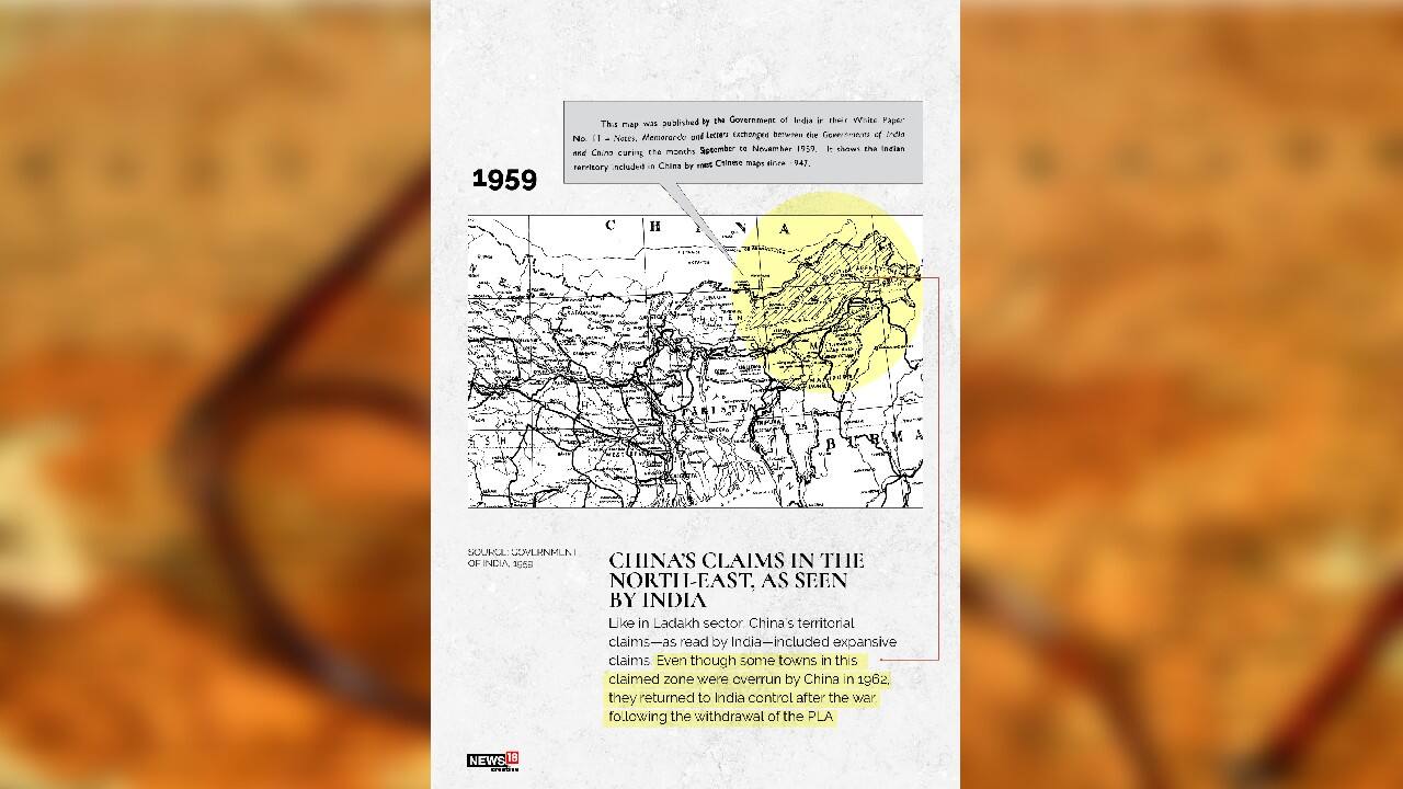
1959 | China’s claims in the northeast as seen by India (Image: News18 Creative)

1988 | Where is the Line of Actual Control (LAC) now in Ladakh? (Image: News18 Creative)

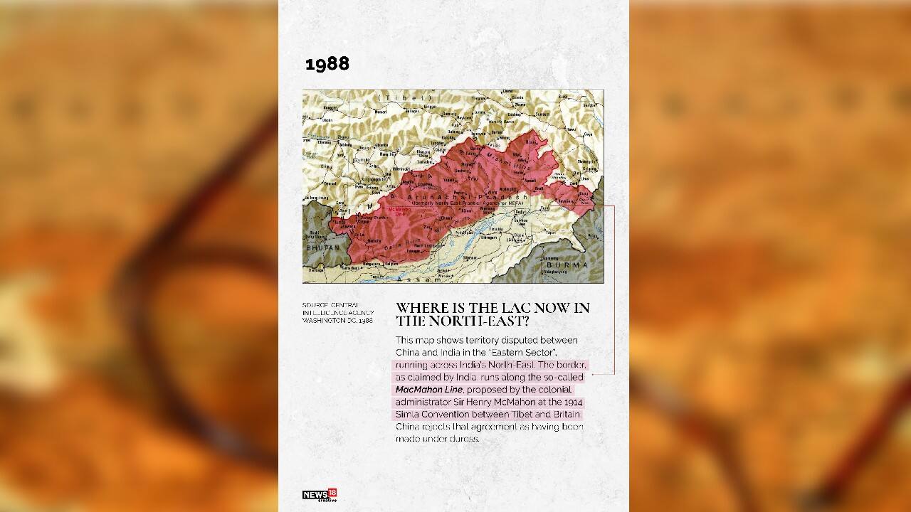
1988 | Where is the LAC now in the northeast? (Image: News18 Creative)
Copyright © e-Eighteen.com Ltd All rights resderved. Reproduction of news articles, photos, videos or any other content in whole or in part in any form or medium without express writtern permission of moneycontrol.com is prohibited.
