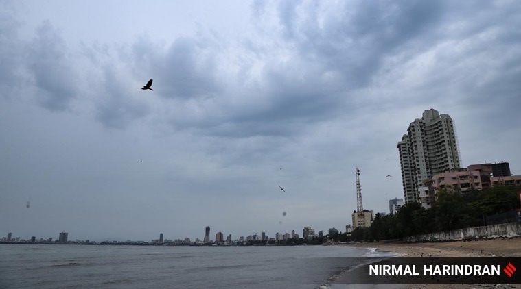
 Drizzle in Mumbai on Monday. (Express Photo by Nirmal Harindran)
Barely a fortnight after super cyclone Amphan, one of the strongest cyclones the country has seen in the last few decades, hit West Bengal, Odisha and Bangladesh, a cyclonic storm has been forming in the Arabian Sea over the l24 hours, which is predicted to intensify into a severe cyclone, ‘Nisarga’, and make landfall by Wednesday evening, according to the Met department.
Nisarga’s impact is likely to be felt most strongly in Mumbai, Thane, Palghar, Raigad districts, with wind speed up to 105-115 km per hour gusting to 125 km per hour around the point of landfall, according to India Meteorological Department (IMD) authorities.
It is expected to land anywhere between Harihareshwar, south of Mumbai in Maharashtra’s Raigad district, and Daman, located on the southern edge of Gujarat, on Wednesday afternoon or evening.
IMD officials said the low pressure area over Southeast and adjoining East-central Arabian Sea and Lakshwadeep concentrated into a deep depression on Monday and lay centred about 370 km southwest of Panaji in Goa, and 690 km south-southwest of Mumbai.
IMD director-general M Mohapatra on Monday said, “We will know tomorrow (Tuesday) where the landfall will be. But as far as we can see now, the intensity of the storm will be felt in Mumbai, Thane, Raigad, Palghar, Daman, Dadar Nagar Haveli, Valsad, Navsari, Ratnagiri and Sindhudurg areas with high wind speed and heavy rainfall.”
While not as strong as Amphan, Mohaptra said the monsoon moisture would lead to very heavy rainfall, and that low-lying areas on the Maharashtra cost, especially in and around Mumbai, are likely to be inundated. Warning that trees and poles could be uprooted, he said while Nisarga will hit both Maharashtra and Gujarat coastline, the latter is likely to be less affected.
Sunitha Devi, a scientist dealing with cyclones at the Regional Specialised Meteorological Centre in the national capital, said, “As per trajectory of the system, it is expected to make landfall somewhere near south of Mumbai on Wednesday evening or at night. But it is dynamic system and is subject to change in next 24- 48 hours. Mumbai is in the trajectory and will feel the adverse impact of the (developing) cyclone. We are closely monitoring the movement of the system (currently a depression).”
Union Home Minister Amit Shah on Monday evening held a video conference with chief ministers of both Maharashtra and Gujarat — along with Administrator of Dadra and Nagar Haveli and Daman and Diu, Praful Patel — and assured them all help from the Centre, according to a release.
Maharashtra CM Uddhav Thackeray said an alert had been sounded in Mumbai, Thane, Palghar, Raigad, Ratnagiri and Sindhudurg districts. “Instructions have been given to authorities to shift people from kutcha houses to safer locations,” Thackeray said in the meeting, according to a statement released by the CM Office.
After chairing a meeting in Gandhinagar to assess preparedness of the state machinery, Gujarat CM Vijay Rupani said that 10 teams of NDRF have taken position in south Gujarat districts of Surat, Bharuch, Navsari, Valsad and the Dangs and Bhavnagar and Amreli districts of Saurashtra to deal with any eventuality, according to reports from Ahmedabad.
On Monday, as the storm gathered strength, there was no official word from the BrihanMumbai Municipal Corporation (BMC) on measures planned, especially at a time when the metropolis is fighting the coronavirus pandemic.
While cyclones have always been more frequent in Bay of Bengal, they have been less frequent off of India’s western coast — a trend that has been gradually changing, according to scientists.
Dr Roxy Mathew Koll, lead author of the International Panel on Climate Change’s Oceans and Cryosphere report and a scientist at the Indian Institute of Tropical Meteorology in Pune, said while post-monsoon cyclones have been seen in Arabian Sea, pre-monsoon cyclones, such as Nisarga, have so far been rare. Koll pointed out that in both Amphan and now Nisarga, the “anomalously warm ocean temperatures’’ are proving to intensify storms.