NASA Satellite Images Show Fires Still Burning May Be Reason for Poor Air Quality in North India
Most of the stubble which continued burning was primarily focused in North India and in the neighboring areas of Pakistan, and not in the rest of India.

Image credits: NASA real-time satellite.
On Monday, Delhi's air quality index deteriorated further, touching the 239-mark in several areas such as Jahagirpuri, Punjabi Bagh and Wazirpur.
This implied that the pollution level in the city plunged with the Air Quality Index (AQI) oscillating between 'moderate' to ‘poor' category.
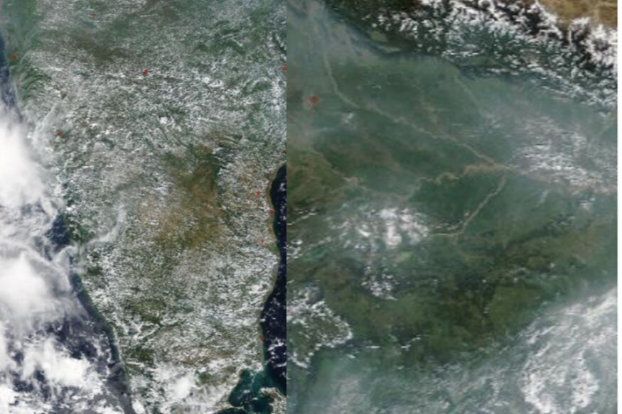
Latest images from US Space Agency's NASA's satellite images show that there are multiple fires still burning in North India.
The satellite images show that the fires from crop stubble are still burning as late as 13th October - almost 5 days after Dusshera, which had already increased the levels of pollution in North India.
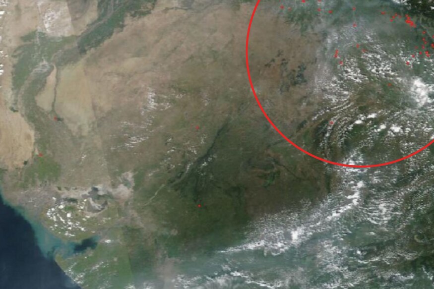
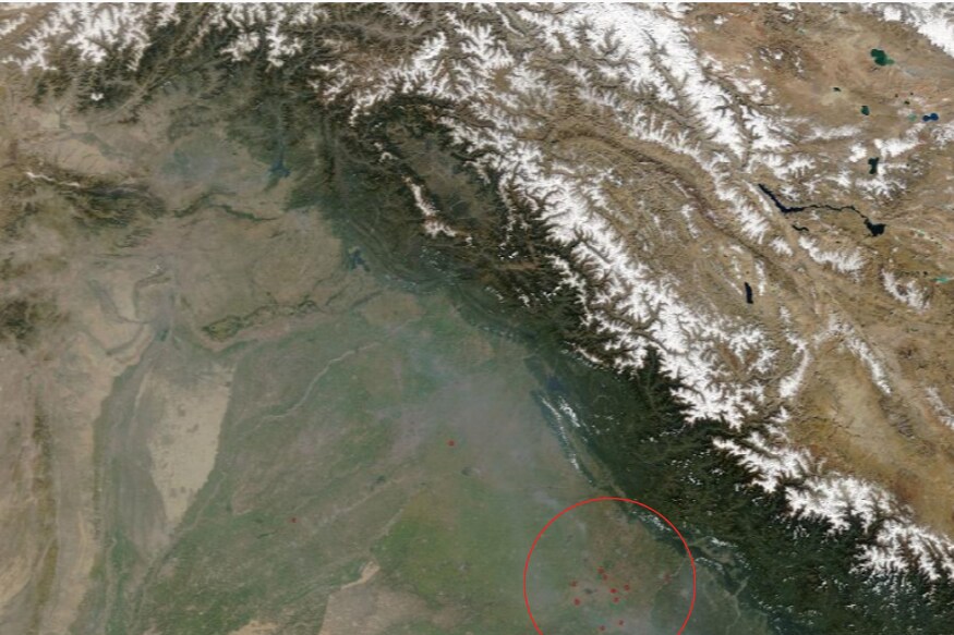
The red dots mark individual fires which are caught by NASA's satellite.
Most of the stubble which continued burning was primarily focused in North India and in the neighboring eras of Pakistan, and not in the rest of India.
The rest of India can be seen characterized by some sporadic dots spread across the country.
On Sunday, the AQI in Anand Vihar was 327; Wazirpur 323; Vivek Vihar 317; Mundka 309; Bawana 302; and in Jahangirpuri 300, according to Central Pollution Control Board data.
On Monday morning, the AQI of Delhi-NCR areas such as Rohini (207), Dwarka (194), Pusa Road (182), Mandir Marg (179), Noida Sector 62 (217), Noida Sector 125 (202), Ghaziabad (252), Anand Vihar (218) and Patparganj (189) wavered between ‘poor’ to ‘moderate’ as reports emerged of farmers defying stubble burning ban in the neighbouring states of Punjab and Haryana.
"It has been widely reported that the smoke coming to Delhi is due to the burning of stubble in Karnal, Haryana," Delhi Chief Minister Arvind Kejriwal had said.
Get the best of News18 delivered to your inbox - subscribe to News18 Daybreak. Follow News18.com on Twitter, Instagram, Facebook, Telegram, TikTok and on YouTube, and stay in the know with what's happening in the world around you – in real time.