
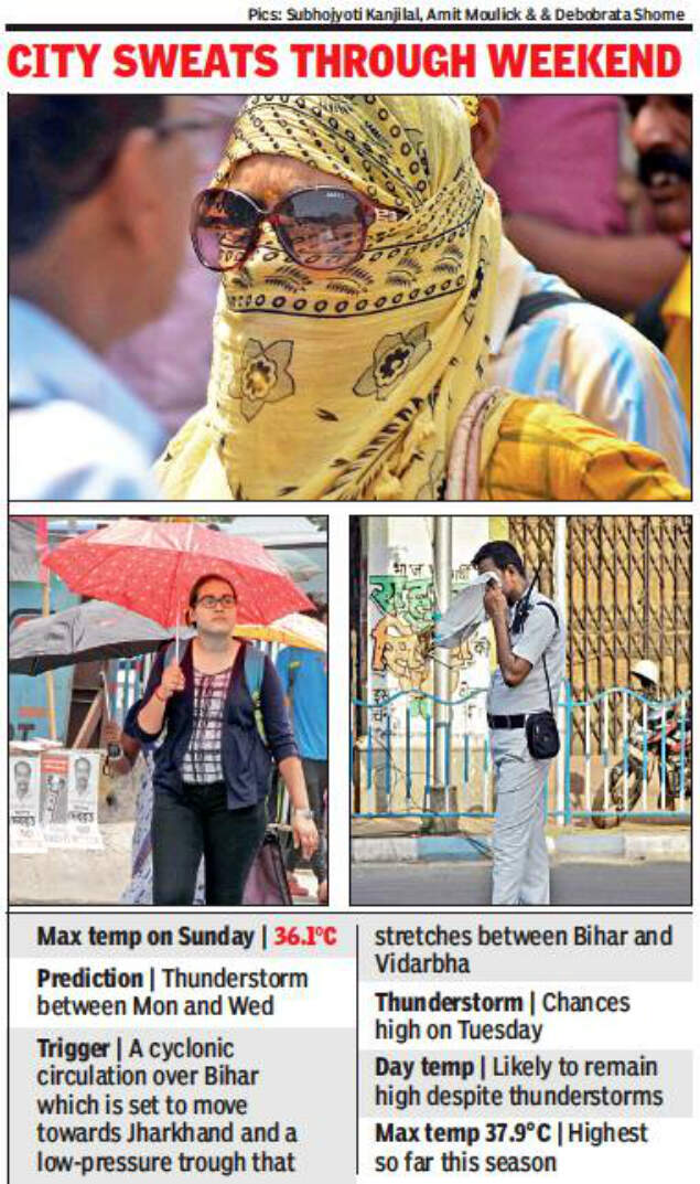
KOLKATA: The city sweltered through a scorching weekend with the maximum temperature touching 36.1°C on Sunday. While the searing heat kept Kolkatans indoors for the longest scorching period this season, a cyclonic circulation over Bihar and a low-pressure trough that stretched between Bihar and Vidarbha has created chances of a respite. The Met office has predicted thunderstorms and rain between Monday and Wednesday.
The moisture infusion necessary for thunderclouds has begun and the mercury has started sliding across south Bengal. The heat wave that had gripped three districts has now passed. However, the weathermen said the day temperature was unlikely to slide till a storm came, and even then, the mercury would shoot back up the next day.
“There is a strong southeasterly wind blowing in from the sea carrying in moisture. It has pushed the humidity up, but has also raised chances of a thunderstorm. Nor’westers may strike twice between Monday and Wednesday. But the day temperature will not slide and it will continue to be just as hot and humid till a storm occurs,” said Regional Meteorological Centre (RMC) director G K Das.
While thunderclouds triggered by the low-pressure trough could start building up from Monday evening, there are high chances of a nor’wester on Tuesday as well. “If the circulation moves closer to Jharkhand, the chances of a thunderstorm will be high. But since this is peak summer, it would continue to sizzle during the day. The maximum temperature has consistently been above 35°C for a week and only a thunderstorm can pull it down. But the relief could be temporary since the mercury is likely to start shooting up again the next day,” said Das.
Warm northwesterly winds have been blowing in unobstructed from central and northwest India for more than a week. Since cyclone Fani had sucked out all moisture from the region, the possibility of thunderclouds building up had been low. But conditions have started changing with the formation of the cyclonic circulation.
“A high-pressure zone above Bay of Bengal that had been supplying moisture to the region was wiped out by Fani. But moisture is again flowing in with the southeasterly wind. Coupled with the circulation, it could lead to thunderstorms and rain on two days between Monday and Wednesday,” Das added.
The heat wave that had gripped West Burdwan, Birbhum and Murshidabad last week has ended. “Thunderclouds started building up in the western districts of Purulia and Bankura on Sunday, which is a good sign. If the moisture continues to flow in and the circulation moves in the right direction, then relief is around the corner,” Das said.
As the mercury soared, the real feel temperature jumped to 44°C on Sunday afternoon, according to a private weather forecasting service. Real feel is calculated on the basis of wind speed, temperature, sun ray intensity, altitude and humidity, and is a measure of how the heat actually feels on the skin.
#ElectionsWithTimes
Elections 2019

Trending Topics
LATEST VIDEOS


More from TOI


Navbharat Times
Featured Today in Travel
Quick Links
Lok Sabha Election Schedule 2019Lok Sabha Election NewsDelhi Capitals teamMI team 2019Rajasthan Royals 2019RCB team 2019Maharashtra Lok Sabha ConstituenciesBJP Candidate ListBJP List 2019 TamilnaduShiv Sena List 2019AP BJP List 2019Mamata BanerjeeBJP List 2019 MaharashtraPriyanka GandhiBJP List 2019 KarnatakaAMMK Candidate List 2019BJP List 2019 WBLok Sabha Elections in Tamil NaduBSP List 2019 UPNews in TamilLok Sabha Poll 2019Satta Matka 2018PM ModiMahagathbandhanNagpur BJP Candidate ListChandrababu NaiduTamil Nadu ElectionsUrmila MatondkarNews in TeluguMadras High CourtTejashwi YadavArvind KejriwalTejasvi SuryaPawan KalyanArvind KejriwalYogi AdityanathJaya PradaSatta King 2019Srinagar encounter
Get the app