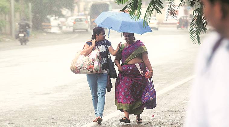
 Rain lashed Mumbai on Sunday. (File)
Sometime this week, the India Meteorological Department (IMD) would release its first forecast for the rainfall expected in this monsoon season. The rainy season for India starts in June and extends till September. The monsoon forecast is keenly awaited by the governments, businesses and general public because of the importance of this rainfall for the Indian economy.
What will the IMD announce about the rainfall?
At the first long-range forecast, released in the middle of April every year, the IMD only announces its overall prediction of rainfall for the entire season over the country as a whole. The forecast for region-wise or month-wise distribution of rainfall is not given at this stage. On an average, India as a whole receives 89 cm of rainfall during the entire season. This is called the ‘long period average’ (LPA) or simply referred to as normal rainfall.
The first forecast, like the one that will come this week, only gives the percentage of LPA that is likely to take place during the season.
IMD comes up with a follow-up forecast, usually in June, in which it gives the region-wise and month-wise distribution of rainfall.
There have been some reports that rainfall might be below-normal this year. On what basis are these claims being made?
One of the important indicators for the monsoon rainfall in India is the state of Pacific Ocean, in the equatorial region, off the western coast of South America. Sea-surface temperatures in this region of the Pacific Ocean often get warmer or cooler than normal, a phenomenon referred to as ENSO, or El Nino Southern Oscillation. ENSO influences several key atmospheric parameters which in turn have a bearing on large-scale weather events across the globe, including the Indian monsoon. A warmer than usual equatorial Pacific Ocean, a condition called El Nino, is known to suppress rainfall over the Indian subcontinent during the monsoon season. On the other hand, the opposite condition, called La Nina, is known to bring good rainfall.
The equatorial Pacific Ocean is currently experiencing a mild El Nino which is likely to strengthen and continue till most of the year. A developing El Nino is not the best news for Indian monsoon.
Is El Nino the only indicator for monsoon?
No. Indian monsoon is influenced by several other phenomena, local, regional and global. The state of waters in nearby Indian Ocean, local conditions like temperature and air pressure, and formation of the low-pressure areas and suitable wind-systems also have a bearing on the amount of rainfall the country gets during monsoon. But at this time, ahead of the start of the season, El Nino, is no doubt one of the most important indicators. It is also the one that is extensively studied and understood.
Are we observing some weather anomaly? Why were winters longer this year?
The recent winter season between November 2018 and February 2019 was slightly unusual. Large areas in north, central and eastern parts of the country covering Jammu and Kashmir, Delhi, Rajasthan and Maharashtra in particular reported some extremely cold days during these four months. Globally also, the winter gone by was extreme and meteorologists have linked the same to the Arctic Cold Blast. More pronounced were these relations established with the North Pole which led to the season prolonged beyond February. In India, for instance, snowing and cold conditions are continuing over Jammu and Kashmir even as the rest of the country is experiencing moderate to peak summers already. Notably, the frequency and the number of western disturbances — a wind pattern that originates beyond Iran and travels till north-west India — recorded this year was much higher, adding to the cold conditions.
Why is the summer so hot, already?
Earlier this month, the IMD forecast a warmer than usual summer season for the whole of India, specifically warning of more heat-wave conditions over the Core Heatwave Zone — Punjab, Himachal Pradesh, Uttarakhand, Delhi, Haryana, Rajasthan, Gujarat, Madhya Pradesh, Chhattisgarh, Bihar, Jharkhand, West Bengal, Odisha, Telangana and coastal Andhra Pradesh, along with sub-divisions Marathwada, Vidarbha and Madhya Maharashtra this year.
In a trend different from the last two years, heat-waves have been already reported from Saurashtra and Kutch, Rajasthan, Madhya Pradesh and Maharashtra as early as third week of March. Some of these areas continue to reel under heat-wave conditions even now. Scientists have blamed global warming as one of the key culprits for such heightened heat.
Are these extreme conditions also linked to El Nino?
The increased numbers of western disturbances recorded during most days of the winter gone by could in part be attributed to the developing El Nino. Similar influencing role, in the ongoing hot and dry conditions over India, is being assessed by meteorologists world over.
How was the monsoon rainfall last year?
At the end of 2018 monsoon, the country as a whole saw rainfall that was nine per cent below normal (LPA). There were regional variations, however. While northwest India, and southern peninsula, had a shortfall of only two per cent, east and northeast India saw a deficiency of as much as 24 per cent. Most of the states in the north-east, including Manipur (- 59 per cent), Meghalaya (- 41 per cent), Arunachal Pradesh (- 32 per cent), Tripura (- 21 per cent), besides Gujarat and Jharkhand ( – 28 per cent, each), Bihar (-25 per cent) and West Bengal (- 20 per cent) remained severely dry. In Maharashtra, Marathwada was the driest region, having received only 79 per cent rainfall.
