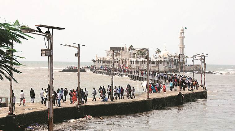
 Haji Ali shoreline marked as ‘sea’ in official maps. (Express file)
Residents, property owners and developers around the prime Tardeo locality of south Mumbai find themselves in a bind after the Haji Ali shoreline was marked as ‘sea’ in official maps, a departure from the earlier description of the coast as a ‘bay’.
With the final published Coastal Zone Management Plan (CZMP) marking the Haji Ali coastline as ‘sea’, the buffer zone where no construction is permitted as per the Coastal Regulations Zone (CRZ) notification will be up to 500 meters from the high tide line.
The decision is likely to affect redevelopment projects of several old housing societies or other buildings within that 500-metre radius. Residents and property owners said that several government documents earlier described Haji Ali as a ‘bay’, under which definition the buffer zone is 100 metres from the high tide line.
For areas under the definition of “bay”, a 2011 Coastal Regulations Zone (CRZ) notification had reduced the restricted buffer zone to 100 metres from the high tide line, from the earlier 500 metres.
With the CZMP redefining their coastline, representatives of an industrial estate and some other buildings near Haji Ali have moved the Bombay High Court claiming that the state authority had in fact shown the same portion as a ‘bay’ while seeking environmental clearances for the Brihanmumbai Municipal Corporation’s (BMC) Coastal Road Project. The first phase of the proposed 29-km coastal road project passes through Haji Ali.
The Jaywant Industrial Co-operative Society Limited and owners of some other buildings in the area have filed a writ petition in the Bombay High Court against the decision to mark the Haji Ali coastline as ‘sea’’. Their next hearing is scheduled in December.
The industrial estate is located on Tardeo Road, opposite the Central Mall at Haji Ali and falls within 500 metres of the high tide line.
An official from the society told The Indian Express, “The state CZMP is not taking a consistent stand. For the coastal road project, all documents issued by the state and Centre and all clearance provided by them and even the tender documents show Haji Ali as a ‘bay’. For state government project or policies you want to show it as a bay, and for citizens, it is otherwise.”
“All government authorities have declared Haji Ali as a bay while referring to the Coastal Road project. Then why is this not mentioned accordingly in the CZMP? All permissions for coastal road project have been obtained by showing Haji Ali as a bay.”
The buildings close to the Heera Panna building opposite, near the Noorani restaurant, will be affected as will buildings further south, closer to Mahalaxmi.
“We raised our objection when the draft CZMP was published but it was not tackled. We have approached the court last month after our suggestions and objections were not considered,” said another Jaywant society office bearer.
When contacted, principal secretary (environment) Anil Diggikar said he would have to study the issue before commenting.
Meanwhile, the coastal mapping has given relief to areas including Ballard Estate, Khar, Bandra, Girgaum by relaxing the buffer zone up to 100 metres.
Four years ago, the Maharashtra Coastal Zone Management Authority had marked Mahim and Backbay areas as ‘bays’, after which the CRZ buffer zone was reduced from 500 metres to 100 metres allowing the construction of several buildings.