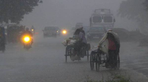
 Bhubaneswar: A rickshaw puller walks alongside his vehicle during heavy rainfall, in Bhubaneswar, Friday, Sept 21, 2018. Cyclonic storm ‘Daye’ caused heavy rainfall in several parts of Odisha on Friday. (PTI Photo)
As cyclonic storm ‘Daye’ made landfall in Odisha Friday morning, causing heavy rainfall in several parts of the state. Malkangiri district bore most of the brunt of the downpour. However, the cyclone turned into a deep depression, concentrated in the interiors of Odisha and Chhattisgarh, during the course of the day and is most likely to continue as a depression. The Meteorological Department has predicted it to weaken in the next 12 hours.
Director of Meteorological Centre in Bhubaneswar H R Biswas was quoted by PTI as saying that at least 150 people were rescued from several places in Malkangiri district and no loss of life has been reported yet.
The storm crossed south Odisha and adjoining Andhra Pradesh coast close to Gopalpur in the early hours of Friday, Director of Meteorological Centre in Bhubaneswar, H R Biswas said, according to PTI. The cyclonic system moved west-northwestward and weakened into a deep depression laying about 65 km east-southeast of Titlagarh.
Chief Minister Naveen Patnaik had held a review meeting on Thursday and asked the officials to closely monitor the situation and take appropriate steps to ensure no loss of life. An advisory has been issued by the cyclone warning division’s (CWD) saying that the sea will be very rough over central and north Bay of Bengal and off the coasts of Odisha, West Bengal and north Andhra Pradesh. A warning was also sent out to fishermen to not venture out into northwest Bay of Bengal and off Odisha, West Bengal and north Andhra Pradesh coasts in the next 24 hours.
(Source: SRC Twitter)
At present, the cyclone is continuing as a deep depression and in the next 12 hours, the cyclone will further weaken, says Raja Rao from the Meteorological Department, Hyderabad.
Rao further predicts heavy to very heavy rainfall to occur over isolated places in Telangana. "Light to moderate rains very likely to occur over coastal Andhra Pradesh. Fairly widespread rains also to occur over coastal Andhra Pradesh," says Rao.
In case you are joining us now, Cyclone Daye hit Odisha near Gopalpur early today causing heavy rainfall, especially in Malkangiri district. So far no loss of life has been reported and around 150 people have been rescued, said the Special Relief Commissioner (SRC).
Relief measures have been taken and Chief Minister Naveen Patnaik has directed the Malkangiri district administration to reach out to the affected people and extend all assistance to them, PTI reported.
At around noon, the cyclone weakened into a deep depression and has been gradually moving west-northwestwards and is centred over Chhattisgarh at present.
The cyclone is likely to continue to move west-northwestwards and weaken gradually into a depression during the next six hours, states a press release issued by the government. However, it also issues a warning of heavy to very heavy rainfall over Chhattisgarh and east Madhya Pradesh during the next 24 hours.
The government of Odisha released a list of safe shelters located in 15 villages across the state along with number of people evacuated and kept in these shelters as on Thursday.
Cyclone Daye is very likely to continue to move westnorthwestwards and weaken gradually into a Depression during the next 12 hours. The west-northwestwards movement of the system is very likely to cause widespread heavy to very heavy rainfalls over Vidarbha, south Chhattisgarh and Telangana during next 24 hours: IMD
Malkangiri, which recorded an average rainfall of 166.25 mm since Thursday, witnessed severe waterlogging and disruption in road connectivity in many areas. Connectivity with Jeypore, Chhattisgarh and Andhra Pradesh remained snapped as all major roads have been submerged under water, said an official. Water level in the Balimela reservoir had also risen alarmingly, he said.
No loss of life has been reported so far, Malkangiri district was severely affected by the cyclonic storm. Immediate steps have been taken for distribution of relief materials in the affected areas and damage caused by the natural calamity was being ascertained, said Special Relief Commissioner B P Sethi.
Cyclone Daye has weakened. There's deep depression positioned near Titlagarh. It's moving towards west, north-west. It'll have an impact in Odisha for the next 24 hours but there's less possibility of very heavy and extremely heavy rain.
Interior districts will receive heavy rainfall. Warning for fishermen continues for the next 24 hours. Malkangiri has received maximum rainfall. Chhattisgarh will also receive rainfall. In Odisha, districts adjacent to Chhattisgarh and in north Odisha will receive rain: Director of MET Bhubaneswar to ANI
Except for Malkangiri, the situation is normal in all other districts. The water level in all major rivers is below the danger level. People residing in low lying areas were evacuated last night and kept at shelters. No persons have been injured or dead. Malkangiri has received very heavy rainfall in last 24 hours, two villages and colonies have been affected, landslide in Chitrakonda area: Special Relief Commissioner of Odisha Bishnu Pada Sethi.
CM Naveen Patnaik reviewed the rain situation in Odisha's Malkangiri and sanctioned gratuitous relief of Rs 60 a day per person and Rs 45/per day for children below 12 for seven days. Officials in Malkangiri have been directed to reach out to the affected and provide all possible assistance.
Cyclonic storm 'Daye' will continue to move west-northwestwards and weaken gradually into depression during next 12 hours. Rain, thundershowers very likely to occur at most places during the next 24 hours. State of the sea will be rough over Odisha coasts during next 12 hours: IMD
Source: IMD
Odisha's Koraput has recorded rains to the tune of 100 mm, while Balasore has recorded 141 mm of rain. West Bengal has received extremely heavy rainfall activity to the tune of 252 mm, reports Skymet Weather.
The developing cyclone off the coast of Odisha is set to bring heavy to moderate showers in Vidarbha and some parts of Maharashtra, an IMD official said Thursday. "The developments on the east coast of India are of cyclone. This has brought more moisture and it would end with heavy showers in Vidarbha region from Saturday onwards," A K Srivastava, head of the Climate Monitoring and Analysis Group, IMD, Pune said.
Odisha government instructed officials in coastal districts and various departments to be alert to tackle any emergency situation. Danger signs with signal number 3, which warns of surface winds clocking 40-50 kmph, have been hoisted at all ports of Odisha, officials said.
CM Patnaik issued direction for cancelling holiday in government offices in Ganjam, Gajapati, Puri, Nayagarh and Khurda districts, which are likely to be hit by fierce winds.
The IMD said a low pressure formed over the west-central Bay of Bengal on Wednesday intensified into a deep depression on Thursday and was likely to transform into a cyclonic storm by Friday. The storm will continue to move west-northwestward and weaken gradually into a deep depression, Meteorological Centre in Bhubaneswar said.
The India Meteorological Department Thursday issued the warning of a cyclone that is likely to hit the east coast of India. The IMD said a low pressure formed over the west-central Bay of Bengal on September 19 had intensified into a deep depression on Thursday and was likely to transform into a cyclonic storm during the next 12 hours. Read more here
One NDRF team each has been deployed in Kalahandi, Rayagada, Gajapati, Puri, Nayagarh and Kandhamal districts with 17 boats and other emergency equipment.
A storm surge of about 0.5 m above astronomical tides is likely to inundate low-lying areas of Vizianagaram, Srikakulam districts in Andhra Pradesh and Gajapati, Ganjam, Khurda and Puri districts in Odisha at the time of landfall, said an advisory by the cyclone warning division's (CWD).
The impact of the cyclonic storm was felt more in Gajapati, Ganjam, Khordha, Nayagarh and Puri districts. MeT warned of gale wind with speed reaching 60-70 kmph and gusting up to 80 kmph along and off south Odisha coast for a few hours.
Heavy to very heavy rainfall is also likely to occur at some places in Balangir, Bararh, Jharsuguda, Sambalpur, Sundargarh, Keonjhar and Mayurbhanj districts till the morning of Saturday. (PTI)
Hello. Welcome to our Cyclone Daye in Odisha LIVE blog... Follow our blog for the latest updates.