More heavy rain and gusts of 50mph are forecast to hit the UK - a day after storms disrupted travel for many as the heatwave came to an end.
A yellow weather warning for wind and rain is in place for southern England and Wales until 15:00 BST.
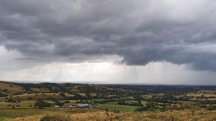
The gusts are forecast for exposed coasts and hills while 80mm of rain is possible in the Brecon Beacons and Dartmoor, the Met Office said.
Flooding was possible and large waves were likely in coastal areas, it added.
On Saturday evening, travellers continued to face delays at Eurotunnel and ferry terminals in Dover.
BBC Weather forecaster Matt Taylor said there had been a "drastic change" from the heatwave to cooler, wetter and windier conditions.
Saturday was the first day that nowhere in the UK had temperatures above 25C since 23 June.
He said the cooler conditions would continue over the next few days, but added that it "doesn't meant that summer is done with us yet".
The fresh weather warning comes after more than a month's worth of rain fell within a few hours in Northern Ireland on Saturday.
Belfast saw 99mm of rain, while homes were flooded in County Antrim.
Travel disruption
On one of its busiest weeks of the year, cross-Channel operator Eurotunnel said it was taking time to bring back carriages after they were removed from service during hot weather on Friday because of air-conditioning issues.
On Saturday evening, Eurotunnel said customers travelling from the UK were departing within one hour of their booked departure time.
But P&O Ferries warned there were long queues into the port of Dover, with some taking three hours to get through border checks.
DFDS ferries reported its service was running with an hour delay on Sunday morning.
Flights from Edinburgh, Birmingham, Luton and Stansted were delayed on Saturday and some cancelled after temporary restrictions were put in place during thunderstorms across Europe on Friday.