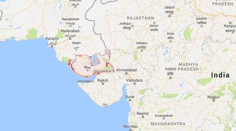
 There are about 12 seismically active small and big faults (probable earthquake source zones) in Kutch, and Gandhinagar-based ISR will begin by mapping the biggest of them — the Kutch Mainland Fault, which has a total length of 140 km and a breath of 40 km. (Source: Google maps)
In order to have greater understanding of all existing “seismic faults” in Kutch and to discover if there are any “hidden” ones that could give rise to earthquakes in future, the Institute of Seismological Research (ISR) is conducting a 3D-mapping of the entire Kutch region that is one of the most seismically active zones in Gujarat.
There are about 12 seismically active small and big faults (probable earthquake source zones) in Kutch, and Gandhinagar-based ISR will begin by mapping the biggest of them — the Kutch Mainland Fault, which has a total length of 140 km and a breath of 40 km.
Wagadh Fault and Gedi Faults are located to the east of Kutch. “This exercise is being done for the first time in India. We are going to start from the same area that had given rise to the 2001 Kutch earthquake. For this purpose, we are currently in the process of laying 50 new broadband seismograph stations,” said Dr M Ravi Kumar, Director General, ISR, Gujarat Government.
The devastating 2001 Kutch earthquake of 7.7 magnitude on the Richter scale had killed over 13,000 people and damaged more than 10 lakh houses in the state.
“The basic idea is to create three-dimensional pictures of the existing faults which will help us understand them better. Secondly, we also want to map if there are any hidden faults in the region. The entire exercise is to study future locations where earthquakes are more probable to occur,” said the head of ISR, adding that two such hidden faults were discovered near Anjar in the last few months.
Seismologists have also discovered “molten material” trapped 25-30 km below the Kutch Mainland Fault.
“We want to study these occurrences in a detailed manner,” Dr Kumar added.
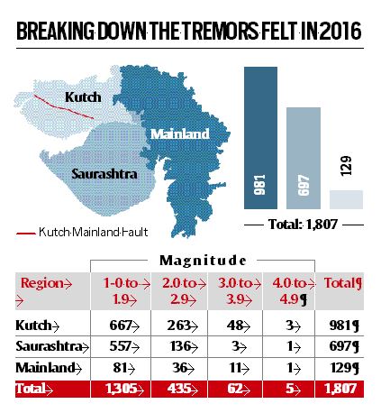
A total of 1,807 local earthquakes were recorded by an existing broadband seismic network (of 70 seismograph stations) of ISR in Gujarat during the year 2016. Of these, 981 shocks — more than half of the total earthquakes— having magnitudes between 1.0 to 4.2 were recorded in the Kutch region. (See box)
After laying a grid of 50 new seismograph stations, ISR will begin the mapping from an area between Anjar in the south to Bela in the north. This region will be about 150 km in length and 30 km wide. “In phases, we plan to map all the areas up to the Allah Bund Fault (near the Indo-Pak border),” Dr Kumar added.
The biggest of the earthquakes ever recorded in Gujarat has occurred at Allah Bund Fault. This quake with a magnitude of 7.8 occurred in 1819 AD. The institute is already doing some small experiments using electromagnetic method at this fault which is located in a swamp region of the Kutch district and is inaccessible for most part of the year.