
Rain is increasing across the area now. The rest of the night will be very wet!
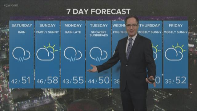
Rain tapers to showers Saturday morning, and showers end Saturday afternoon. A new weather system rolls onshore Saturday night for more rain.
But that lifts north into Washington late Saturday night. Warmer air and at least some clearing roll northward in its wake. Valley temperatures will push to near 60-degrees and record values under a partly sunny sky on Sunday.
The dry weather lasts into Monday, before that same frontal system moves south as a cold front Monday night, allowing the rain to return.
Showers set in Tuesday as the snow level drops back down to about 3,000 feet.
Enjoy the weekend!
Matt Zaffino
KGW Chief Meteorologist
__________________________________________
- Radar: on.kgw.com/radar
- Weather-related closures: on.kgw.com/closures
- Weather alerts on.kgw.com/weatheralerts
Traffic links:
- Traffic alerts: on.kgw.com/alerts
- Traffic speed maps: on.kgw.com/traffic
And images (updated automatically):
- 7-day: on.kgw.com/7day
- Timberline cam: on.kgw.com/timberline
- Cannon Beach: on.kgw.com/cannon
- Downtown (Wells Fargo): on.kgw.com/wellsfargo