HARTORD, CT (WFSB) -
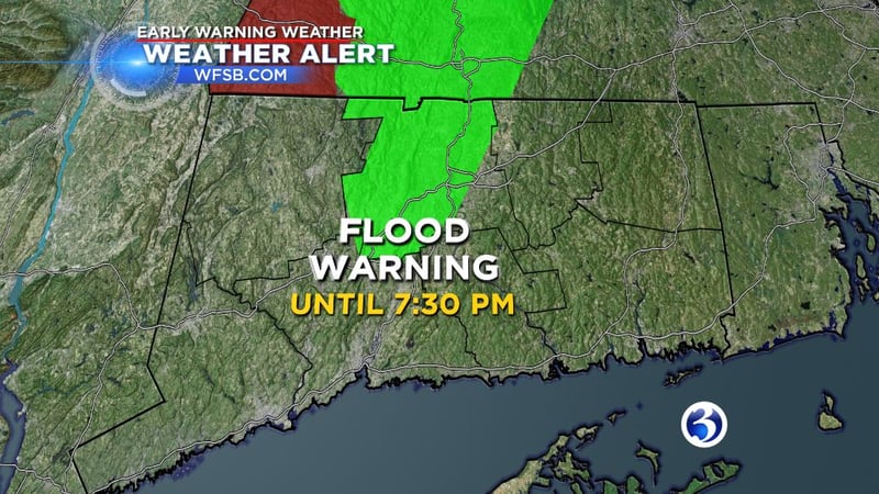
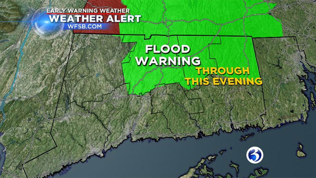
The potential of flooding throughout Connecticut isn't over after a day of record-breaking temperatures as well as heavy rain and more rain is still on the way.
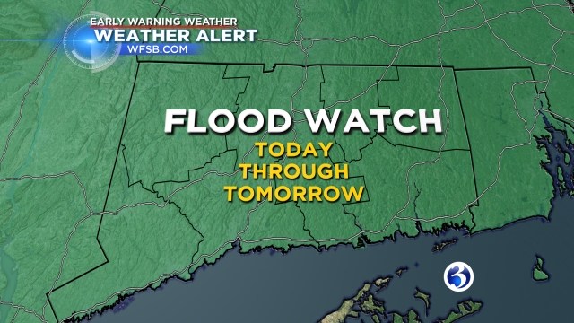
A flood watch remains in effect for all of Connecticut until Saturday afternoon.
" Rain will be heavy at times this evening and tonight and there is even a chance for a thunderstorm," Chief Meteorologist Bruce DePrest said
There will be poor drainage and flooding along smaller streams and rivers.
"It won’t be raining the entire time, but there will be downpours from time to time," DePrest said.
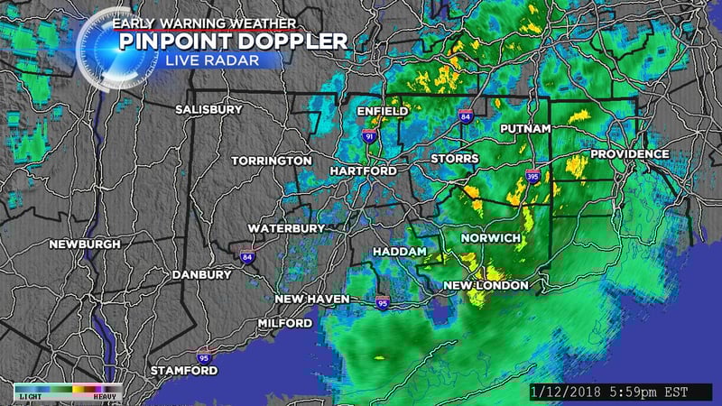
Track the rain with Early Warning Pinpoint Doppler here.
Rainfall totals from this storm will range from 1-3” with locally higher amounts up to 4", DePrest said.
Another concern is fog that could develop as the warm air moves over the melting snow. A dense fog advisory for the southern parts of Fairfield, New London, New Haven and Middlesex counties from Friday afternoon until early Sunday morning.
"There will be areas of dense fog in other parts of the state tonight as well," DePrest said.
The heaviest rain should start to fall by late Friday afternoon and will linger into Saturday morning.
As the rain wraps up on Saturday, a winter weather advisory will go into effect for Hartford, Tolland and Windham counties from 9 a.m. to 4 p.m. For Litchfield County, it's from 3 a.m. until 7 p.m. A winter weather advisory for Fairfield County from 4 a.m. on Saturday until noon on Saturday.
Temps will drop to the 40s and 50s overnight. More arctic air arrives.
"Any standing water from the heavy rain and snow melt will begin to freeze tomorrow. Ice will form on roads, parking lots, driveways, and sidewalks," DePrest said.
A record high temperature was set at Bradley International Airport in Windsor Locks for Jan. 6. Around 12:30 p.m., it was 58 degrees and could go higher, according to Dixon. The 105-year-old record was 57 degrees.
For Bridgeport, The record high temperature of 55 degrees, which was set last year, was tied on Friday.
Dixon said records are also in jeopardy on Saturday during the pre-dawn hours before temperature plummet.
Temps will dip into the single digits and teens by Saturday night. The wind chill will be around zero.
Highs for Sunday will be in the 20s with a wind chill in the single digits. However, it'll be sunny.
To read the complete technical discussion, click here.
For weather alerts on smartphones and tablets, head here or text "WFSB" to 23765 to download the Channel 3 app.
Copyright 2018 WFSB (Meredith Corporation). All rights reserved.