A storm system is forming east of Florida on Wednesday, but already a mix of ice and snow has brought winter storm warnings to northern Florida and southern Georgia. The storm will move up the East Coast over the next two days, bringing plenty of headaches.
Interested in Weather?
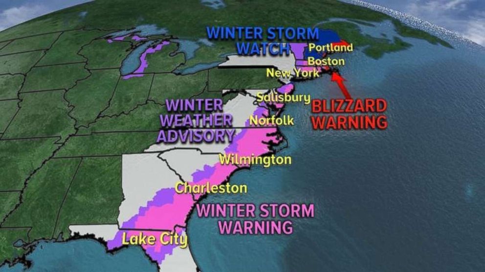
Add Weather as an interest to stay up to date on the latest Weather news, video, and analysis from ABC News.Parts of 15 states from Florida to Maine will see effects from this developing coastal storm. Winter storm watches, warnings and advisories have been issued from Florida to Maine.
 ABC News
Snow and ice will fall in southern Georgia on Wednesday where some areas could see up to 4 to 6 inches of snow and up to half of an inch of ice.
For northern Florida, at most 1 inch of snow is expected with a glaze of ice, mostly east of Tallahassee. Nevertheless, this is a major event for northern Florida, because they don’t have any snow removal equipment or salting trucks.
The icy mix quickly moves out of Florida and Georgia by Wednesday evening and moves into the Carolinas where we are expecting 2 to 5 inches of snow.
 ABC News
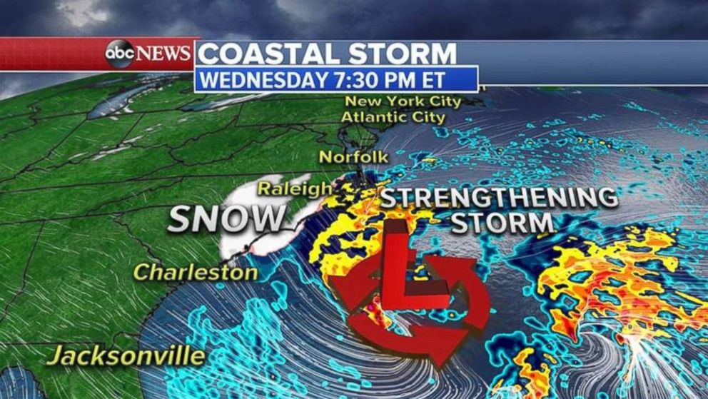
The storm system will begin to strengthen late Wednesday and move up the East Coast, spreading snow into the eastern mid-Atlantic states and southern New Jersey.
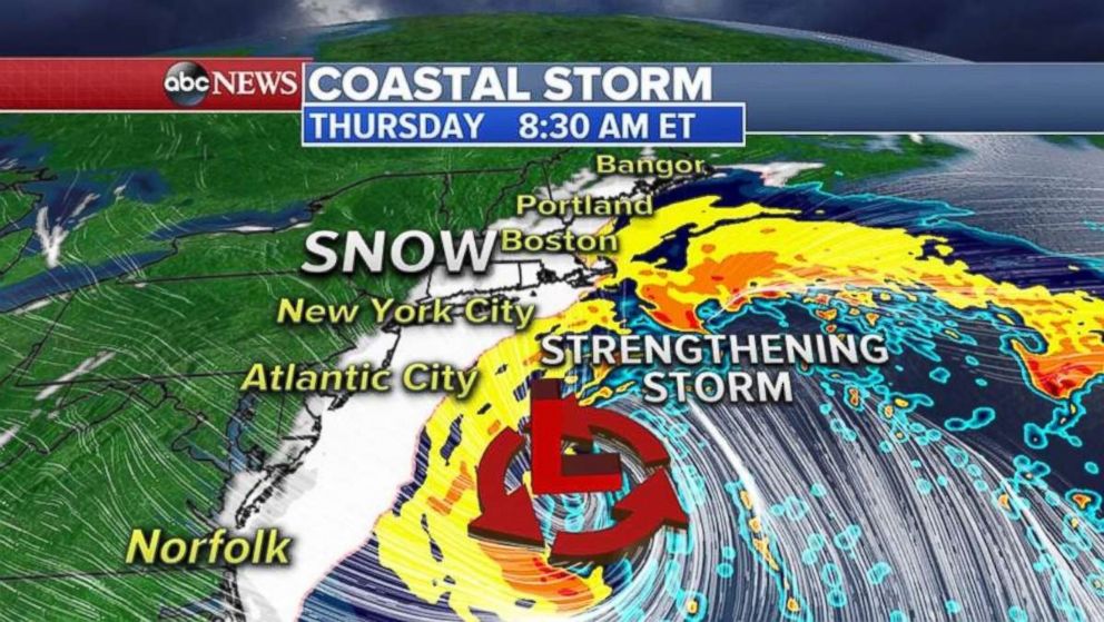
By early Thursday morning, snow will cover Long Island and southern New England and will be heavy at times with winds gusting to 50 mph.
 ABC News
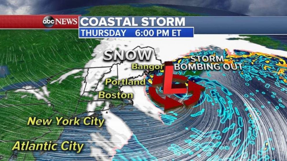
The storm begins to move east of Cape Cod on Thursday during the late morning and into the afternoon. As it does so, it will undergo a rapid intensification, or as it’s called in meteorology, bombogenesis.
Bombogenesis, or a storm bombing out, means the surface pressure of the storm will drop 24 millibars in 24 hours, or at the rate of 1 millibar per hour.
This usually happens when a storm system moves over the warm waters of the western Atlantic and the Gulf Stream at the same time arctic cold air moves in behind from the west. The difference between the two air masses helps to strengthen the storm system.
This type of storm system happens almost every year.
 ABC News
Snowfall totals for the East Coast in the next 36 to 48 hours will span from an inch or two, up to the heaviest amounts in New England and eastern Long Island, where locally 1 foot of snow is possible. Some areas in eastern Maine could see up to 18 inches of snow.
 ABC News
Cold weather enters
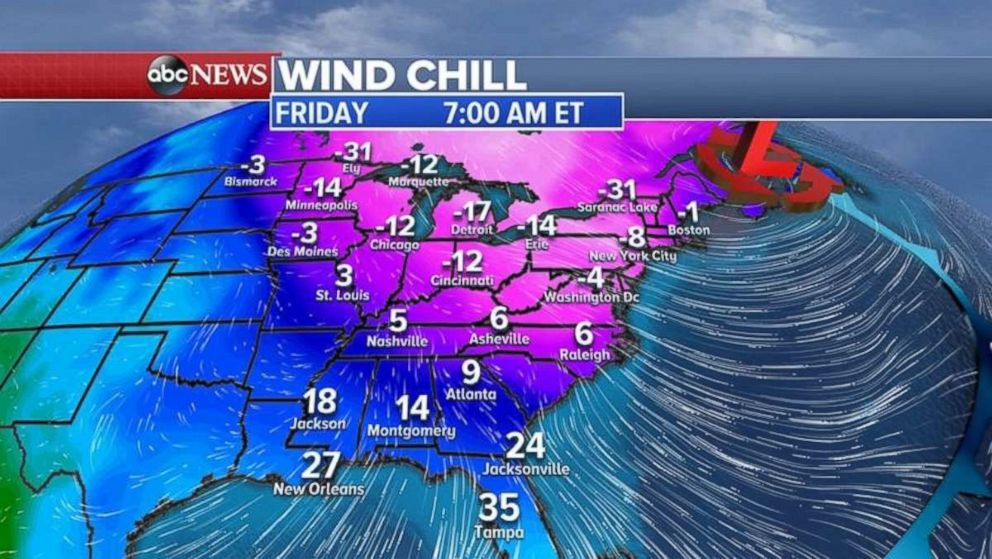
Behind the storm, we are expecting the coldest air of the season for the Northeast.
Frigid wind chills on Friday morning will reach all the way to the Gulf Coast and Florida once again.
 ABC News